A274 road
The A274 is a major road running through mid Kent. The northern end of the road is in Maidstone, at the Wheatsheaf public house where it leaves the A229. The road then follows a south easterly route to Langley, where it changes to a south south easterly alignment through Sutton Valence and Headcorn,[1] ending at a junction with the A262 in Biddenden.[2] It is 12.37 miles (19.91 km) long.
The B2163 crossing the A274 Sutton Road
| |
|---|---|
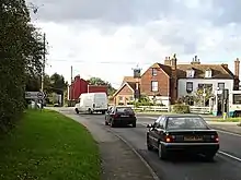
 The White Horse public house on the A274 through Headcorn | |
| Route information | |
| Length | 12.37 mi (19.91 km) |
| Major junctions | |
| North end | Maidstone 51.2578°N 0.53123°E |
| South end | Biddenden 51.1149°N 0.6436°E |
| Location | |
| Primary destinations | Langley Sutton Valence Headcorn |
| Road network | |

The A274 was originally classified B2078 and was re-designated in the 1950s. The road has seen some upgrades to short sections at Park Wood (on the outskirts of Maidstone) and to the south of Sutton Valence.
References
- Thompsett, Mike (16 January 2016). "A274 North Street, Headcorn, closed as power cables on road". kentonline.co.uk. Retrieved 7 November 2016.
- Weir, Jamie (30 April 2015). "Smash leaves A274 Headcorn Road closed to traffic". kentnews.co.uk. Archived from the original on 8 November 2016. Retrieved 7 November 2016.
A roads in Zone 2 of the Great Britain road numbering scheme | ||
|---|---|---|
This article is issued from Wikipedia. The text is licensed under Creative Commons - Attribution - Sharealike. Additional terms may apply for the media files.
