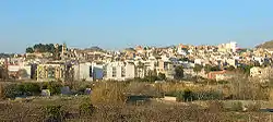
Abarán
Abarán is a Spanish municipality located in the province of Murcia.[2] It is situated in the Valley of Ricote[3] on the banks of the River Segura 40 km from the city of Murcia. It belongs to the parish of Santiago. It has a population of 12,917 (as of 2005). Abarán belongs to the comarca of Vega Alta del Segura, the capital of which is Cieza. Abarán and Cieza share a healthy rivalry.
Abarán | |
|---|---|
 | |
 Flag  Coat of arms | |
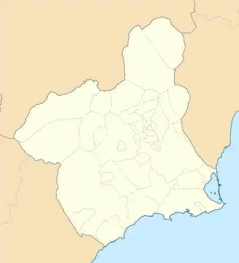 Abarán Location in Murcia 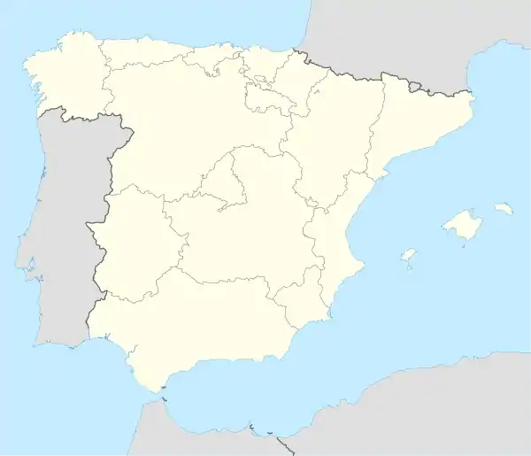 Abarán Location in Spain | |
| Coordinates: | |
| Country | |
| Autonomous community | |
| Comarca | Vega Alta del Segura |
| Parish | Santiago |
| Government | |
| • Mayor | Jesús Gómez Montiel (PSRM/PSOE) |
| Area | |
| • Total | 115 km2 (44 sq mi) |
| Elevation | 400 m (1,300 ft) |
| Population (2018)[1] | |
| • Total | 13,030 |
| Post code | 30550 |
| Area code(s) | 968 |
| Website | Official website |
Geography
The ground is high in the northeast of Abarán. In the southwest end the ground is also raised. There are six gullies in the northeastern half and two in the southeastern half.[4]
Human geography
The main town is located in the southwestern half of the territory and had a population of 9,776 in 2019. The village Hoya del Campo is approximately placed in the centre of the municipality and was populated with 1,393 people in 2019. Another locality of the municipality is San José Artesano, which population consisted of 684 in 2019 and is placed in the southwestern half of the territory. Venta de la Aurora is another hamlet, which occurs in the southwest of the northeastern half and had a population of 130 in 2019. Casablanca hamlet is located in the north and was populated with 21 people in 2019. Vergeles hamlet occurs in the northeastern half and it was inhabited by 10 people in 2019.[5][6]
Demographics
The population of Abarán is 12,968 (2007).
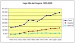
9.179% inhabitants were foreigners in 2019. 72 people are from other coutries of Europe, 6.1% are Africans, 2.33% are Americans and 23 Asian people also reside there.[7] The table below shows the population trend of the municipality during the 20th and 21st centuries by the beginning of the decades.[8]
| 1900 | 1910 | 1920 | 1930 | 1940 | 1950 | 1960 | 1970 | 1981 | 1991 | 2001 | 2011 | |
|---|---|---|---|---|---|---|---|---|---|---|---|---|
| Population | 3,925 | 4,161 | 5,393 | 6,997 | 7,980 | 8,461 | 8,878 | 10,200 | 11,183 | 11,865 | 12,513 | 13,157 |
Economy
28.7% of the territory is utilised with crop purposes.[9] The most widely grown products are the grapes, the peaches, the almonds and the apricots.[10] 77.9% of the agreements were writen for jobs in the agriculture and fishing sectors in 2019, and 49.18% were signed by labourers in the second half of 2018.[11][12]
Facilities
Healthcare
The municipality is included in the Healtharea IX (Vega Alta del Segura) of Region of Murcia and in a subarea that covers the territory. Abarán hosts two consultorios (primary care centres with fewer functions than the centros de salud) and a centro de salud.[13]
Education
There are 3 earlychildhood and primary education centres and one secondary education centre in the main village. An early childhood and primary education centre can also be found in Barranco Mólax and another one in Hoya del Campo.[14]
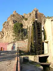
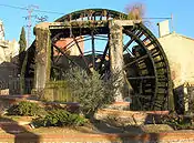
Tourism
Points of interest
References
- Municipal Register of Spain 2018. National Statistics Institute.
- "Instituto Nacional de Estadística (Spanish Statistical Institute)". Retrieved October 10, 2020.
- "Paisaje del Valle del Ricote - IPCE │Ministerio de Cultura y Deporte" (in Spanish). Retrieved October 10, 2020.
- "Montes catalogados de Abarán". Murcianatural (in Spanish). Retrieved November 14, 2020.
- "Pedanías de Abarán - Región de Murcia Digital" (in Spanish). Retrieved November 14, 2020.
- "INEBase / Demography and population / Municipal Register. Population by municipality /Nomenclature: Continuous Register Population by Population Unit / Results". Spanish Statistical Office. Retrieved November 14, 2020.
- "CREM - Datos Municipales de Abarán - 5. Evolución de la población según nacionalidad". Portal Estadístico de la Región de Murcia CREM (in Spanish). Retrieved November 14, 2020.
- "CREM - Datos Municipales de Abarán - 1. Censos de Población. Evolución de la población según sexo". Portal Estadístico de la Región de Murcia - CREM (in Spanish). Retrieved November 14, 2020.
- "1. Evolución de la distribución general de la tierra". Portal Estadístico de la Región de Murcia (in Spanish). Retrieved October 10, 2020.
- "3. Evolución de la superficie dedicada a cada grupo de cultivo". Portal Estadístico de la Región de Murcia - CREM (in Spanish). Retrieved October 10, 2020.
- "CREM - Datos Municipales Abarán - 5. Evolución de los contratos de trabajo según sector de la actividad económica. CNAE-2009". Portal Estadístico de la Región de Murcia - CREM (in Spanish). Retrieved October 16, 2020.
- "Cifras de Empleo Segundo Semestre 2008". SEFCARM.ES - Murcia Empleo (in Spanish). p. 25. Retrieved October 16, 2020.
- "MurciaSalud, el portal sanitario de la Región de Murcia. Centros Sanitarios" (in Spanish). Retrieved October 10, 2020.
- "Listado de Centros". Portal de Transparencia - Región de Murcia (in Spanish). pp. 1, 2. Retrieved October 10, 2020.