Alhama de Murcia
Alhama de Murcia is a Spanish municipality in the autonomous community of the Region of Murcia. It is located in the north of the southern half of the region. The municipality shares borders with Librilla in its north, Murcia in its northeast, Fuente Álamo de Murcia in its east, Mazarrón in its south, Totana in its west and Mula in its northwest.[2]
Alhama de Murcia | |
|---|---|
.jpg.webp) Town hall. | |
 Flag  Seal | |
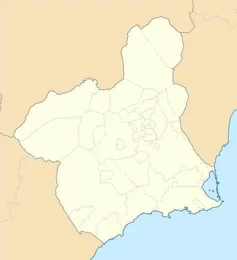 Alhama de Murcia Location in Murcia 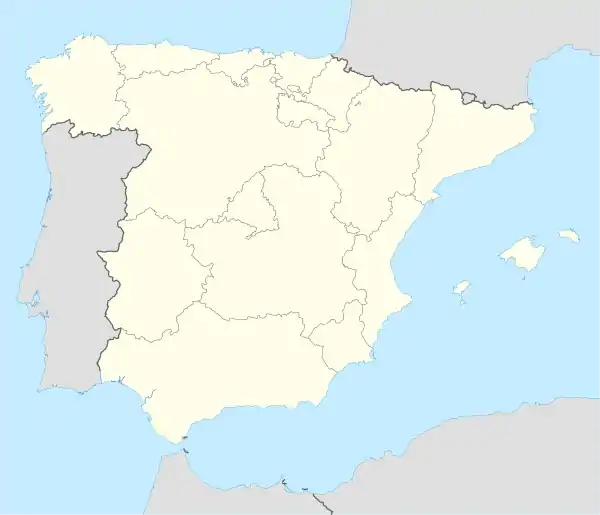 Alhama de Murcia Location in Spain | |
| Coordinates: | |
| Country | |
| Autonomous community | |
| Province | |
| Comarca | Bajo Guadalentín |
| Judicial party | Totana |
| Government | |
| • Mayor | Alfonso Fernando Cerón Morales |
| Area | |
| • Total | 311.55 km2 (120.29 sq mi) |
| Elevation | 176 m (577 ft) |
| Population (2018)[1] | |
| • Total | 21,657 |
| • Density | 70/km2 (180/sq mi) |
| Demonym(s) | Alhameños |
| Website | Official website |
Geography
Physical geography
The west of Sierra de Carrascoy mountain range occupies part of the east of Alhama de Murcia. Guadalentín River traverses the municipality from its south-west to its north-east. The territory is especially raised in the north-west, where some raised landforms occur and the south-eastern foot of Sierra Espuña mountain range occurs, and even the norht-west end of Alhama de Murcia occupies the mountain range itself.[3]
Human geography
The inhabitants of the municipality are distributed in the following localities: Alhama de Murcia, which is located in the south-east of the north-west and is inhabited by 19,265 people; Las Cañadas, which is placed in the north-east and is populated by 903 people; La Costera, which occurs in the north-west and is home to 310 people; El Cañarico, which is located in the north-east end and is inhabited by 154 people; El Berro, which is placed in the north-west and its population consists of 140 and El Gebas, that is home to 24 people and occurs in the north-west.[4][5][6][7]
History
The Battle of Faḥṣ al-Jullāb between the Almohad Caliphate and the Taifa of Murcia was fought here on 15 October 1165.[8]
Demographics
19.22% inhabitants are foreigners – 4.7% come from other countries of Europe, 18.38 are African and 3.8% are American.[9] The table below shows the population trend during the 20th and the 21st centuries by the beginning of their decades.[10]
| 1900 | 1910 | 1920 | 1930 | 1940 | 1950 | 1960 | 1970 | 1981 | 1991 | 2001 | 2011 | |
|---|---|---|---|---|---|---|---|---|---|---|---|---|
| Population | 8,410 | 9,207 | 9,743 | 10,042 | 11,083 | 11,344 | 11,786 | 11,600 | 13,132 | 14,175 | 16,316 | 20,560 |
Economy
Agriculture is highly performed in the municipality. 34.2% of the territory is utilised for crop purposes.[11] The most widely grown products are the grapes, oranges, lettuces, and cauliflowers and broccoli.[12] 37.43% of the contracts corresponded to jobs in the agriculture sector and 50.86% were written for labourers.[13][14] 43.01% of the agreements were about service sector in 2018 and 17.56% about industry jobs.[13]
Facilities
Healthcare
There is a consultorio (a primary care centre with the fewest functions) in La Costera, another one in El Cañarico, and another one in El Berro. The main town hosts a centro de salud (a primary care centre).[15]
Education
Five early childhood and primary education centres (CEIP) and two secondary education centres (IES) can be found in the main town. There is also an early childhood and primary education centre in El Berro, another one in Venta de los Carrascos and another one i Los Ventorillos.[16]
Notable people
- Antonio Peñalver (born 1968), decathlete
References
- Municipal Register of Spain 2018. National Statistics Institute.
- "Mapa de municipios de la Región de Murcia" (in Spanish). Retrieved 2020-06-18.
- "Montes catalogados de Alhama de Murcia". Murcianatural.
- "Pedanías de Alhama de Murcia - Región de Murcia Digital" (in Spanish). Retrieved 2020-06-18.
- "Ayuntamiento de Alhama de Murcia - Área de pedanías" (in Spanish). Retrieved 2020-06-18.
- "Pedanías de Alhama de Murcia - Región de Murcia Digital".
- "INEbase / Demography and population /Municipal Register. Population by municipality /Nomenclature: Continuous Register Population by Population Unit / Results". INE. Retrieved 2020-06-18.
- Hugh N. Kennedy (1996), Muslim Spain and Portugal: A Political History of al-Andalus, Routledge, p. 219.
- "CREM - Datos Municipales Alhama de Murcia - 5. Evolución de la población según nacionalidad". Portal Estadístico de la Regiónde Murcia - CREM (in Spanish).
- "CREM - Datos Municipales Alhama de Murcia - 1. Censos de Población. Evolución de la población según sexo". Portal Estadístico de la Región de Murcia - CREM (in Spanish).
- "CREM - Datos Municipales de Alhama - 1. Evolución de la distribución general de la tierra" (in Spanish). Retrieved 2020-06-18.
- "CREM - Datos Municipales de Alhama - Evolución de la superficie dedicada a cada grupo de cultivo" (in Spanish). Retrieved 2020-06-18.
- "CREM- Datos Municipales de Alhama de Murcia - 5. Evolución de los contratos de trabajo registrados según sector de la actividad económica. CNAE-2009" (in Spanish). Retrieved 2020-06-18.
- "Cifras de empleo municipal. 1er semestre de 2013. Municipio de Alhama de Murcia" (in Spanish). Retrieved 2020-06-18.
- "MurciaSalud, el portal sanitario de la Región de Murica" (in Spanish).
- "Listado de centros". Portal de Transparencia - Región de Murcia (in Spanish).
External links
- Official website (in Spanish)
| Wikimedia Commons has media related to Alhama de Murcia. |
| Authority control |
|
|---|