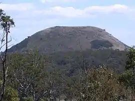
Mount Fox, Queensland
Mount Fox is a rural locality in the Shire of Hinchinbrook, Queensland, Australia.[2] In the 2016 census Mount Fox had a population of 87 people.[1]
| Mount Fox Queensland | |||||||||||||||
|---|---|---|---|---|---|---|---|---|---|---|---|---|---|---|---|
 Mount Fox, 2006 | |||||||||||||||
 Mount Fox | |||||||||||||||
| Coordinates | 18.8198°S 145.8544°E | ||||||||||||||
| Population | 87 (2016 census)[1] | ||||||||||||||
| • Density | 0.627/km2 (1.625/sq mi) | ||||||||||||||
| Postcode(s) | 4850 | ||||||||||||||
| Area | 138.7 km2 (53.6 sq mi) | ||||||||||||||
| Time zone | AEST (UTC+10:00) | ||||||||||||||
| Location |
| ||||||||||||||
| LGA(s) | Shire of Hinchinbrook | ||||||||||||||
| State electorate(s) | Hinchinbrook | ||||||||||||||
| Federal Division(s) | Kennedy | ||||||||||||||
| |||||||||||||||
Geography
Mount Fox is a locality on the western side of the Great Dividing Range. The eastern side of the locality is mountainous and undeveloped; much of it is within the Girrigun National Park and the Lannercost State Forest. The dormant volcano Mount Fox (also known as Mount Yellerai) is 810 metres (2,660 ft) above sea level in the western part of the locality (18.8411°S 145.8053°E).[3][4][5] The locality presumably takes its name from that mountain.
History
Mount Fox State School opened on 12 February 1938 but it closed in December 1941. It reopened on 28 July 1954 but closed on 2 September 1955. It reopened on 11 May 1959 but closed again on 6 July 1964. It reopened on 28 January 1988.[6]
In the 2016 census Mount Fox had a population of 87 people.[1]
Education
Mount Fox State School is a government primary (Early Childhood-6) school for boys and girls at 2957 Mt Fox Road (18.8190°S 145.7945°E).[7][8] In 2016, the school had an enrolment of 5 students with 2 teachers (1 full-time equivalent) and 4 non-teaching staff (1 full-time equivalent).[9] In 2018, the school had an enrolment of 5 students with 2 teachers (1 full-time equivalent) and 5 non-teaching staff (2 full-time equivalent).[10]
There is no secondary school in Mount Fox. The nearest secondary school is Ingham State High School in Ingham to the north-east.[5]
References
- Australian Bureau of Statistics (27 June 2017). "Mount Fox (SSC)". 2016 Census QuickStats. Retrieved 20 October 2018.

- "Mount Fox – locality in Shire of Hinchinbrook (entry 42523)". Queensland Place Names. Queensland Government. Retrieved 27 December 2020.
- "Mountain peaks and capes - Queensland". Queensland Open Data. Queensland Government. 12 November 2020. Archived from the original on 25 November 2020. Retrieved 25 November 2020.
- "Mount Fox – mountain in Hinchinbrook Shire (entry 13103)". Queensland Place Names. Queensland Government. Retrieved 25 November 2020.
- "Queensland Globe". State of Queensland. Retrieved 18 January 2021.
- Queensland Family History Society (2010), Queensland schools past and present (Version 1.01 ed.), Queensland Family History Society, ISBN 978-1-921171-26-0
- "State and non-state school details". Queensland Government. 9 July 2018. Archived from the original on 21 November 2018. Retrieved 21 November 2018.
- "Mount Fox State School". Retrieved 21 November 2018.
- "Annual Report 2016" (PDF). Mount Fox State School. Archived (PDF) from the original on 13 October 2017. Retrieved 13 October 2017.
- "ACARA School Profile 2018". Australian Curriculum, Assessment and Reporting Authority. Retrieved 28 January 2020.
Further reading
- Shepherd, R. L; Australia. Army. Royal Queensland Regiment, 2nd (1962), Mount Fox background : history of mining, pastoral and timber activities of Mt. Fox and hinterland providing background setting for 1962 Annual Camp, 2nd Royal Queensland Regiment, retrieved 13 October 2017
- Blackford, Keith (1990), A history of the timber industry covering Kirrama Range, Mt. Spec, Mt. Fox, Herbert River, Keith Blackford], retrieved 13 October 2017