Acton, Alabama
Acton is an unincorporated community in Shelby County, in the U.S. state of Alabama. It is partially located within the city of Hoover. It is not to be confused with the village of Acton, approximately 6 1/2 miles to the northeast in Jefferson County.
Acton, Alabama | |
|---|---|
 Acton, Alabama  Acton, Alabama | |
| Coordinates: 33°21′22″N 86°48′25″W | |
| Country | United States |
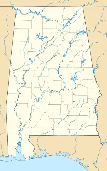
| State | Alabama |
| County | Shelby |
| Elevation | 505 ft (154 m) |
| Time zone | UTC-6 (Central (CST)) |
| • Summer (DST) | UTC-5 (CDT) |
| Zip Code | 35244 |
| Area codes | 205, 659 |
| GNIS feature ID | 112906[1] |
History
Alabama Fuel & Iron Company established coal mines at Acton and the company town of Acton grew up around them. The mines were served by the Louisville and Nashville Railroad. On November 18, 1913, 21 miners were killed by an explosion in Mine Number 2.[2] After the mines closed, the area was converted into the Riverchase real estate development.[3]
A post office was established at Acton in 1908, and remained in operation until it was discontinued in 1926.[4] The community was likely named for William Acton, a local businessperson in the mining industry.[5]
In the 1970s, the land was developed into the Riverchase residential planned community, which was annexed into Hoover, Alabama in 1980.
Demographics
Acton/Highland Precinct (1870-1950)
| Historical population | |||
|---|---|---|---|
| Census | Pop. | %± | |
| 1870 | 657 | — | |
| 1880 | 494 | −24.8% | |
| 1890 | 484 | −2.0% | |
| 1900 | 444 | −8.3% | |
| 1910 | 1,282 | 188.7% | |
| 1920 | 1,076 | −16.1% | |
| 1930 | 746 | −30.7% | |
| 1940 | 834 | 11.8% | |
| 1950 | 974 | 16.8% | |
| U.S. Decennial Census[6] | |||
According to the census returns from 1850[7]-2010[8] for Alabama, Acton village has never reported a population figure separately on the U.S. Census.[9] Acton (Precinct 12 of Shelby County) first appeared on the 1920 U.S. Census[10] (not to be confused with Acton's Precinct 15, which appeared in 1880 and was moved to Jefferson County, where the other Acton village is located). Acton Precinct only appeared under this name on this one occasion. Prior to 1920 and again from 1930-50 the name was Highland Precinct, which first appeared on the 1870 census as Shelby County Beat 4[11] and then Beat/Precinct 12 from 1880-onwards.[12] In 1960, the precincts were merged and/or reorganized into census divisions (as part of a general reorganization of counties) and it was consolidated into the census division of Helena.[13] In 1980, that census division was consolidated into the new division of Alabaster-Helena.[14]
References
- "Acton". Geographic Names Information System. United States Geological Survey.
- "Explosion Kills Miners", New York Times, November 19, 1913
- James Sanders Day (24 June 2013). Diamonds in the Rough: A History of Alabama's Cahaba Coal Field. University of Alabama Press. pp. 83–206. ISBN 978-0-8173-1794-2.
- "Shelby County". Jim Forte Postal History. Retrieved 9 February 2015.
- Foscue, Virginia O. (1989). Place Names in Alabama. University of Alabama Press. p. 6. ISBN 978-0-8173-0410-2.
- "U.S. Decennial Census". Census.gov. Retrieved June 6, 2013.
- http://www2.census.gov/prod2/decennial/documents/1850c-11.pdf, 1850 Census (places)
- http://www.census.gov/prod/cen2010/cph-1-2.pdf, 2010 AL Census
- http://www.census.gov/prod/www/decennial.html
- http://www2.census.gov/prod2/decennial/documents/06229686v1-7ch01.pdf, 1920 AL Census
- http://www2.census.gov/prod2/decennial/documents/1870a-05.pdf, 1870 AL Census
- http://www2.census.gov/prod2/decennial/documents/1880a_v1-09.pdf, 1880 AL Census
- http://www2.census.gov/prod2/decennial/documents/37721510v1p2ch2.pdf, 1960 AL Census
- http://www2.census.gov/prod2/decennial/documents/1980a_alABC-01.pdf, 1980 AL Census
External links
Municipalities and communities of Shelby County, Alabama, United States | ||
|---|---|---|
| Cities | 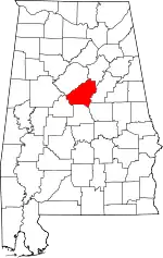 Map of Alabama highlighting Shelby County | |
| Towns | ||
| CDPs | ||
| Unincorporated communities | ||
| Footnotes | ‡This populated place also has portions in an adjacent county or counties | |
| ||