Aka Aka
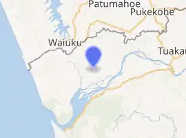
Aka Aka is a rural locality on the Aka Aka Stream, a tributary of the Waikato River. It lies about 7 km southeast of Waiuku. In the 2013 New Zealand census, the meshblock containing Aka Aka had a population of 102 people.[1]
Aka Aka | |
|---|---|
Locality | |
| |
| Coordinates: 37.293°S 174.7926°E | |
| Country | New Zealand |
| Region | Waikato region |
| District | Waikato District |
| Ward | Awaroa ki Tuakau |
| Elevation | 30 m (100 ft) |
| Population (2018 census) | |
| • Territorial | 102 |
| Time zone | UTC+12 (NZST) |
| • Summer (DST) | UTC+13 (NZDT) |
The area was originally a swamp, drained in the late 19th century.[2][3]
The New Zealand Co-operative Dairy Company has a factory in Aka Aka,[4] built in 1901.[5][6]
The current Aka Aka Hall, opened in 2002, contains a Roll of Honour commemorating people from the area killed in the first and second world wars.[7] The hall replaced one which was described as a "splendid new hall" in 1912.[8]
Demographics
| Year | Pop. | ±% p.a. |
|---|---|---|
| 2006 | 2,556 | — |
| 2013 | 2,637 | +0.45% |
| 2018 | 3,102 | +3.30% |
| Source: [9] | ||
The statistical area of Aka Aka, which at 187 square kilometres is much larger than the locality, covers all of the Waikato District north of the Waikato River. It had a population of 3,102 at the 2018 New Zealand census, an increase of 465 people (17.6%) since the 2013 census, and an increase of 546 people (21.4%) since the 2006 census. There were 1,047 households. There were 1,584 males and 1,518 females, giving a sex ratio of 1.04 males per female. The median age was 42.2 years, with 639 people (20.6%) aged under 15 years, 573 (18.5%) aged 15 to 29, 1,479 (47.7%) aged 30 to 64, and 408 (13.2%) aged 65 or older.
Ethnicities were 92.6% European/Pākehā, 11.7% Māori, 2.4% Pacific peoples, 4.2% Asian, and 1.5% other ethnicities (totals add to more than 100% since people could identify with multiple ethnicities).
The proportion of people born overseas was 15.7%, compared with 27.1% nationally.
Although some people objected to giving their religion, 59.0% had no religion, 30.8% were Christian, 0.4% were Hindu, 0.4% were Muslim, 0.2% were Buddhist and 2.0% had other religions.
Of those at least 15 years old, 381 (15.5%) people had a bachelor or higher degree, and 477 (19.4%) people had no formal qualifications. The median income was $39,200. The employment status of those at least 15 was that 1,485 (60.3%) people were employed full-time, 402 (16.3%) were part-time, and 36 (1.5%) were unemployed.[9]
Education
Aka Aka School is a co-educational state primary school covering years 1 to 8,[10] with a roll of 40 as of March 2020.[11]
There is also a primary school at Otaua.
References
- "Meshblock Electoral Populations 2020 for proposed boundaries data". Statistics New Zealand. April 2020. Meshblock 0833300.
- "Highway Boards - Waiuku". The New Zealand Herald. XXI (7015). 12 May 1884.
- "Table Talk". Auckland Star. XXIII (293). 15 December 1892.
- "N Z Co-operative Dairy Company - Aka Aka Branch". Kete New Plymouth. Retrieved 22 August 2019.
- "Untitled". Auckland Star. XXXII (18). 22 January 1901.
- "Co-operative Dairying Company - Prospectus". Waikato Argus. XI (1031). 26 August 1901.
- "Aka Aka Roll of Honour". New Zealand Ministry for Culture and Heritage. 17 February 2017.
- "A Developing District". Pukekohe & Waiuku Times. 1 (23). 14 August 1912. p. 3.
- "Statistical area 1 dataset for 2018 Census". Statistics New Zealand. March 2020. Aka Aka (169700). 2018 Census place summary: Aka Aka
- Education Counts: Aka Aka School
- "New Zealand Schools Directory". New Zealand Ministry of Education. Retrieved 26 April 2020.
