Alabama Port, Alabama
Alabama Port, also sometimes known as Port Alabama, is an unincorporated community on Mon Louis Island, in Mobile County, Alabama, United States.[1]
Alabama Port, Alabama | |
|---|---|
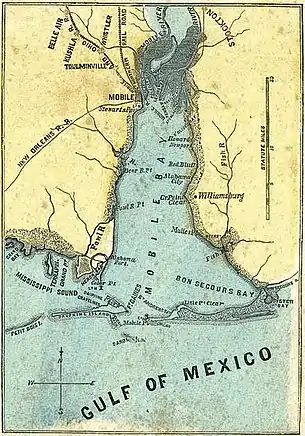 Map of Alabama Port on lower west side of Mobile Bay, 1861 | |
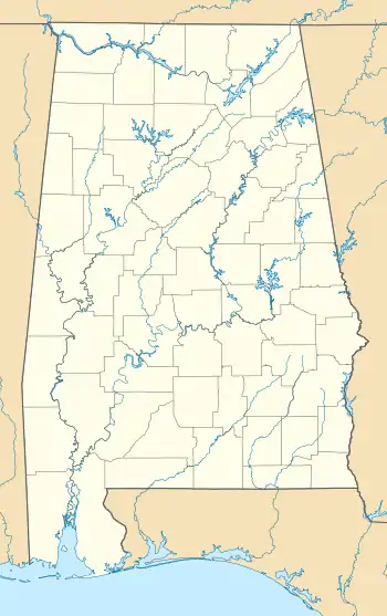 Alabama Port, Alabama Location within the state of Alabama  Alabama Port, Alabama Alabama Port, Alabama (the United States) | |
| Coordinates: 30°21′45″N 88°6′52″W | |
| Country | United States |
| State | Alabama |
| County | Mobile |
| Elevation | 7 ft (2 m) |
| Time zone | UTC-6 (Central (CST)) |
| • Summer (DST) | UTC-5 (CDT) |
| Area code(s) | 251 |
Geography
Alabama Port is located at 30.440474°N 88.105832°W, on the western shore of Mobile Bay, at an elevation of 7 feet (2 m).[1]
Demographics
Alabama Port Precinct (1880)
| Historical population | |||
|---|---|---|---|
| Census | Pop. | %± | |
| 1880 | 417 | — | |
| U.S. Decennial Census[2] | |||
Alabama Port has never reported separately as an unincorporated community on the U.S. Census. However, in 1880, the 19th precinct of Mobile County bore its name, and had 417 residents.[3] The name of the precinct was changed in 1890[4] to Cedar Point, then Heron Bayou and Dauphin Island in 1900,[5] simply Heron Bayou for 1910-20[6] and "Herron Bay" for 1930–50.[7] It was consolidated under the Bayou La Batre census division in 1960.[8]
References
- U.S. Geological Survey Geographic Names Information System: Alabama Port, Alabama
- "U.S. Decennial Census". Census.gov. Retrieved June 6, 2013.
- http://www2.census.gov/prod2/decennial/documents/1880a_v1-09.pdf
- http://www2.census.gov/prod2/decennial/documents/1890a_v1-07.pdf
- http://www2.census.gov/prod2/decennial/documents/33405927v1ch05.pdf
- http://www2.census.gov/prod2/decennial/documents/41033935v1-8ch1.pdf
- http://www2.census.gov/prod2/decennial/documents/10612963v3p1ch02.pdf
- http://www2.census.gov/prod2/decennial/documents/37721510v1p2ch2.pdf
Municipalities and communities of Mobile County, Alabama, United States | ||
|---|---|---|
| Cities | 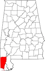 Map of Alabama highlighting Mobile County | |
| Towns | ||
| CDPs | ||
| Unincorporated communities | ||
| Ghost town | ||
| Indian reservation | ||
| Footnotes | ‡This populated place also has portions in an adjacent county or counties | |
| ||
This article is issued from Wikipedia. The text is licensed under Creative Commons - Attribution - Sharealike. Additional terms may apply for the media files.
