Alazeya Plateau
The Alazeya Plateau (Russian: Алазейское плоскогорье) is a mountain plateau in the Sakha Republic, Far Eastern Federal District, Russia. The area is named after the Alazeya River, which has its source in the plateau.
| Alazeya Plateau | |
|---|---|
| Алазейское плоскогорье | |
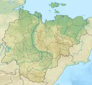 Location in the Sakha Republic, Russia | |
| Highest point | |
| Elevation | 954 m (3,130 ft) |
| Dimensions | |
| Length | 300 km (190 mi) |
| Width | 200 km (120 mi) |
| Geography | |
| Country | Russia |
| Federal subject | Sakha Republic |
| Range coordinates | 67°38′N 147°50′E |
| Parent range | East Siberian System |
| Geology | |
| Age of rock | Proterozoic and Devonian |
| Type of rock | Gneiss, Sedimentary rocks, granite and syenite |
There are kigilyakhs in the Alazeya Plateau. The particularity of the kigilyakhs found in this location is that their lower part (corresponding to the legs) is thinner than the upper part.[1]
Geography
The Alazeya Plateau is located in eastern Sakha Republic, between the Indigirka, Kolyma, Alazeya and Ozhogina rivers.[2] The average height of the plateau surface is around 350 meters (1,150 ft). There are slightly higher tableland type elevations cutting across the plateau area; the highest point is a 954 metres (3,130 ft) high unnamed summit.[3]
The plateau is limited by the Yana-Indigirka Lowland, including the Aby Lowland, to the west, with rivers Yana and Indigirka, the Ozhogina to the south, and the Kolyma Lowland with the Kolyma to the east and northeast.[2] Besides the Alazeya, the Sededema River also has its source in the plateau.[3]
There are forests of larch in the lower areas and mountain tundra in the higher altitudes.[3]
References
- Murzin Yuri Andreyevich, Kigilyakhi of Yakutia
- Google Earth
- Алазейское плоскогорье, Great Soviet Encyclopedia
