Alba, Michigan
Alba is an unincorporated community and census-designated place (CDP) located in Antrim County in the U.S. state of Michigan. As of the 2010 census, it had a population of 295.[3] Situated just north of Mancelona along U.S. Route 131, Alba is divided between Star Township on the east and Chestonia Township on the west.
Alba, Michigan | |
|---|---|
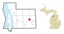 Location within Antrim County | |
 Alba Location within the state of Michigan  Alba Alba (the United States) | |
| Coordinates: 44°58′29″N 84°58′07″W | |
| Country | United States |
| State | Michigan |
| County | Antrim |
| Townships | Chestonia and Star |
| Established | 1876 |
| Area | |
| • Total | 2.723 sq mi (7.05 km2) |
| • Land | 2.723 sq mi (7.05 km2) |
| • Water | 0.0 sq mi (0 km2) |
| Elevation | 1,178 ft (359 m) |
| Population | |
| • Total | 295 |
| • Density | 108.3/sq mi (41.8/km2) |
| Time zone | UTC-5 (Eastern (EST)) |
| • Summer (DST) | UTC-4 (EDT) |
| ZIP code(s) | 49611 |
| Area code(s) | 231 |
| GNIS feature ID | 619894[2] |
History
Alba was established in 1876.[4]
In the 1900s, it was the site of the Detroit and Charlevoix and Grand Rapids and Indiana railroad junction.
The community of Alba was listed as a newly-organized census-designated place for the 2010 census, meaning it now has officially defined boundaries and population statistics for the first time.[5]
Geography
Alba is at 44°58′29″N 84°58′07″W in northern Michigan, and the FIPS place code is 00900. The elevation is 1,179 feet (359 m) above sea level.[2] The Alba ZIP code 49611 provides P.O. Box only service[6] for an area around the community.[7]
According to the U.S. Census Bureau, the Alba CDP has an area of 2.7 square miles (7.1 km2), all land.[3]
References
- "2010 Census Gazetteer Files - Places: Michigan". U.S. Census Bureau. Retrieved May 4, 2018.
- U.S. Geological Survey Geographic Names Information System: Alba, Michigan
- "Geographic Identifiers: 2010 Demographic Profile Data (G001): Alba CDP, Michigan". U.S. Census Bureau, American Factfinder. Archived from the original on February 12, 2020. Retrieved June 10, 2013.
- Romig, Walter (1986). Michigan Place Names. Detroit: Wayne State University Press. p. 14. ISBN 978-0-8143-1838-6 – via Google Books.
- "Michigan: 2010 Population and Housing Unit Counts 2010 Census of Population and Housing" (PDF). 2010 United States Census. United States Census Bureau. September 2012. p. III-4. Retrieved January 21, 2020.
- ZIP Code Lookup Archived January 1, 2008, at the Wayback Machine United States Postal Service
- 49611 5-Digit ZCTA, 496 3-Digit ZCTA - Reference Map - American FactFinder, U.S. Census Bureau, 2000 census
Municipalities and communities of Antrim County, Michigan, United States | ||
|---|---|---|
| Villages | 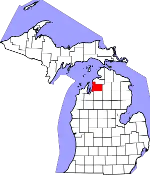 Map of Michigan highlighting Antrim County.svg | |
| Civil townships | ||
| CDPs | ||
| Other unincorporated communities | ||
| Indian reservation | ||
| Footnotes | ‡This populated place also has portions in an adjacent county or counties | |
| ||