Alphamstone
Alphamstone is a village and civil parish in Essex, England. It is located 3 3⁄4 miles (6.0 km) south of Sudbury in Suffolk and is 20 mi (32 km) northeast from the county town of Chelmsford. The village is in the district of Braintree and in the parliamentary constituency of Saffron Walden. The parish is part of the Stour Valley South parish cluster.[1] The parish is 1,709 acres (2.67 sq mi; 692 ha) with a geology of fertile clay-soils,[2] and is at an elevation of 216 feet (66 m) above sea level. The population is included in the civil parish of Lamarsh.[3]
| Alphamstone | |
|---|---|
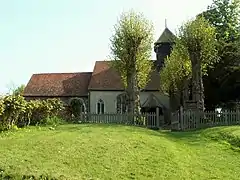 St. Barnabas church, Alphamstone | |
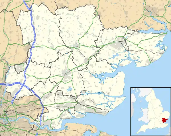 Alphamstone Location within Essex | |
| Area | 2.67 sq mi (6.9 km2) |
| OS grid reference | TL884358 |
| Civil parish |
|
| District | |
| Shire county | |
| Region | |
| Country | England |
| Sovereign state | United Kingdom |
| Post town | BURES |
| Postcode district | CO8 |
| Dialling code | 01787 |
| Police | Essex |
| Fire | Essex |
| Ambulance | East of England |
| UK Parliament | |
The village is a mile west of the River Stour, which forms the Essex-Suffolk county-border in the local area. The village has one parish church the CofE St Barnabas. It was built in the thirteenth century and went through restorations in the 16th and 19th centuries.[4] In 1831 the population of the village was 244 inhabitants.[5]
It is about 2 miles (3.2 km) from the nearest railway station at Bures on the Sudbury Branch Line. Its nearest significant road link is the A131.
References
- "Parish cluster map". www.braintree.gov.uk. Archived from the original (JPG) on 14 October 2006. Retrieved 22 January 2007.
- Kelly's Directory of Essex. 1933.
- "Alphamstone Ordinace Survey".
- "St Barnabas, Alphamstone, Essex". The Corpus of Romanesque Sculpture in Britain & Ireland - Kings College London.
- Samuel Lewis A Topographical Dictionary of England (1831)
External links
 Media related to Alphamstone at Wikimedia Commons
- http://www.essexchurches.info - Alphamstone Church on Essex Churches website
- GENUKI reference library on Alphamstone
- Alphamstone in the Domesday Book
