Alsó-Fehér County
Alsó-Fehér was an administrative county (comitatus) of the Kingdom of Hungary. Its territory is now in western Romania (central Transylvania). The latest capital of the county was Nagyenyed (present-day Aiud).
| Alsó-Fehér County | |
|---|---|
| County of the Principality of Transylvania (1744-1867) County the Kingdom of Hungary (1867-1920) | |
 Coat of arms
| |
 | |
| Capital | Gyulafehérvár; Nagyenyed (1876-1920) |
| Area | |
| • Coordinates | 46°19′N 23°44′E |
• 1910 | 3,580 km2 (1,380 sq mi) |
| Population | |
• 1910 | 221618 |
| History | |
• Established | 1744 |
| 4 June 1920 | |
| Today part of | |
| Alba Iulia; Aiud are the current name of the capital. | |
Geography
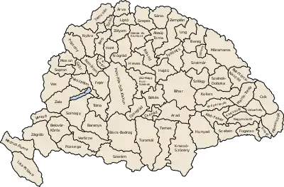
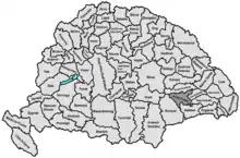
Alsó-Fehér county shared borders with Hunyad, Torda-Aranyos, Kis-Küküllő, Nagy-Küküllő and Szeben counties. The rivers Maros and Küküllő flowed through the county. Its area was 3580 km² around 1910.
History
Alsó-Fehér (Lower Fehér) county was formed when the county Fehér was split in the 1744 (the other half, Felső-Fehér county, consisted entirely of enclaves between Székely and Saxon seats). In 1876, when the administrative structure of Transylvania was changed, the territory of Alsó-Fehér was modified and Felső-Fehér county was entirely abolished and merged with other counties. In 1920 the Treaty of Trianon assigned the territory of the county to Romania. Its territory lies in the present Romanian counties of Alba, Sibiu (the south-east) and Mureș (a small northeastern part).
Demographics
In 1900, the county had a population of 212,352 people and was composed of the following linguistic communities:[1]
Total:
- Romanian: 166,099 (78,2%)
- Hungarian: 36,360 (17,1%)
- German: 7,953 (3,8%)
- Slovak: 100 (0,0%)
- Serbian: 40 (0,0%)
- Croatian: 14 (0,0%)
- Ruthenian: 6 (0,0%)
- Other or unknown: 1,780 (0,9%)
According to the census of 1900, the county was composed of the following religious communities:[2]
Total:
- Eastern Orthodox: 87,210 (41,1%)
- Greek Catholic: 80,211 (37,8%)
- Calvinist: 21,296 (10,0%)
- Roman Catholic: 11,226 (5,3%)
- Lutheran: 7,170 (3,4%)
- Jewish: 3,903 (1,8%)
- Unitarian: 1,315 (0,6%)
- Other or unknown: 21 (0,0%)
In 1910, county had a population of 221,618 people and was composed of the following linguistic communities:[3]
Total:
- Romanian: 171,483 (77,4%)
- Hungarian: 39,107 (17,6%)
- German: 7,269 (3,3%)
- Slovak: 184 (0,1%)
- Serbian: 18 (0,0%)
- Croatian: 8 (0,0%)
- Ruthenian: 8 (0,0%)
- Other or unknown: 3,541 (1,6%)
According to the census of 1910, the county was composed of the following religious communities:[4]
Total:
- Eastern Orthodox: 89,724 (40,5%)
- Greek Catholic: 85,276 (38,5%)
- Calvinist: 23,009 (10,4%)
- Roman Catholic: 11,194 (5,0%)
- Lutheran: 7,283 (3,3%)
- Jewish: 3,845 (1,7%)
- Unitarianist: 1,269 (0,6%)
- Other or unknown: 18 (0,0%)
The majority of the Hungarians lived in the cities of the county (like Gyulafehérvár, Nagyenyed, Abrudbánya, Vízakna, etc.) and in the districts of Marosújvár and Nagyenyed.
Subdivisions
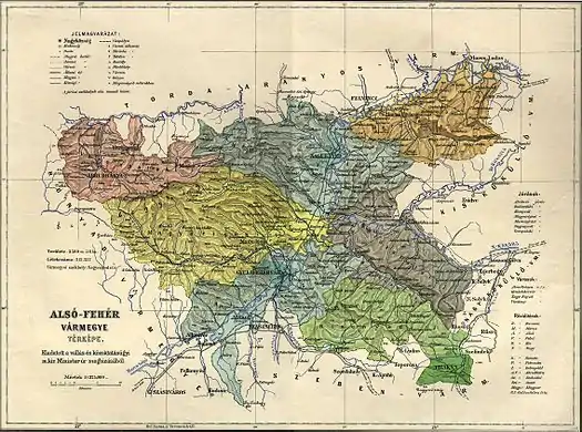
In the early 20th century, the subdivisions of Alsó-Fehér county were:
| Districts (járások) | |
|---|---|
| District | County seat |
| Alvinc | Alvinc |
| Balázsfalva | Balázsfalva |
| Kisenyed | Vízakna |
| Magyarigen | Magyarigen |
| Marosújvár | Marosújvár |
| Nagyenyed | Nagyenyed |
| Tövis (from 1908) | Tövis |
| Verespatak | Verespatak |
| Urban districts (rendezett tanácsú városok) | |
| Abrudbánya | |
| Gyulafehérvár | |
| Nagyenyed | |
| Vízakna | |
References
- "KlimoTheca :: Könyvtár". Kt.lib.pte.hu. Retrieved 2012-12-06.
- "KlimoTheca :: Könyvtár". Kt.lib.pte.hu. Retrieved 2012-12-06.
- "KlimoTheca :: Könyvtár". Kt.lib.pte.hu. Retrieved 2012-06-19.
- "KlimoTheca :: Könyvtár". Kt.lib.pte.hu. Retrieved 2012-06-19.