Amami, Kagoshima
Amami (奄美市, Amami-shi) is a city located on the island of Amami Ōshima, in Kagoshima Prefecture, Japan.
Amami
奄美市 | |
|---|---|
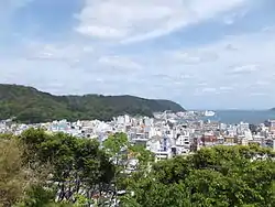 Skyline of Amami City | |
Flag Seal | |
Location of Amami in Kagoshima Prefecture | |
 Amami 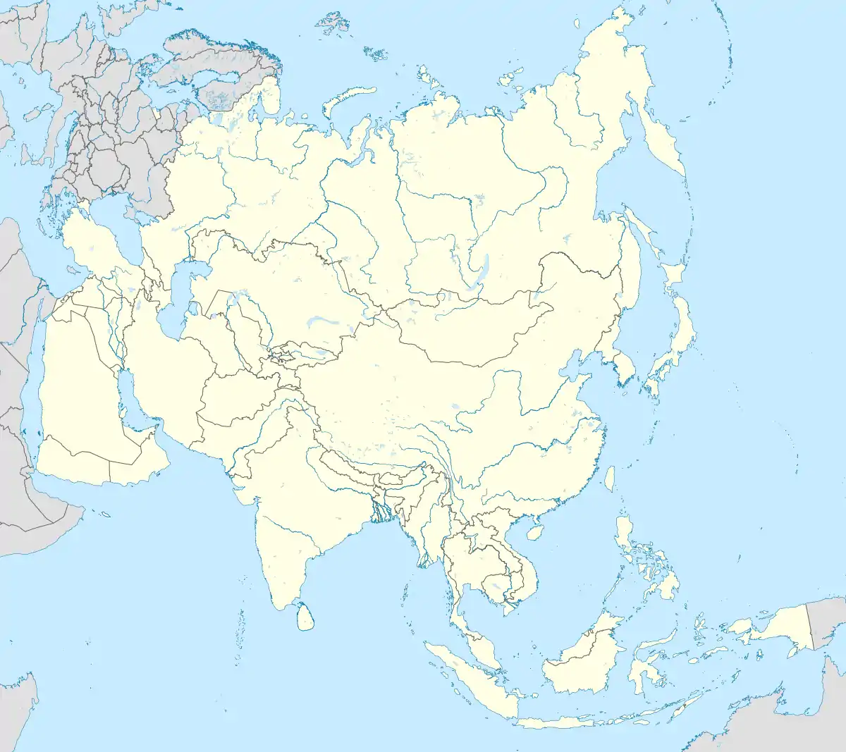 Amami Amami (Asia) | |
| Coordinates: 28°22′42″N 129°29′40″E | |
| Country | Japan |
| Region | Kyushu (Amami Islands) |
| Prefecture | Kagoshima Prefecture |
| First official recorded | 657 AD |
| Naze City Settled | July 1, 1946 |
| Current city name changed for | March 20, 2006 |
| Government | |
| • Mayor | Tsuyoshi Asayama |
| Area | |
| • Total | 308.15 km2 (118.98 sq mi) |
| Population (October 1, 2016) | |
| • Total | 42,718 |
| • Density | 145/km2 (380/sq mi) |
| Time zone | UTC+9 (Japan Standard Time) |
| -Tree | Ryūkyūmatsu and Banyan |
| - Flower | Sharinbai and Hibiscus |
| -Other Plants | Hikagehego |
| Phone number | 0997-52-1111 |
| Address | 25-8 Naze-saiwaichō, Amami-shi, Kagoshima-ken 894-0025 |
| Website | www |
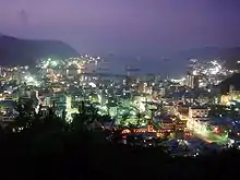
Amami is the most populated municipality on Amami Ōshima. The most urban part of the municipality as well as the island's main port is a small city also known as Naze. As of June 2013, the city has an estimated population of 44,561 and a population density of 145 persons per km². The total area is 308.15 km².
History
The village of Naze was established on April 1, 1908. It was elevated to town status on October 1, 1922. As with all of the Amami Islands, the village came under the administration of the United States from July 1, 1946, to December 25, 1953. It was elevated to city status on July 1, 1946.
The modern city of Amami was established on March 20, 2006, from the merger of the city of Naze, the town of Kasari, and the village of Sumiyō (both from Ōshima District).
Geography
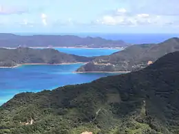
Amami, located on the eastern and northern portion of Amami Ōshima, is bordered by the East China Sea to the north and the Pacific Ocean to the south. The Kasari area of the city is an exclave, separated from the main part of Amami by the town of Tatsugō.
Climate
Amami has a humid subtropical climate (Köppen climate classification Cfa) with long, hot, humid summers and mild winters. Precipitation is abundant throughout the year, with particularly heavy rainfall in May, June, August and September. The area is subject to frequent typhoons.
| Climate data for Amami, Kagoshima | |||||||||||||
|---|---|---|---|---|---|---|---|---|---|---|---|---|---|
| Month | Jan | Feb | Mar | Apr | May | Jun | Jul | Aug | Sep | Oct | Nov | Dec | Year |
| Average high °C (°F) | 17.0 (62.6) |
17.5 (63.5) |
19.8 (67.6) |
23.3 (73.9) |
26.0 (78.8) |
29.0 (84.2) |
32.1 (89.8) |
31.7 (89.1) |
30.2 (86.4) |
26.7 (80.1) |
23.0 (73.4) |
19.2 (66.6) |
24.6 (76.3) |
| Daily mean °C (°F) | 14.2 (57.6) |
14.6 (58.3) |
16.6 (61.9) |
20.0 (68.0) |
22.6 (72.7) |
25.6 (78.1) |
28.4 (83.1) |
28.1 (82.6) |
26.6 (79.9) |
23.3 (73.9) |
19.8 (67.6) |
16.1 (61.0) |
21.3 (70.4) |
| Average low °C (°F) | 11.3 (52.3) |
11.7 (53.1) |
13.4 (56.1) |
16.7 (62.1) |
19.5 (67.1) |
22.9 (73.2) |
25.4 (77.7) |
25.3 (77.5) |
23.7 (74.7) |
20.3 (68.5) |
16.8 (62.2) |
13.0 (55.4) |
18.3 (65.0) |
| Average precipitation mm (inches) | 187.7 (7.39) |
154.1 (6.07) |
195.9 (7.71) |
214.6 (8.45) |
319.2 (12.57) |
406.7 (16.01) |
220.2 (8.67) |
311.0 (12.24) |
298.5 (11.75) |
219.0 (8.62) |
190.2 (7.49) |
153.5 (6.04) |
2,870.6 (113.01) |
| Average relative humidity (%) | 69 | 70 | 71 | 74 | 78 | 80 | 78 | 79 | 79 | 73 | 71 | 70 | 74 |
| Mean monthly sunshine hours | 62.0 | 59.9 | 85.4 | 115.7 | 122.7 | 131.7 | 223.2 | 191.7 | 156.2 | 126.2 | 87.7 | 73.4 | 1,435.8 |
| Source: NOAA (1961-1990) [1] | |||||||||||||
Transportation
Airport
Seaport
Naze Port is a regional transportation hub, with frequent ferry service to Kagoshima, Tokyo, Kobe, and Osaka, as well as Okinawa, the other Amami islands, and Tokara Islands.
Highway
Points of interest
Sister cities
 Nishinomiya, Hyōgo
 Nacogdoches, Texas, United States
Notable people from Amami
- Kousuke Atari, musician
- Kyokunankai Hiromitsu, former sumo wrestler (Real Name: Hirokazu Ken, Nihongo: 健博和, Ken Hirokazu)
- Kazuhito Sakae, olympic wrestling coach and retired freestyle wrestler and Greco-Roman wrestler
- Utami Hayashishita, Japanese professional wrestler
References
- "Naze Climate Normals 1961-1990". National Oceanic and Atmospheric Administration. Retrieved January 7, 2013.
External links
| Wikimedia Commons has media related to Amami, Kagoshima. |
| Core city | |||||||||||
|---|---|---|---|---|---|---|---|---|---|---|---|
| Cities |
| ||||||||||
| Districts |
| ||||||||||
| Authority control |
|---|