Makurazaki, Kagoshima
Makurazaki (枕崎市, Makurazaki-shi) is a city located in Kagoshima Prefecture, Japan. The city was founded on September 1, 1949.
Makurazaki
枕崎市 | |||||||||||
|---|---|---|---|---|---|---|---|---|---|---|---|
View of Makurazaki | |||||||||||
Flag Chapter | |||||||||||
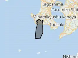
Location of Makurazaki in Kagoshima Prefecture | |||||||||||
 Makurazaki Location in Japan | |||||||||||
| Coordinates: 31°16′22″N 130°17′49″E | |||||||||||
| Country | Japan | ||||||||||
| Region | Kyushu | ||||||||||
| Prefecture | Kagoshima Prefecture | ||||||||||
| Government | |||||||||||
| • Mayor | Yoshiaki Setoguchi | ||||||||||
| Area | |||||||||||
| • Total | 74.88 km2 (28.91 sq mi) | ||||||||||
| Population (April 1, 2017) | |||||||||||
| • Total | 21,960 | ||||||||||
| • Density | 290/km2 (760/sq mi) | ||||||||||
| Time zone | UTC+09:00 (JST) | ||||||||||
| City hall address | 27, Chiyodachō, Makurazaki-shi, Kagoshima-ken 898-8501 | ||||||||||
| Website | www | ||||||||||
| |||||||||||
As of April 2017, the city has an estimated population of 21,960 and a population density of 290 persons per km².[1] The total area is 74.88 km².
It is famous for its katsuobushi processing plants, which produce the chief flavoring ingredient—dried fish flakes—found in Japanese miso soup. About 70 small family businesses year-round boil, cut, dry and smoke the pungent fish, often sending a unique odor of steam, smoke and fish scent across the downtown area and out to sea.
Makurazaki is the site of the terminus of the southernmost JR train line in Japan, the Ibusuki Makurazaki Line. The Japanese know the town as the Typhoon Ginza (after Ginza in Tokyo). Each summer many cyclones strike the main islands first in the area of Makurazaki.
Climate
Makurazaki has a humid subtropical climate (Köppen climate classification Cfa) with hot summers and mild winters. Precipitation is high throughout the year, and is especially high from May to July. The highest record temperature was 36.7 °C (98.1 °F) on August 22, 2016 while the lowest recorded temperature was −4.4 °C (24.1 °F) on February 19, 1977.[2]
| Climate data for Makurazaki, Kagoshima (1981–2010) | |||||||||||||
|---|---|---|---|---|---|---|---|---|---|---|---|---|---|
| Month | Jan | Feb | Mar | Apr | May | Jun | Jul | Aug | Sep | Oct | Nov | Dec | Year |
| Record high °C (°F) | 22.8 (73.0) |
22.8 (73.0) |
24.3 (75.7) |
28.4 (83.1) |
29.9 (85.8) |
32.6 (90.7) |
35.3 (95.5) |
36.7 (98.1) |
34.8 (94.6) |
32.7 (90.9) |
27.5 (81.5) |
23.8 (74.8) |
36.7 (98.1) |
| Average high °C (°F) | 12.7 (54.9) |
13.7 (56.7) |
16.4 (61.5) |
20.4 (68.7) |
23.8 (74.8) |
26.4 (79.5) |
30.1 (86.2) |
31.0 (87.8) |
29.0 (84.2) |
24.9 (76.8) |
20.0 (68.0) |
15.2 (59.4) |
22.0 (71.6) |
| Daily mean °C (°F) | 8.8 (47.8) |
9.7 (49.5) |
12.4 (54.3) |
16.4 (61.5) |
19.9 (67.8) |
23.2 (73.8) |
26.9 (80.4) |
27.6 (81.7) |
25.2 (77.4) |
20.4 (68.7) |
15.5 (59.9) |
10.7 (51.3) |
18.1 (64.6) |
| Average low °C (°F) | 4.7 (40.5) |
5.6 (42.1) |
8.2 (46.8) |
12.1 (53.8) |
16.0 (60.8) |
20.2 (68.4) |
24.2 (75.6) |
24.5 (76.1) |
21.8 (71.2) |
16.4 (61.5) |
11.3 (52.3) |
6.5 (43.7) |
14.3 (57.7) |
| Record low °C (°F) | −3.3 (26.1) |
−4.4 (24.1) |
−1.7 (28.9) |
0.0 (32.0) |
5.0 (41.0) |
11.2 (52.2) |
16.6 (61.9) |
16.9 (62.4) |
10.7 (51.3) |
4.6 (40.3) |
−0.5 (31.1) |
−3.0 (26.6) |
−4.4 (24.1) |
| Average precipitation mm (inches) | 94.5 (3.72) |
107.7 (4.24) |
182.7 (7.19) |
203.6 (8.02) |
208.5 (8.21) |
399.4 (15.72) |
273.7 (10.78) |
179.8 (7.08) |
221.5 (8.72) |
98.5 (3.88) |
111.1 (4.37) |
94.5 (3.72) |
2,175.6 (85.65) |
| Average precipitation days (≥ 0.5 mm) | 12.6 | 11.1 | 14.5 | 12.2 | 11.7 | 15.1 | 10.8 | 11.0 | 10.7 | 8.4 | 9.0 | 11.0 | 138.1 |
| Average relative humidity (%) | 68 | 67 | 70 | 72 | 75 | 82 | 82 | 79 | 77 | 72 | 71 | 69 | 74 |
| Mean monthly sunshine hours | 110.3 | 117.7 | 141.1 | 165.6 | 173.7 | 124.5 | 210.3 | 228.0 | 187.4 | 186.0 | 149.2 | 133.2 | 1,926.8 |
| Source: Japan Meteorological Agency (records 1872–present)[2][3][4] | |||||||||||||
References
- "Official website of Makurazaki City" (in Japanese). Japan: Makurazaki City. Retrieved 7 May 2017.
- 観測史上1~10位の値( 年間を通じての値) (in Japanese). Japan Meteorological Agency. Retrieved April 20, 2015.
- 気象庁 / 平年値(年・月ごとの値) (in Japanese). Japan Meteorological Agency. Retrieved April 20, 2015.
- 気象庁 / 平年値(年・月ごとの値) (in Japanese). Japan Meteorological Agency. Retrieved April 20, 2015.
External links
| Wikimedia Commons has media related to Makurazaki, Kagoshima. |
- Makurazaki City official website (in Japanese)
- Makurazaki Katsuobushi official website
 Geographic data related to Makurazaki, Kagoshima at OpenStreetMap
| Core city | |||||||||||
|---|---|---|---|---|---|---|---|---|---|---|---|
| Cities |
| ||||||||||
| Districts |
| ||||||||||
| Authority control |
|---|
