Amity, Bucks County, Pennsylvania
Amity is an unincorporated community located in Springfield Township, Bucks County, Pennsylvania in the United States.
Amity | |
|---|---|
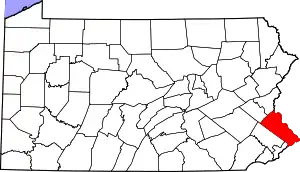
 Amity Location of Amity in Bucks County, Pennsylvania  Amity Amity (the United States) | |
| Coordinates: 40°30′33″N 75°17′10″W | |
| Country | United States |
| State | Pennsylvania |
| County | Bucks |
| Township | Springfield |
| Elevation | 479 ft (146 m) |
| Time zone | UTC-5 (EST) |
| • Summer (DST) | UTC-4 (EDT) |
| ZIP code | 18951 |
| Area codes | 215, 267, 445 |
History
Amity was entered into the Geographic Names Information System of the United States Geological Survey on 2 August 1979 as identification number 1168265.[1][2]
Geography
Amity is located at the intersection of Old Bethlehem Road and Round House Road at coordinates 40°30′33″N 75°17′10″W in Springfield Township just south of Pleasant Valley. The summit of Molasses Hill (elevation 495 feet (151 m) is located approximately 0.79 miles (1.27 km) to the southwest of Amity.[2]
Amity's zip code is 18951, mail is delivered by the Quakertown post office, telephone service area codes are 215, 267 and 445.[3]
Geology
Amity falls within the watershed of a tributary of Cooks Creek, part of the Delaware River watershed, at an elevation of 479 feet (146 m), and it lies within the Brunswick Formation, bedrock laid down during the Triassic, consisting of mudstone, shale and siltstone.[2][4]
References
- "Amity". Geographic Names Information System. United States Geological Survey.
- https://viewer.nationalmap.gov/advanced-viewer/ The National Map, retrieved 25 March 2019
- https://pennsylvania.hometownlocator.com/pa/bucks/amity.cfm, PA HomeTownLocator, retrieved 23 March 2019
- http://www.gis.dcnr.state.pa.us/maps/index.html Pennsylvania Department of Conservation and Natural Resources PA Geode, retrieved 25 March 2019