Anchor Bay, California
Anchor Bay (formerly, Anchor Bay Settlement) is a census-designated place[4] in Mendocino County, California.[2] It is located 3.5 miles (5.6 km) northwest of Gualala,[5] at an elevation of 105 feet (32 m).[2] The population was 340 at the 2010 census.
Anchor Bay | |
|---|---|
 | |
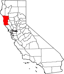
 Location of Anchor Bay in Mendocino County, California. | |
 Anchor Bay Location in California | |
| Coordinates: 38°48′10″N 123°34′40″W | |
| Country | |
| State | |
| County | Mendocino |
| Area | |
| • Total | 3.51 sq mi (9.10 km2) |
| • Land | 3.51 sq mi (9.10 km2) |
| • Water | 0.00 sq mi (0.00 km2) 0% |
| Elevation | 105 ft (32 m) |
| Population (2010) | |
| • Total | 340 |
| • Estimate (2016)[3] | N/A |
| Time zone | UTC-8 (Pacific (PST)) |
| • Summer (DST) | UTC-7 (PDT) |
| Area code(s) | 707 |
| GNIS feature IDs | 1657928; 2628706 |
| U.S. Geological Survey Geographic Names Information System: Anchor Bay, California; U.S. Geological Survey Geographic Names Information System: Anchor Bay, California | |
Geography
According to the United States Census Bureau, the CDP covers an area of 9.1 km2 (3.5 sq mi), all of it land.
Demographics
| Historical population | |||
|---|---|---|---|
| Census | Pop. | %± | |
| U.S. Decennial Census[6] | |||
At the 2010 census Anchor Bay had a population of 340. The population density was 96.8 people per square mile (37.4/km2). The racial makeup of Anchor Bay was 301 (88.5%) White, 2 (0.6%) African American, 5 (1.5%) Native American, 2 (0.6%) Asian, 1 (0.3%) Pacific Islander, 12 (3.5%) from other races, and 17 (5.0%) from two or more races. Hispanic or Latino of any race were 29 people (8.5%).[7]
The whole population lived in households, no one lived in non-institutionalized group quarters and no one was institutionalized.
There were 174 households, 25 (14.4%) had children under the age of 18 living in them, 85 (48.9%) were opposite-sex married couples living together, 11 (6.3%) had a female householder with no husband present, 6 (3.4%) had a male householder with no wife present. There were 9 (5.2%) unmarried opposite-sex partnerships, and 12 (6.9%) same-sex married couples or partnerships. 53 households (30.5%) were one person and 26 (14.9%) had someone living alone who was 65 or older. The average household size was 1.95. There were 102 families (58.6% of households); the average family size was 2.37.
The age distribution was 39 people (11.5%) under the age of 18, 8 people (2.4%) aged 18 to 24, 47 people (13.8%) aged 25 to 44, 161 people (47.4%) aged 45 to 64, and 85 people (25.0%) who were 65 or older. The median age was 57.3 years. For every 100 females, there were 96.5 males. For every 100 females age 18 and over, there were 96.7 males.
There were 327 housing units at an average density of 93.1 per square mile, of the occupied units 128 (73.6%) were owner-occupied and 46 (26.4%) were rented. The homeowner vacancy rate was 3.6%; the rental vacancy rate was 2.1%. 255 people (75.0% of the population) lived in owner-occupied housing units and 85 people (25.0%) lived in rental housing units.
Politics
In the state legislature, Anchor Bay is in the 2nd Senate District, represented by Democrat Mike McGuire,[8] and the 2nd Assembly District, represented by Democrat Jim Wood.[9]
Federally, Anchor Bay is in California's 2nd congressional district, represented by Democrat Jared Huffman.[10]
References
- "2016 U.S. Gazetteer Files". United States Census Bureau. Retrieved Jul 19, 2017.
- U.S. Geological Survey Geographic Names Information System: Anchor Bay, California
- "Population and Housing Unit Estimates". Retrieved June 9, 2017.
- U.S. Geological Survey Geographic Names Information System: Anchor Bay, California
- Durham, David L. (1998). California's Geographic Names: A Gazetteer of Historic and Modern Names of the State. Clovis, Calif.: Word Dancer Press. p. 9. ISBN 1-884995-14-4.
- "Census of Population and Housing". Census.gov. Retrieved June 4, 2016.
- "2010 Census Interactive Population Search: CA - Anchor Bay CDP". U.S. Census Bureau. Archived from the original on July 15, 2014. Retrieved July 12, 2014.
- "Senators". State of California. Retrieved March 10, 2013.
- "Members Assembly". State of California. Retrieved March 2, 2013.
- "California's 2nd Congressional District - Representatives & District Map". Civic Impulse, LLC. Retrieved March 1, 2013.
| Wikimedia Commons has media related to Anchor Bay, California. |