Mendocino County, California
Mendocino County is a county located on the North Coast of the U.S. state of California. As of the 2010 census, the population was 87,841.[4] The county seat is Ukiah.[5]
Mendocino County, California | |
|---|---|
| County of Mendocino | |
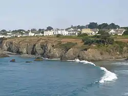 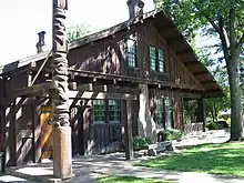 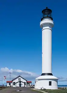 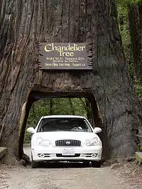  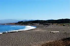 Images, from top down, left to right: The community of Mendocino, the historic Grace Hudson Sun House, Point Arena Lighthouse, the Chandelier Tree, the "Skunk Train", a beach in MacKerricher State Park | |
 Seal | |
| Nickname(s): "Mendo" | |
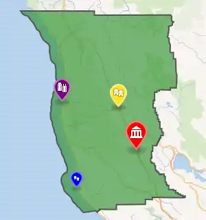
County shown in green with markers for each of its four incorporated cities | |
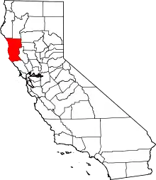 Mendocino County's location within California | |
| Coordinates (Geographic center of Mendocino County): 39.4692°N 123.3942°W | |
| Country | |
| State | |
| Region | California North Coast |
| Incorporated | February 18, 1850[1] |
| Named for | Antonio de Mendoza, Viceroy of New Spain, 1535–42 |
| County seat | Ukiah |
| Largest city | Ukiah |
| Government | |
| • Body | Mendocino County Board of Supervisors |
| Area | |
| • Total | 3,878 sq mi (10,040 km2) |
| • Land | 3,506 sq mi (9,080 km2) |
| • Water | 372 sq mi (960 km2) |
| Highest elevation | 6,958 ft (2,121 m) |
| Population | |
| • Total | 87,841 |
| • Estimate (2019)[3] | 86,749 |
| • Density | 25/sq mi (10/km2) |
| Time zone | UTC−8 (Pacific Time Zone) |
| • Summer (DST) | UTC−7 (Pacific Daylight Time) |
| Area code | 707 |
| Website | www |
Mendocino County consists wholly of the Ukiah, CA Micropolitan Statistical Area (μSA) for the purposes of the U.S. Census Bureau. It is located approximately equidistant from the San Francisco Bay Area and California/Oregon border, separated from the Sacramento Valley to the east by the California Coast Ranges. While smaller areas of redwood forest are found further south, it is the southernmost California county to be included in the World Wildlife Fund's Pacific temperate rainforests ecoregion, the largest temperate rainforest ecoregion on the planet.[6]
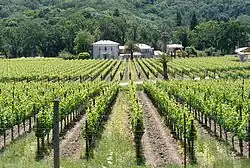
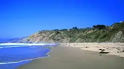
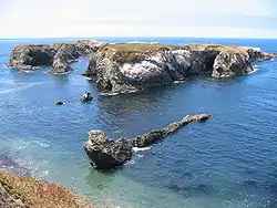
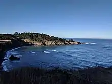
The county is noted for its distinctive Pacific Ocean coastline, its location along California's "Lost Coast", Redwood forests, wine production, microbrews, and liberal views about the use of cannabis and support for its legalization. In 2009 it was estimated that roughly one-third of the economy was based on the cultivation of marijuana.[7]
The notable historic and recreational attraction of the "Skunk Train" connects Fort Bragg with Willits in Mendocino County via a steam-locomotive engine, along with other vehicles.
History
Mendocino County was one of the original counties of California, created in 1850 at the time of statehood. Due to an initially minor settler American population, it did not have a separate government until 1859 and was under the administration of Sonoma County prior to that.[8] Some of the county's land was given to Sonoma County between 1850 and 1860.[9]
The county derives its name from Cape Mendocino (most of which is actually located in adjacent Humboldt County), which was probably named in honor of either Antonio de Mendoza, Viceroy of New Spain, 1535–1542 (who sent the Juan Rodríguez Cabrillo Expedition to this coast in 1542),[10] or Lorenzo Suárez de Mendoza, Viceroy from 1580 to 1583. Mendocino is the adjectival form of the family name of Mendoza.[8]
Neither Spanish nor Mexican influence extended into Mendocino County beyond the establishment of two Mexican land grants in southern Mendocino County: Rancho Sanel in Hopland, in 1844 and Rancho Yokaya that forms the majority of the Ukiah Valley, in 1845.[8][10]
In the 19th century, despite the establishment of the Mendocino Indian Reservation and Nome Cult Farm in 1856, the county witnessed many of the most serious atrocities in the extermination of the Californian Native American tribes who originally lived in the area, like the Yuki, the Pomo, the Cahto, and the Wintun. The systematic occupation of their lands, the reduction of many of their members into slavery and the raids against their settlements led to the Mendocino War in 1859, where hundreds of Indians were killed. Establishment of the Round Valley Indian Reservation on March 30, 1870, did not prevent the segregation that continued well into the 20th century. Other tribes from the Sierra Nevada mountains were also relocated to the Round Valley Indian Reservation during the "California Trail Of Tears", where the Natives were forced to march in bad conditions to their new home in Round Valley.[11] Many of these tribes thrown together were not on good terms with the other tribes they were forced to live with on the reservation, resulting in tensions still evident today.
Geography
According to the U.S. Census Bureau, the county has a total area of 3,878 square miles (10,040 km2), of which 3,506 square miles (9,080 km2) is land and 372 square miles (960 km2) (9.6%) is water.[12]
Adjacent counties
- Humboldt County - north
- Trinity County - north
- Tehama County - northeast
- Glenn County - east
- Lake County - east
- Sonoma County - south
Rivers
- Russian River (inland)
- Gualala River
- Garcia River
- Elk Creek
- Navarro River
- Albion River
- Little River
- Big River
- Big Salmon Creek
- Little Salmon Creek
- Noyo River
- Pudding Creek
- Virgin Creek
- Ten Mile River
- Usal Creek
- Eel River (inland)
Beaches
- Big River Beach
- Caspar Headlands State Beach
- Van Damme Beach
- Greenwood State Beach
- Seaside Beach
- Westport-Union Landing State Beach
- Manchester State Beach
- Navarro Beach
- Portuguese Beach
- Schooner Gulch State Beach
- Long Valley Creek
- 10 Mile Creek
- Glass Beach
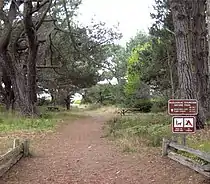
National and state protected areas
- Admiral William Standley State Recreation Area
- Caspar Headlands State Recreation Area
- Hendy Woods State Park
- Jug Handle State Reserve
- MacKerricher State Park
- Mailliard Redwoods State Reserve
- Manchester State Park
- Mendocino Coast Botanical Gardens
- Mendocino Headlands State Park
- Mendocino National Forest
- Mendocino Woodlands State Park
- Montgomery Woods State Reserve
- Navarro River Redwoods State Park
- Point Arena State Marine Reserve & Point Arena State Marine Conservation Area
- Point Cabrillo Light Station
- Reynolds Wayside Campground
- Round Valley Indian Reservation
- Russian Gulch State Park
- Saunders Reef State Marine Conservation Area
- Sea Lion Cove State Marine Conservation Area
- Sinkyone Wilderness State Park
- Smythe Redwoods State Reserve
- Standish-Hickey State Recreation Area
- Van Damme State Park
Flora and fauna
Demographics
2011
| Population, race, and income | |||||
|---|---|---|---|---|---|
| Total population[13] | 87,525 | ||||
| White[13] | 72,596 | 82.9% | |||
| Black or African American[13] | 949 | 1.1% | |||
| American Indian or Alaska Native[13] | 4,273 | 4.9% | |||
| Asian[13] | 1,554 | 1.8% | |||
| Native Hawaiian or other Pacific Islander[13] | 202 | 0.2% | |||
| Some other race[13] | 5,127 | 5.9% | |||
| Two or more races[13] | 2,824 | 3.2% | |||
| Hispanic or Latino (of any race)[14] | 18,964 | 21.7% | |||
| Per capita income[15] | $23,585 | ||||
| Median household income[16] | $44,527 | ||||
| Median family income[17] | $54,083 | ||||
Places by population, race, and income
| Places by population and race | ||||||||
|---|---|---|---|---|---|---|---|---|
| Place | Type[18] | Population[13] | White[13] | Other[13] [note 1] |
Asian[13] | Black or African American[13] |
Native American[13] [note 2] |
Hispanic or Latino (of any race)[14] |
| Albion | CDP | 255 | 80.0% | 14.5% | 5.5% | 0.0% | 0.0% | 12.2% |
| Anchor Bay | CDP | 361 | 97.8% | 2.2% | 0.0% | 0.0% | 0.0% | 0.0% |
| Boonville | CDP | 997 | 68.3% | 30.8% | 0.0% | 0.0% | 0.9% | 56.1% |
| Brooktrails | CDP | 3,280 | 91.8% | 2.9% | 2.7% | 0.0% | 2.7% | 3.8% |
| Calpella | CDP | 890 | 79.8% | 9.3% | 2.7% | 5.1% | 3.1% | 6.7% |
| Caspar | CDP | 637 | 97.2% | 2.8% | 0.0% | 0.0% | 0.0% | 0.2% |
| Cleone | CDP | 736 | 100.0% | 0.0% | 0.0% | 0.0% | 0.0% | 20.5% |
| Comptche | CDP | 133 | 100.0% | 0.0% | 0.0% | 0.0% | 0.0% | 33.1% |
| Covelo | CDP | 1,473 | 60.8% | 0.2% | 3.4% | 0.5% | 35.1% | 11.3% |
| Fort Bragg | City | 7,211 | 82.2% | 12.8% | 0.9% | 0.5% | 3.6% | 33.1% |
| Hopland | CDP | 743 | 91.5% | 7.0% | 0.0% | 0.0% | 1.5% | 44.3% |
| Laytonville | CDP | 1,384 | 81.7% | 1.4% | 0.9% | 0.0% | 16.0% | 11.0% |
| Leggett | CDP | 51 | 100.0% | 0.0% | 0.0% | 0.0% | 0.0% | 3.9% |
| Little River | CDP | 261 | 100.0% | 0.0% | 0.0% | 0.0% | 0.0% | 0.0% |
| Manchester | CDP | 163 | 81.6% | 18.4% | 0.0% | 0.0% | 0.0% | 56.4% |
| Mendocino | CDP | 936 | 93.2% | 4.7% | 2.1% | 0.0% | 0.0% | 8.5% |
| Philo | CDP | 325 | 94.2% | 2.5% | 3.4% | 0.0% | 0.0% | 80.0% |
| Point Arena | City | 439 | 90.2% | 9.8% | 0.0% | 0.0% | 0.0% | 43.5% |
| Potter Valley | CDP | 835 | 83.0% | 17.0% | 0.0% | 0.0% | 0.0% | 18.9% |
| Redwood Valley | CDP | 1,378 | 100.0% | 0.0% | 0.0% | 0.0% | 0.0% | 2.5% |
| Talmage | CDP | 974 | 67.1% | 15.4% | 14.6% | 1.2% | 1.6% | 25.7% |
| Ukiah | City | 15,979 | 81.6% | 9.8% | 2.0% | 2.7% | 3.9% | 27.8% |
| Willits | City | 4,896 | 88.9% | 6.9% | 2.0% | 0.2% | 2.1% | 22.1% |
| Places by population and income | |||||
|---|---|---|---|---|---|
| Place | Type[18] | Population[19] | Per capita income[15] | Median household income[16] | Median family income[17] |
| Albion | CDP | 255 | $16,818 | $30,331 | $80,104 |
| Anchor Bay | CDP | 361 | $35,296 | $66,544 | $66,765 |
| Boonville | CDP | 997 | $19,573 | $40,242 | $42,097 |
| Brooktrails | CDP | 3,280 | $25,260 | $46,932 | $52,885 |
| Calpella | CDP | 890 | $15,354 | $39,265 | $50,740 |
| Caspar | CDP | 637 | $30,469 | $74,934 | $74,408 |
| Cleone | CDP | 736 | $25,717 | $43,920 | $68,661 |
| Comptche | CDP | 133 | $16,162 | $2,499 | $24,554 |
| Covelo | CDP | 1,473 | $16,471 | $27,656 | $27,022 |
| Fort Bragg | City | 7,211 | $20,164 | $35,030 | $40,849 |
| Hopland | CDP | 743 | $17,281 | $39,883 | $72,607 |
| Laytonville | CDP | 1,384 | $16,754 | $32,941 | $43,750 |
| Leggett | CDP | 51 | $16,857 | $40,625 | $41,563 |
| Little River | CDP | 261 | $64,048 | $52,188 | $250,001 |
| Manchester | CDP | 163 | $12,548 | $25,972 | $22,625 |
| Mendocino | CDP | 936 | $41,653 | $65,395 | $80,278 |
| Philo | CDP | 325 | $11,826 | $40,875 | $42,188 |
| Point Arena | City | 439 | $17,615 | $31,786 | $41,136 |
| Potter Valley | CDP | 835 | $23,445 | $83,036 | $84,205 |
| Redwood Valley | CDP | 1,378 | $27,334 | $71,719 | $75,313 |
| Talmage | CDP | 974 | $15,445 | $23,448 | $50,208 |
| Ukiah | City | 15,979 | $21,550 | $45,577 | $51,328 |
| Willits | City | 4,896 | $20,709 | $41,195 | $51,457 |
2010
| Historical population | |||
|---|---|---|---|
| Census | Pop. | %± | |
| 1850 | 55 | — | |
| 1860 | 3,967 | 7,112.7% | |
| 1870 | 7,545 | 90.2% | |
| 1880 | 12,800 | 69.6% | |
| 1890 | 17,612 | 37.6% | |
| 1900 | 20,465 | 16.2% | |
| 1910 | 23,929 | 16.9% | |
| 1920 | 24,116 | 0.8% | |
| 1930 | 23,505 | −2.5% | |
| 1940 | 27,864 | 18.5% | |
| 1950 | 40,854 | 46.6% | |
| 1960 | 51,059 | 25.0% | |
| 1970 | 51,101 | 0.1% | |
| 1980 | 66,738 | 30.6% | |
| 1990 | 80,345 | 20.4% | |
| 2000 | 86,265 | 7.4% | |
| 2010 | 87,841 | 1.8% | |
| 2019 (est.) | 86,749 | [3] | −1.2% |
| U.S. Decennial Census[20] 1790–1960[21] 1900–1990[22] 1990–2000[23] 2010–2015[4] | |||
The 2010 United States Census reported that Mendocino County had a population of 87,841. The racial makeup of Mendocino County was 67,218 (76.5%) White, 622 (0.7%) African American, 4,277 (4.9%) Native American, 1,450 (1.7%) Asian, 119 (0.1%) Pacific Islander, 10,185 (11.6%) from other races, and 3,970 (4.5%) from two or more races. Hispanic or Latino of any race were 19,505 persons (22.2%).[24]
| Population reported at 2010 United States Census | |||||||||
|---|---|---|---|---|---|---|---|---|---|
Population | American | American | Islander | races | more races | or Latino (of any race) | |||
| Mendocino County | 87,841 | 67,218 | 622 | 4,277 | 1,450 | 119 | 10,185 | 3,970 | 19,505 |
city | Population | American | American | Islander | races | more races | or Latino (of any race) | ||
| Fort Bragg | 7,273 | 5,439 | 51 | 160 | 108 | 14 | 1,165 | 336 | 2,313 |
| Point Arena | 449 | 305 | 2 | 1 | 0 | 0 | 118 | 23 | 150 |
| Ukiah | 16,075 | 11,592 | 174 | 601 | 412 | 34 | 2,385 | 877 | 4,458 |
| Willits | 4,888 | 3,862 | 34 | 216 | 68 | 5 | 479 | 224 | 1,008 |
place | Population | American | American | Islander | races | more races | or Latino (of any race) | ||
| Albion | 168 | 150 | 1 | 4 | 5 | 0 | 0 | 8 | 4 |
| Anchor Bay | 340 | 301 | 2 | 5 | 2 | 1 | 12 | 17 | 29 |
| Boonville | 1,035 | 630 | 9 | 18 | 7 | 2 | 340 | 29 | 520 |
| Brooktrails | 3,235 | 2,818 | 22 | 87 | 26 | 4 | 109 | 169 | 329 |
| Calpella | 679 | 465 | 3 | 25 | 3 | 0 | 145 | 38 | 256 |
| Caspar | 509 | 474 | 3 | 0 | 8 | 0 | 3 | 21 | 15 |
| Cleone | 618 | 518 | 1 | 3 | 3 | 0 | 79 | 14 | 124 |
| Comptche | 159 | 146 | 0 | 1 | 1 | 0 | 5 | 6 | 10 |
| Covelo | 1,255 | 611 | 14 | 475 | 10 | 0 | 49 | 96 | 163 |
| Hopland | 756 | 521 | 4 | 38 | 10 | 0 | 142 | 41 | 263 |
| Laytonville | 1,227 | 839 | 16 | 244 | 10 | 1 | 60 | 57 | 141 |
| Leggett | 122 | 101 | 0 | 3 | 0 | 0 | 0 | 18 | 4 |
| Little River | 117 | 113 | 0 | 1 | 0 | 0 | 0 | 3 | 2 |
| Manchester | 195 | 151 | 0 | 4 | 1 | 0 | 29 | 10 | 48 |
| Mendocino | 894 | 834 | 5 | 8 | 13 | 1 | 6 | 27 | 42 |
| Philo | 349 | 171 | 2 | 4 | 5 | 0 | 157 | 10 | 204 |
| Potter Valley | 646 | 516 | 2 | 13 | 2 | 0 | 97 | 16 | 154 |
| Redwood Valley | 1,729 | 1,432 | 7 | 63 | 10 | 1 | 155 | 61 | 305 |
| Talmage | 1,130 | 503 | 3 | 27 | 273 | 4 | 278 | 42 | 366 |
unincorporated areas | Population | American | American | Islander | races | more races | or Latino (of any race) | ||
| All others not CDPs (combined) | 48,881 | 38,588 | 301 | 2,492 | 541 | 57 | 4,851 | 2,051 | 9,605 |
2000
As of the census[25] of 2000, there were 86,265 people, 33,266 households, and 21,855 families residing in the county. The population density was 25 people per square mile (9/km2). There were 36,937 housing units at an average density of 10 per square mile (4/km2). The racial makeup of the county was 80.8% White, 0.6% Black or African American, 4.8% Native American, 1.2% Asian, 0.2% Pacific Islander, 8.6% from other races, and 3.9% from two or more races. 16.5% of the population were Hispanic or Latino of any race. 12.2% were of German, 10.8% English, 8.6% Irish, 6.1% Italian and 5.6% American ancestry according to Census 2000. 84.4% spoke English and 13.2% Spanish as their first language.
There were 33,266 households, out of which 31.4% had children under the age of 18 living with them, 48.9% were married couples living together, 11.7% had a female householder with no husband present, and 34.3% were non-families. 27.0% of all households were made up of individuals, and 10.4% had someone living alone who was 65 years of age or older. The average household size was 2.53 and the average family size was 3.04.
In the county, the population was spread out, with 25.5% under the age of 18, 8.1% from 18 to 24, 25.6% from 25 to 44, 27.1% from 45 to 64, and 13.6% who were 65 years of age or older. The median age was 39 years. For every 100 females there were 98.9 males. For every 100 females age 18 and over, there were 97.1 males.
The median income for a household in the county was $35,996, and the median income for a family was $42,168. Males had a median income of $33,128 versus $23,774 for females. The per capita income for the county was $19,443. About 10.9% of families and 15.9% of the population were below the poverty line, including 21.5% of those under age 18 and 7.7% of those age 65 or over.
Government
As of 2020, the district attorney of Mendocino County is C. David Eyster,[26] the elected sheriff-coroner is Matthew Kendall [27] and the chief executive officer is Carmel J. Angelo.[28]
Mendocino County is legislatively governed by a board of five supervisors, each with a separate district.[29] The first district is represented by Carre Brown,[30] and serves the central-eastern region of the county, including Potter Valley, Redwood Valley, Calpella, and Talmage. The second district, represented by John McCowen,[30] serves Ukiah. The third district, in the northeastern quadrant of the county from Willits north to Laytonville and Covelo, is represented by John Haschak.[31] The fourth district covers the northwestern quadrant of the county, including the coast from Caspar northwards through Fort Bragg; its supervisor is Dan Gjerde,[30] who previously served on the Fort Bragg City Council. The supervisor for the fifth district is Ted Williams;[31] his district covers the southern portion of the county, including the coast from Mendocino to Gualala, the Anderson Valley, the western outskirts of Ukiah, and portions of the Russian River valley near Hopland.
Politics
Voter registration statistics
| Population and registered voters | ||
|---|---|---|
| Total population[13] | 87,525 | |
| Registered voters[32][note 3] | 48,993 | 56.0% |
| Democratic[32] | 22,728 | 46.4% |
| Republican[32] | 10,650 | 21.7% |
| Democratic–Republican spread[32] | +12,078 | +24.7% |
| Independent[32] | 1,679 | 3.4% |
| Green[32] | 1,857 | 3.8% |
| Libertarian[32] | 431 | 0.9% |
| Peace and Freedom[32] | 281 | 0.6% |
| Americans Elect[32] | 1 | 0.0% |
| Other[32] | 191 | 0.4% |
| No party preference[32] | 11,175 | 22.8% |
Cities by population and voter registration
| Cities by population and voter registration | |||||||
|---|---|---|---|---|---|---|---|
| City | Population[13] | Registered voters[32] [note 3] |
Democratic[32] | Republican[32] | D–R spread[32] | Other[32] | No party preference[32] |
| Fort Bragg | 7,211 | 45.5% | 51.0% | 17.9% | +33.1% | 12.5% | 22.4% |
| Point Arena | 439 | 57.2% | 51.8% | 10.4% | +41.4% | 17.9% | 24.7% |
| Ukiah | 15,979 | 47.8% | 47.0% | 23.6% | +23.4% | 9.9% | 22.5% |
| Willits | 4,896 | 51.9% | 45.9% | 20.7% | +25.2% | 13.4% | 24.1% |
Overview
Mendocino is a strongly Democratic county in Presidential and congressional elections.[33] The last Republican to win a majority in the county was Ronald Reagan in 1984. However, in the 2016 election, Mendocino County gave Hillary Clinton a reduced margin of victory of any Democratic since Al Gore (though support for third-party candidates more than doubled from 2012). In 2020 the county was won by Joe Biden with an increased margin of victory from the previous election.
| Year | GOP | Dem | Others |
|---|---|---|---|
| 2020 | 30.6% 13,267 | 66.4% 28,782 | 3.0% 1,291 |
| 2016 | 28.7% 10,888 | 58.2% 22,079 | 13.1% 4,948 |
| 2012 | 27.5% 9,658 | 66.0% 23,193 | 6.5% 2,286 |
| 2008 | 26.7% 10,721 | 69.3% 27,843 | 4.0% 1,620 |
| 2004 | 33.7% 12,955 | 63.5% 24,385 | 2.8% 1,089 |
| 2000 | 35.7% 12,272 | 48.3% 16,634 | 16.0% 5,504 |
| 1996 | 29.9% 9,765 | 45.7% 14,952 | 24.4% 7,975 |
| 1992 | 21.8% 7,958 | 50.2% 18,344 | 28.0% 10,236 |
| 1988 | 41.9% 12,979 | 55.4% 17,152 | 2.6% 816 |
| 1984 | 52.1% 16,369 | 45.9% 14,407 | 2.1% 646 |
| 1980 | 44.1% 12,432 | 38.2% 10,784 | 17.7% 5,008 |
| 1976 | 45.5% 9,784 | 49.5% 10,653 | 5.0% 1,072 |
| 1972 | 51.0% 11,128 | 43.3% 9,435 | 5.7% 1,251 |
| 1968 | 46.4% 8,305 | 44.3% 7,935 | 9.3% 1,664 |
| 1964 | 34.7% 6,322 | 65.1% 11,869 | 0.2% 36 |
| 1960 | 49.3% 9,301 | 50.2% 9,476 | 0.5% 94 |
| 1956 | 56.9% 10,327 | 42.8% 7,767 | 0.2% 43 |
| 1952 | 60.9% 10,897 | 38.1% 6,813 | 1.1% 191 |
| 1948 | 50.5% 6,368 | 44.1% 5,553 | 5.4% 682 |
| 1944 | 45.9% 4,655 | 53.8% 5,452 | 0.4% 36 |
| 1940 | 42.5% 5,345 | 56.1% 7,055 | 1.3% 169 |
| 1936 | 35.8% 3,670 | 62.7% 6,432 | 1.6% 164 |
| 1932 | 35.2% 3,365 | 61.4% 5,867 | 3.3% 319 |
| 1928 | 63.4% 4,810 | 34.6% 2,628 | 2.0% 150 |
| 1924 | 56.5% 3,465 | 12.0% 739 | 31.5% 1,933 |
| 1920 | 65.8% 4,443 | 26.5% 1,789 | 7.7% 517 |
| 1916 | 46.8% 3,494 | 45.1% 3,371 | 8.1% 603 |
| 1912 | 0.2% 11 | 44.4% 2,507 | 55.4% 3,130 |
| 1908 | 55.6% 2,746 | 35.5% 1,752 | 9.0% 444 |
| 1904 | 61.6% 2,904 | 31.6% 1,489 | 6.9% 325 |
| 1900 | 53.2% 2,192 | 45.1% 1,861 | 1.7% 71 |
| 1896 | 48.9% 2,093 | 49.6% 2,120 | 1.5% 65 |
| 1892 | 41.9% 1,709 | 49.6% 2,023 | 8.6% 350 |
| 1888 | 44.8% 1,708 | 52.5% 2,005 | 2.7% 104 |
| 1884 | 43.7% 1,317 | 52.7% 1,589 | 3.6% 107 |
| 1880 | 42.3% 969 | 57.3% 1,313 | 0.3% 8 |
Federally, Mendocino County is in California's 2nd congressional district, represented by Democrat Jared Huffman.[36]
In the state legislature Mendocino is in the 2nd Senate District, represented by Democrat Mike McGuire,[37] and the 2nd Assembly District, represented by Democrat Jim Wood.[38]
As of April 2008, the California Secretary of State reports that Mendocino County has 47,168 registered voters. Of those, 22,264 (47.2%) are registered Democratic; 11,422 (24.2%) are registered Republican; 4,179 (8.9%) are registered with other political parties, and 9,303 (19.7%) declined to state a political party.
In 2000, Mendocino County voters approved Measure G, which calls for the decriminalization of marijuana when used and cultivated for personal use.[39] Measure G passed with a 58% majority vote, making it the first county in the United States to declare prosecution of small-scale marijuana offenses the "lowest priority" for local law enforcement. Measure G does not protect individuals who cultivate, transport or possess marijuana for sale. However, Measure G was passed at the local government level affecting only Mendocino County, and therefore does not affect existing state or federal laws. The city of Berkeley has had a similar law (known as the Berkeley Marijuana Initiative II) since 1979 which has generally been found to be unenforceable.[40]
In 2008, the Mendocino County Board of Supervisors placed Measure B on the June 3 county-wide ballot. After three months of hard-fought campaigning and national attention, voters narrowly approved "B", which repealed the provisions of 2000's Measure G.[41][42] However, opponents of Measure B intend to continue the challenge in court, as the wording of Measure B relies heavily on S.B. 420's state limitations which were recently ruled unconstitutional by the California supreme court. On July 3, the Sheriff and District Attorneys offices announced that they would not be enforcing the new regulations for the time being, citing pending legal challenges and conflicts with existing state law.[43]
In April, 2009, Sheriff Tom Allman issued his department's medical marijuana enforcement policy, which includes the provisions of Measure B and also cites the California Supreme Court Ruling narrowly defining "caregiver" in the state's medical marijuana law.[44]
In 2004, Measure H was passed in Mendocino County with a 56% majority, making it the first county in the United States to ban the production and cultivation of genetically modified organisms.[45]
On Nov. 4, 2008, Mendocino County voted 63.1% against Proposition 8 which amended the California Constitution to define marriage as a union between one man and one woman.[46]
Crime
The following table includes the number of incidents reported and the rate per 1,000 persons for each type of offense.
| Population and crime rates | ||
|---|---|---|
| Population[13] | 87,525 | |
| Violent crime[47] | 520 | 5.94 |
| Homicide[47] | 5 | 0.06 |
| Forcible rape[47] | 31 | 0.35 |
| Robbery[47] | 46 | 0.53 |
| Aggravated assault[47] | 438 | 5.00 |
| Property crime[47] | 777 | 8.88 |
| Burglary[47] | 469 | 5.36 |
| Larceny-theft[47][48] | 792 | 9.05 |
| Motor vehicle theft[47] | 99 | 1.13 |
| Arson[47] | 22 | 0.25 |
Cities by population and crime rates
| Cities by population and crime rates | ||||||||
|---|---|---|---|---|---|---|---|---|
| City | Population[49] | Violent crimes[49] | Violent crime rate per 1,000 persons |
Property crimes[49] | Property crime rate per 1,000 persons | |||
| Fort Bragg | 7,317 | 34 | 4.65 | 367 | 50.16 | |||
| Ukiah | 16,172 | 108 | 6.68 | 481 | 29.74 | |||
| Willits | 4,917 | 32 | 6.51 | 71 | 14.44 | |||
A coroner's jury ruled that the 2018 Hart family crash in Mendocino County was deliberate.[50]
Media
Mendocino County is considered part of the San Francisco Bay Area television market, and primarily receives the major Bay Area TV stations.
The county is also served by local and regional newspapers as well as a community radio stations. Community radio stations include KZYX, operating out of Philo, and KLLG, operating out of the Little Lake Grange in Willits. The Humboldt County-based KMUD is also receivable in large parts of the county. Local independent newspapers include the online news service The Mendocino Voice,[51] and The Laytonville Observer, the Anderson Valley Advertiser,[52] the Willits Weekly[53] and the Independent Coast Observer. Four formerly independent newspapers are now owned by the national conglomerate media company Digital First Media, they are: The Ukiah Daily Journal, The Mendocino Beacon, the Willits News, and The Fort Bragg Advocate. These four papers have seen a precipitous decline in the size of editorial staff and in coverage over the past several years, in keeping with the nationwide tactics of DFM.[54] The Sonoma County-based Press Democrat also covers the area.
Education
Community colleges
- Mendocino College:
- Main campus, Ukiah
- North County Center, Willits
- Coast Center, Fort Bragg
- Pacific Union College's Albion Biological Field Station
Universities
Transportation
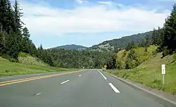
Major highways
Bus
The Mendocino Transit Authority provides local and intercity bus service within Mendocino County. Limited service also connects with transit in Sonoma County. Greyhound Bus Lines currently serves Ukiah.
Amtrak's operates connecting bus service to Ukiah, Willits and Laytonville.[55]
The historic Skunk Train is a heritage railway that connects Fort Bragg, California with Willits using steam locomotives.
Airports
- Ukiah Municipal Airport is a general aviation airport owned by the City of Ukiah. It is located south of downtown Ukiah.
- Little River Airport is a general aviation airport serving the Mendocino coast.
- Willits Municipal Airport is a general aviation airport serving the Willits / Little Lake Valley area. Located in the Brooktrails subdivision area west of Willits.
- Round Valley Airport is a general aviation airport serving the Covelo / Round Valley area.
- Boonville Airport (California) is a general aviation airport serving the Boonville / Anderson Valley area.
- Ocean Ridge Airport is a privately owned general aviation airport serving the Gualala area.
For commercial service, passengers in Mendocino County need to go to Eureka, one county to the north in Humboldt County, or to Sonoma County Airport in Santa Rosa, Sonoma County, one county to the south. More comprehensive service is available from Sacramento to the east or San Francisco, well to the south.
Emergency services for the largely unincorporated county are coordinated through Howard Forest Station, a local Cal Fire station just south of Willits.
Communities
Cities
- Fort Bragg
- Point Arena
- Ukiah (county seat)
- Willits
Census-designated places
Unincorporated communities
Indian reservations
Mendocino County has nine Indian reservations lying within its borders, the fourth most of any county in the United States (after San Diego County, California; Sandoval County, New Mexico; and Riverside County, California).
Population ranking
The population ranking of the following table is based on the 2010 census of Mendocino County.[56]
† county seat
| Rank | City/Town/etc. | Municipal type | Population (2010 Census) |
|---|---|---|---|
| 1 | † Ukiah | City | 16,075 |
| 2 | Fort Bragg | City | 7,273 |
| 3 | Willits | City | 4,888 |
| 4 | Brooktrails | CDP | 3,235 |
| 5 | Redwood Valley | CDP | 1,729 |
| 6 | Covelo | CDP | 1,255 |
| 7 | Laytonville | CDP | 1,227 |
| 8 | Talmage | CDP | 1,130 |
| 9 | Boonville | CDP | 1,035 |
| 10 | Mendocino | CDP | 894 |
| 11 | Hopland | CDP | 756 |
| 12 | Calpella | CDP | 679 |
| 13 | Potter Valley | CDP | 646 |
| 14 | Cleone | CDP | 618 |
| 15 | Caspar | CDP | 509 |
| 16 | Point Arena | City | 449 |
| 17 | Round Valley Reservation[57] (partially in Trinity County) | AIAN | 401 |
| 18 | Philo | CDP | 349 |
| 19 | Anchor Bay | CDP | 340 |
| 20 | Redwood Valley Rancheria[58] | AIAN | 238 |
| t-21 | Laytonville Rancheria[59] | AIAN | 212 |
| t-21 | Manchester-Point Arena Rancheria[60] | AIAN | 212 |
| 22 | Manchester | CDP | 195 |
| t-23 | Albion | CDP | 168 |
| t-23 | Sherwood Valley Rancheria[61] | AIAN | 168 |
| 24 | Comptche | CDP | 159 |
| 25 | Coyote Valley Reservation[62] | AIAN | 144 |
| 26 | Pinoleville Rancheria[63] | AIAN | 129 |
| 27 | Leggett | CDP | 122 |
| 28 | Little River | CDP | 117 |
| 29 | Guidiville Rancheria[64] | AIAN | 52 |
| 30 | Hopland Rancheria (Pomo Indians)[65] | AIAN | 38 |
In popular culture
"Mendocino" by The Sir Douglas Quintet was released in December 1968 and reached No. 27 in the U.S. Billboard Hot 100 by early 1969, spending 15 weeks in the chart.
Kate McGarrigle's song "(Talk to Me of) Mendocino," is one of the songs on the McGarrigles' 1975 debut album; it has been covered by Linda Ronstadt on her 1982 album Get Closer, and by the English singer-songwriter John Howard on his 2007 E.P., and also by Bette Midler on her 2014 album It's The Girls.
A song written by Matt Serletic and Bernie Taupin, "Mendocino County Line" which was released in 2002, is about a love that could not last and cites the 'Mendocino County Line' in the chorus.
See also
Notes
- Other = Some other race + Two or more races
- Native American = Native Hawaiian or other Pacific Islander + American Indian or Alaska Native
- Percentage of registered voters with respect to total population. Percentages of party members with respect to registered voters follow.
Footnotes
- "Chronology". California State Association of Counties. Archived from the original on 2015-02-06. Retrieved 2015-02-06.
- "Anthony Peak". Peakbagger.com. Archived from the original on 2015-05-02. Retrieved 2015-03-26.
- "American Fact Finder - Results". United States Census Bureau. Archived from the original on 2020-02-13. Retrieved 2019-04-19.
- "State & County QuickFacts". United States Census Bureau. Archived from the original on 2016-02-19. Retrieved 2016-04-04.
- "NACo County Explorer - Mendocino County, CA". National Association of Counties. Retrieved 2019-08-22.
- "Northern California coastal forests | Ecoregions". World Wildlife Fund. Archived from the original on 2019-08-22. Retrieved 2019-08-22.
- Regan, Trish (2009-01-23). Marijuana Inc., Inside America's Pot Industry (televised documentary). Mendocino County, California, USA: CNBC, Incorporated. Retrieved 2009-03-15.
- "History of Mendocino County". County of Mendocino. Retrieved 3 August 2013.
- "The Creation of Our 58 Counties". California State Association of Counties. Retrieved 2019-03-09.
- Cape Mendocino was named in honor of Antonio de Mendoza, the first Viceroy of New Spain. He was appointed by the emperor, and, arriving in the city of Mexico in 1535, ordered a survey of the coast of California, wherein the cape was discovered. The county was named after the cape. History of Northern California, p. 138.
- Aanestad, Christina (September 19, 2007). "Native Americans walk the California Trail of Tears". indybay.org. Retrieved June 5, 2016.
- "2010 Census Gazetteer Files". United States Census Bureau. August 22, 2012. Retrieved September 28, 2015.
- U.S. Census Bureau. American Community Survey, 2011 American Community Survey 5-Year Estimates, Table B02001. U.S. Census website. Retrieved 2013-10-26.
- U.S. Census Bureau. American Community Survey, 2011 American Community Survey 5-Year Estimates, Table B03003. U.S. Census website. Retrieved 2013-10-26.
- U.S. Census Bureau. American Community Survey, 2011 American Community Survey 5-Year Estimates, Table B19301. U.S. Census website. Retrieved 2013-10-21.
- U.S. Census Bureau. American Community Survey, 2011 American Community Survey 5-Year Estimates, Table B19013. U.S. Census website. Retrieved 2013-10-21.
- U.S. Census Bureau. American Community Survey, 2011 American Community Survey 5-Year Estimates, Table B19113. U.S. Census website. Retrieved 2013-10-21.
- U.S. Census Bureau. American Community Survey, 2011 American Community Survey 5-Year Estimates. U.S. Census website. Retrieved 2013-10-21.
- U.S. Census Bureau. American Community Survey, 2011 American Community Survey 5-Year Estimates, Table B01003. U.S. Census website. Retrieved 2013-10-21.
- "U.S. Decennial Census". United States Census Bureau. Retrieved September 28, 2015.
- "Historical Census Browser". University of Virginia Library. Retrieved September 28, 2015.
- Forstall, Richard L., ed. (March 27, 1995). "Population of Counties by Decennial Census: 1900 to 1990". United States Census Bureau. Retrieved September 28, 2015.
- "Census 2000 PHC-T-4. Ranking Tables for Counties: 1990 and 2000" (PDF). United States Census Bureau. April 2, 2001. Retrieved September 28, 2015.
- "2010 Census P.L. 94-171 Summary File Data". United States Census Bureau.
- "U.S. Census website". United States Census Bureau. Retrieved 2011-05-14.
- "District Attorney". The County of Mendocino. Retrieved March 20, 2015.
- "Mendocino County Sheriff's Office". Retrieved March 20, 2015.
- "Executive Office : Welcome". The County of Mendocino. Retrieved March 20, 2015.
- "Mendocino County district boundaries". Mendocino County Government. Retrieved 21 August 2010.
- "Board of Supervisors - Board Members". Mendocino County. Retrieved February 24, 2015.
- "Board of Supervisors | Mendocino County, CA". www.mendocinocounty.org. Retrieved 2019-03-09.
- California Secretary of State. February 10, 2013 - Report of Registration Archived July 27, 2013, at the Wayback Machine. Retrieved 2013-10-31.
- "Mendocino County, California". Epodunk.com. Retrieved 2009-09-23.
- Leip, David. "Dave Leip's Atlas of U.S. Presidential Elections". Uselectionatlas.org. Retrieved 7 November 2017.
- http://geoelections.free.fr/. Retrieved January 13, 2021. Missing or empty
|title=(help) - "California's 2nd Congressional District - Representatives & District Map". Civic Impulse, LLC. Retrieved March 1, 2013.
- "Senators". State of California. Retrieved March 10, 2013.
- "Members Assembly". State of California. Retrieved March 2, 2013.
- "Mendocino County Personal Use of Marijuana Initiative". CA NORML News. California National Organization for the Reform of Marijuana Laws. November 8, 2000. Retrieved 2009-09-23.
- La Barre, Suzanne (March 31, 2006). "Legal Limbo for Pot Users?". Berkeley Daily Planet. Retrieved 2009-09-23.
- "Measure B on the June 3 ballot". Ballotpedia. Retrieved 5 August 2013.
- Burgess, Rob (21 June 2008). "It's official: Marijuana reform effort passes". Ukiah Daily Journal. Retrieved 5 August 2013.
- Geniella, Mike (July 3, 2008). "Mendocino County won't enforce pot measure". The Press Democrat. Santa Rosa, CA. Archived from the original on March 3, 2009. Retrieved 2009-09-23.
- "Directive on Medical Marijuana 2009-04-03-NO.1" (PDF). Mendocino County Sheriff's Office. April 3, 2009. Retrieved 2009-09-23.
- "Mendocino Becomes First County in Nation to Ban Genetically Modified Crops". Wine Spectator. 2004-03-03. Archived from the original on 2019-08-22. Retrieved 2019-08-22.
- "Election Summary Report - COUNTY OF MENDOCINO CONSOLIDATED GENERAL ELECTION - NOVEMBER 4, 2008". Mendocino County, CA - GEMS Election Results. 2008-12-02. p. 8. Archived from the original (PDF) on August 22, 2019. Retrieved 2019-08-22.
- Office of the Attorney General, Department of Justice, State of California. Table 11: Crimes – 2009 Archived 2013-12-02 at the Wayback Machine. Retrieved 2013-11-14.
- Only larceny-theft cases involving property over $400 in value are reported as property crimes.
- United States Department of Justice, Federal Bureau of Investigation. Crime in the United States, 2012, Table 8 (California). Retrieved 2013-11-14.
- Holcombe, Madeline; Augie Martin (2019-04-06). "Jennifer Hart drove her six children to their deaths as her wife looked up how much they would suffer, a jury says". CNN. Retrieved 2020-01-01.
- https://www.mendovoice.com/
- http://theava.com/
- http://www.willitsweekly.com/
- https://www.democracynow.org/2018/5/9/invest_or_sell_digital_first_media
- "amtrak.com Thruway map" (PDF). Amtrak.com. Retrieved 7 November 2017.
- "Census Coverage Measurement". Census.gov. Retrieved 7 November 2017.
- "2010 Census Interactive Population Search : Round Valley Reservation". Census.gov. Retrieved 7 November 2017.
- "2010 Census Interactive Population Search : Redwood Valley Rancheria". Census.gov. Retrieved 7 November 2017.
- "2010 Census Interactive Population Search : Laytonville Rancheria". Census.gov. Retrieved 7 November 2017.
- "2010 Census Interactive Population Search : Manchester-Point Arena Rancheria". Census.gov. Retrieved 7 November 2017.
- "2010 Census Interactive Population Search : Sherwood Valley Rancheria". Census.gov. Retrieved 7 November 2017.
- "2010 Census Interactive Population Search : Coyote Valley Reservation". Census.gov. Retrieved 7 November 2017.
- "2010 Census Interactive Population Search : Pinoleville Rancheria". Census.gov. Retrieved 7 November 2017.
- "2010 Census Interactive Population Search : Guidiville Rancheria". Census.gov. Retrieved 7 November 2017.
- "2010 Census Interactive Population Search : Hopland Rancheria". Census.gov. Retrieved 7 November 2017.
Further reading
- California Legislature, Special Joint Committee on the Mendocino War, Majority and Minority Reports of the Special Joint Committee on the Mendocino War. Sacramento, CA: Charles T. Botts, State Printer, 1860.
- Aurelius O. Carpenter and Percy H. Millberry, History of Mendocino and Lake Counties, California: With Biographical Sketches of the Leading Men and Women of the Counties Who Have Been Identified with their Growth and Development from the Early Days to the Present. Los Angeles, CA: Historic Record Co., 1914.
- V.K. Chesnut, Plants Used by the Indians of Mendocino County, California. Washington, DC: U.S. Government Printing Office, 1902.
- Thomas N. Layton, Western Pomo Prehistory: Excavations at Albion Head, Nightbirds' Retreat, and Three Chop Village, Mendocino County, California. Los Angeles, CA: Institute of Archaeology, University of California, Los Angeles, 1990.
- M.B. Levick, Mendocino County, California. San Francisco, CA: Sunset Magazine Homeseekers' Bureau, n.d. [c. 1912].
- Mendocino County Chamber of Commerce, Mendocino County, California. Beverly Hills, CA: Windsor Publications, 1968.
- Lyman Palmer, History of Mendocino County, California, Comprising Its Geography, Geology, Topography, Climatography, Springs and Timber. San Francisco, CA: Alley, Bowen and Co., 1880.
- John A. Parducci, Six Decades of Making Wine in Mendocino County, California. Berkeley, CA: Regional Oral History Office, Bancroft Library, University of California, 1992.
- G. Yoell Parkhurst, Mendocino County, California. San Francisco, CA: Sunset Magazine Homeseekers' Bureau, 1909.
External links
| Wikimedia Commons has media related to Mendocino County, California. |
| Wikivoyage has a travel guide for Mendocino County. |
- Official website

- Mendocino County Tourism Commission website
- Mendocino County and Coast Travel Directory
- Mendocino County Museum
- Mendocino's Movie History - Information and Video
- Hiking trails in Mendocino County at WikiSpot
Places adjacent to Mendocino County, California | ||||||||||
|---|---|---|---|---|---|---|---|---|---|---|
| ||||||||||
| Authority control |
|---|