Andover, Iowa
Andover is a city in Clinton County, Iowa, United States. The population was 103 at the 2010 census.
Andover, Iowa | |
|---|---|
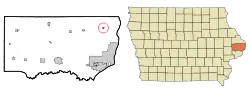 Location of Andover, Iowa | |
| Coordinates: 41°58′44″N 90°15′6″W | |
| Country | |
| State | |
| County | Clinton |
| Area | |
| • Total | 0.19 sq mi (0.50 km2) |
| • Land | 0.19 sq mi (0.50 km2) |
| • Water | 0.00 sq mi (0.00 km2) |
| Elevation | 728 ft (222 m) |
| Population | |
| • Total | 103 |
| • Estimate (2019)[3] | 98 |
| • Density | 510.42/sq mi (197.43/km2) |
| Time zone | UTC-6 (Central (CST)) |
| • Summer (DST) | UTC-5 (CDT) |
| ZIP code | 52701 |
| Area code(s) | 563 |
| FIPS code | 19-02080 |
| GNIS feature ID | 0454184 |
History
Andover was platted in 1886, and incorporated as a town in 1910.[4] It was named by a railroad official after Andover, Vermont.[5]
Geography
Andover is located at 41°58′44″N 90°15′06″W (41.978834, -90.251713).[6]
According to the United States Census Bureau, the city has a total area of 0.19 square miles (0.49 km2), all land.[7]
Demographics
| Year | Pop. | ±% |
|---|---|---|
| 1910 | 51 | — |
| 1920 | 83 | +62.7% |
| 1930 | 76 | −8.4% |
| 1940 | 72 | −5.3% |
| 1950 | 80 | +11.1% |
| 1960 | 91 | +13.7% |
| 1970 | 90 | −1.1% |
| 1980 | 107 | +18.9% |
| 1990 | 99 | −7.5% |
| 2000 | 87 | −12.1% |
| 2010 | 103 | +18.4% |
| 2019 | 98 | −4.9% |
| Source:"U.S. Census website". United States Census Bureau. Retrieved 2020-03-28. and Iowa Data Center Source: | ||
2010 census
As of the census[2] of 2010, there were 103 people, 38 households, and 27 families living in the city. The population density was 542.1 inhabitants per square mile (209.3/km2). There were 40 housing units at an average density of 210.5 per square mile (81.3/km2). The racial makeup of the city was 100.0% White.
There were 38 households, of which 47.4% had children under the age of 18 living with them, 52.6% were married couples living together, 10.5% had a female householder with no husband present, 7.9% had a male householder with no wife present, and 28.9% were non-families. 18.4% of all households were made up of individuals, and 18.4% had someone living alone who was 65 years of age or older. The average household size was 2.71 and the average family size was 3.15.
The median age in the city was 30.5 years. 29.1% of residents were under the age of 18; 7.8% were between the ages of 18 and 24; 35% were from 25 to 44; 14.6% were from 45 to 64; and 13.6% were 65 years of age or older. The gender makeup of the city was 43.7% male and 56.3% female.
2000 census
As of the census[9] of 2000, there were 87 people, 39 households, and 26 families living in the city. The population density was 439.9 people per square mile (168.0/km2). There were 40 housing units at an average density of 202.3 per square mile (77.2/km2). The racial makeup of the city was 94.25% White, and 5.75% from two or more races.
There were 39 households, out of which 35.9% had children under the age of 18 living with them, 51.3% were married couples living together, 7.7% had a female householder with no husband present, and 33.3% were non-families. 30.8% of all households were made up of individuals, and 23.1% had someone living alone who was 65 years of age or older. The average household size was 2.23 and the average family size was 2.77.
In the city, the population was spread out, with 26.4% under the age of 18, 4.6% from 18 to 24, 31.0% from 25 to 44, 17.2% from 45 to 64, and 20.7% who were 65 years of age or older. The median age was 40 years. For every 100 females, there were 97.7 males. For every 100 females age 18 and over, there were 120.7 males.
The median income for a household in the city was $33,750, and the median income for a family was $36,250. Males had a median income of $31,250 versus $19,167 for females. The per capita income for the city was $19,843. There were 8.0% of families and 3.3% of the population living below the poverty line, including 5.9% of under eighteens and none of those over 64.
Education
The Northeast Community School District operates public schools serving the community.[10]
References
- "2019 U.S. Gazetteer Files". United States Census Bureau. Retrieved July 17, 2020.
- "U.S. Census website". United States Census Bureau. Retrieved 2012-05-11.
- "Population and Housing Unit Estimates". United States Census Bureau. May 24, 2020. Retrieved May 27, 2020.
- Wolfe, Patrick B. (1911). Wolfe's History of Clinton County, Iowa, Volume 1. B. F. Bowen. pp. 251.
- Chicago and North Western Railway Company (1908). A History of the Origin of the Place Names Connected with the Chicago & North Western and Chicago, St. Paul, Minneapolis & Omaha Railways. p. 37.
- "US Gazetteer files: 2010, 2000, and 1990". United States Census Bureau. 2011-02-12. Retrieved 2011-04-23.
- "US Gazetteer files 2010". United States Census Bureau. Archived from the original on 2012-01-25. Retrieved 2012-05-11.
- "Census of Population and Housing". Census.gov. Retrieved June 4, 2015.
- "U.S. Census website". United States Census Bureau. Retrieved 2008-01-31.
- "Northeast Archived 2018-04-27 at the Wayback Machine." Iowa Department of Education. Retrieved on January 17, 2019.
Municipalities and communities of Clinton County, Iowa, United States | ||
|---|---|---|
| Cities | Map of Iowa highlighting Clinton County | |
| Townships | ||
| Unincorporated communities | ||
| Footnotes | ‡This populated place also has portions in an adjacent county or counties | |
| ||