Angoram-Middle Sepik Rural LLG
Angoram-Middle Sepik Rural LLG is a local-level government (LLG) of East Sepik Province, Papua New Guinea.[1][2]
Angoram-Middle Sepik Rural LLG | |
|---|---|
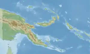 Angoram-Middle Sepik Rural LLG Location within Papua New Guinea | |
| Coordinates: 4.050312°S 144.073038°E | |
| Country | Papua New Guinea |
| Province | East Sepik Province |
| Time zone | UTC+10 (AEST) |
Wards
- 01. Changriwa (Changriwa language speakers)
- 02. Marambao
- 03. Kanduanum
- 04. Krinjambi
- 05. Tambari
- 06. Agrumara
- 07. Yuarma
- 08. Mundomundo
- 09. Kambrindo
- 10. Moim
- 11. Pinang
- 12. Magendo 1
- 13. Magendo 2
- 15. Ex Service Camp
- 16. Angoram Village
- 17. Gavieng Resett 1
- 18. Gavieng Resett 2
- 19. Gavieng Resett 3
- 20. Gavieng Resett 4
- 21. Tambunum
- 22. Wombun
- 23. Timbunke
- 24. Angriman
- 25. Mindimbit
- 26. Kamanimbit
- 27. Kararau
- 28. Timboli
- 29. Indigum
- 30. Chikinumbu
- 31. Chimbian
- 32. Saui
- 33. Kingavi
- 34. Koiwat (Koiwat language speakers)[3][4]
- 35. Paimbit
- 81. Angoram Urban
References
- "Census Figures by Wards – Momase Region". www.nso.gov.pg. 2011 National Population and Housing Census: Ward Population Profile. Port Moresby: National Statistical Office, Papua New Guinea. 2014.
- "Final Figures". www.nso.gov.pg. 2011 National Population and Housing Census: Ward Population Profile. Port Moresby: National Statistical Office, Papua New Guinea. 2014.
- Eberhard, David M.; Simons, Gary F.; Fennig, Charles D., eds. (2019). "Papua New Guinea languages". Ethnologue: Languages of the World (22nd ed.). Dallas: SIL International.
- United Nations in Papua New Guinea (2018). "Papua New Guinea Village Coordinates Lookup". Humanitarian Data Exchange. 1.31.9.
- OCHA FISS (2018). "Papua New Guinea administrative level 0, 1, 2, and 3 population statistics and gazetteer". Humanitarian Data Exchange. 1.31.9.
- United Nations in Papua New Guinea (2018). "Papua New Guinea Village Coordinates Lookup". Humanitarian Data Exchange. 1.31.9.
This article is issued from Wikipedia. The text is licensed under Creative Commons - Attribution - Sharealike. Additional terms may apply for the media files.