Arboles, Colorado
Arboles is an unincorporated town, a post office, and a census-designated place (CDP) located in southwestern Archuleta County, Colorado, United States. The Arboles post office has the ZIP code 81121.[3] At the United States Census 2010, the population of the Arboles CDP was 280, while the population of the 81121 ZIP Code Tabulation Area was 270.[4] The town's name means "trees" in Spanish.[5]
Arboles, Colorado | |
|---|---|
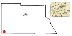 Location of the Arboles CDP in Archuleta County, Colorado. | |
 Arboles Location of the Arboles CDP in the United States. | |
| Coordinates: 37°01′13″N 107°25′20″W[1] | |
| Country | |
| State | |
| County | Archuleta County |
| Government | |
| • Type | unincorporated community |
| Area | |
| • Total | 6.170 sq mi (15.981 km2) |
| • Land | 5.155 sq mi (13.352 km2) |
| • Water | 1.015 sq mi (2.629 km2) |
| Elevation | 6,388 ft (1,947 m) |
| Population (2010) | |
| • Total | 280 |
| • Density | 54/sq mi (21/km2) |
| Time zone | UTC-7 (MST) |
| • Summer (DST) | UTC-6 (MDT) |
| ZIP Code[3] | 81121 |
| Area code(s) | 970 |
| GNIS feature[2] | Arboles CDP |
Geography
The Arboles CDP has an area of 3,949 acres (15.981 km2), including 650 acres (2.629 km2) of water.[1]
Demographics
The United States Census Bureau initially defined the Arboles CDP for the United States Census 2000.
| Year | Pop. | ±% |
|---|---|---|
| 2000 | 232 | — |
| 2010 | 280 | +20.7% |
| 2020 | — | |
| Source: United States Census Bureau | ||
See also
- Outline of Colorado
- State of Colorado
- Colorado cities and towns
- Colorado counties
- Old Spanish National Historic Trail
References
- "State of Colorado Census Designated Places - BAS20 - Data as of January 1, 2020". United States Census Bureau. Retrieved December 2, 2020.
- "U.S. Board on Geographic Names: Domestic Names". United States Geological Survey. Retrieved December 2, 2020.
- "Look Up a ZIP Code". United States Postal Service. Retrieved December 2, 2020.
- "2010: DEC Summary File 1". United States Census Bureau. Retrieved November 22, 2020.
- Dawson, John Frank (1954). Place names in Colorado: why 700 communities were so named, 150 of Spanish or Indian origin. Denver, CO: The J. Frank Dawson Publishing Co. p. 7.
External links
Municipalities and communities of Archuleta County, Colorado, United States | ||
|---|---|---|
| Town | 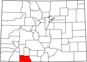 Map of Colorado highlighting Archuleta County | |
| CDP | ||
| Unincorporated communities | ||
| Indian reservation | ||
| Footnotes | ‡This populated place also has portions in an adjacent county or counties | |
| ||
This article is issued from Wikipedia. The text is licensed under Creative Commons - Attribution - Sharealike. Additional terms may apply for the media files.
