Arkoma, Oklahoma
Arkoma is a town in Le Flore County, Oklahoma, United States. It is part of the Fort Smith, Arkansas-Oklahoma Metropolitan Statistical Area. The population was 1,989 at the 2010 census, a decline from 2,180 in 2000. The name of the town is a portmanteau of Arkansas and Oklahoma. Throughout its history, Arkoma has served as a "bedroom community" because many residents commuted to work in Fort Smith.[6]
Arkoma, Oklahoma | |
|---|---|
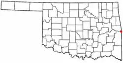 Location of Arkoma, Oklahoma | |
| Coordinates: 35°20′58″N 94°26′15″W | |
| Country | United States |
| State | Oklahoma |
| County | Le Flore |
| Area | |
| • Total | 3.52 sq mi (9.12 km2) |
| • Land | 3.47 sq mi (9.00 km2) |
| • Water | 0.05 sq mi (0.12 km2) |
| Elevation | 518 ft (158 m) |
| Population | |
| • Total | 1,989 |
| • Estimate (2019)[3] | 1,899 |
| • Density | 546.63/sq mi (211.04/km2) |
| Time zone | UTC-6 (Central (CST)) |
| • Summer (DST) | UTC-5 (CDT) |
| ZIP code | 74901 |
| Area code(s) | 539/918 |
| FIPS code | 40-02650[4] |
| GNIS feature ID | 1089693[5] |
History
The community of Arkoma was established circa 1911 on land owned by Captain James Reynolds, a Civil War veteran who had married into the Choctaw Nation. He decided to develop his property as a suburb of Fort Smith, constructed houses to rent, and persuaded the Fort Smith Light and Traction Company to build tracks and run a regular electric trolley route to his new community. The streetcar line ceased operating in 1917.[6]
Arkoma was incorporated as a town in 1946.
Geography
Arkoma is located at 35°20′58″N 94°26′15″W (35.349516, -94.437558).[7] It is located on the same side of the Arkansas River as Fort Smith, Arkansas,[6] and is bounded by the Poteau River to the west and north, and the Arkansas-Oklahoma state line to the east.
According to the United States Census Bureau, the town has a total area of 3.6 square miles (9.3 km2), of which 3.5 square miles (9.1 km2) is land and 0.1 square miles (0.26 km2) (2.23%) is water.
Arkoma enjoys a temperate climate with often mild winters and hot summers. Arkoma is near an area known as Tornado Alley.
Demographics
| Historical population | |||
|---|---|---|---|
| Census | Pop. | %± | |
| 1950 | 1,691 | — | |
| 1960 | 1,862 | 10.1% | |
| 1970 | 2,098 | 12.7% | |
| 1980 | 2,175 | 3.7% | |
| 1990 | 2,393 | 10.0% | |
| 2000 | 2,180 | −8.9% | |
| 2010 | 1,989 | −8.8% | |
| 2019 (est.) | 1,899 | [3] | −4.5% |
| U.S. Decennial Census[8] | |||
As of the census of 2010, there were 1,989 people living in the town.[2] The population density was 620.7 people per square mile (239.8/km2). There were 975 housing units at an average density of 277.6 per square mile (107.3/km2). The racial makeup of the town was 89.22% White, 0.41% African American, 5.78% Native American, 0.32% Asian, 0.87% from other races, and 3.39% from two or more races. Hispanic or Latino of any race were 1.83% of the population.
There were 877 households, out of which 28.4% had children under the age of 18 living with them, 50.4% were married couples living together, 13.5% had a female householder with no husband present, and 32.0% were non-families. 28.6% of all households were made up of individuals, and 10.5% had someone living alone who was 65 years of age or older. The average household size was 2.43 and the average family size was 2.97.
In the town, the population was spread out, with 24.6% under the age of 18, 8.8% from 18 to 24, 25.9% from 25 to 44, 25.8% from 45 to 64, and 15.0% who were 65 years of age or older. The median age was 38 years. For every 100 females, there were 96.8 males. For every 100 females age 18 and over, there were 90.9 males.
The median income for a household in the town was $23,718, and the median income for a family was $31,500. Males had a median income of $24,200 versus $17,104 for females. The per capita income for the town was $13,467. About 17.0% of families and 20.1% of the population were below the poverty line, including 26.8% of those under age 18 and 18.0% of those age 65 or over.
References
- "2019 U.S. Gazetteer Files". United States Census Bureau. Retrieved July 28, 2020.
- "2010 City Population and Housing Occupancy Status". U.S. Census Bureau. Retrieved October 18, 2013.
- "Population and Housing Unit Estimates". United States Census Bureau. May 24, 2020. Retrieved May 27, 2020.
- "U.S. Census website". United States Census Bureau. Retrieved 2008-01-31.
- "US Board on Geographic Names". United States Geological Survey. 2007-10-25. Retrieved 2008-01-31.
- Larry O'Dell, "Arkoma", Encyclopedia of Oklahoma History and Culture. Accessed March 20, 2015.
- "US Gazetteer files: 2010, 2000, and 1990". United States Census Bureau. 2011-02-12. Retrieved 2011-04-23.
- "Census of Population and Housing". Census.gov. Retrieved June 4, 2015.
External links
- Arkoma High School
- Arkoma Public Library
- Encyclopedia of Oklahoma History and Culture - Arkoma
- Oklahoma Digital Maps: Digital Collections of Oklahoma and Indian Territory
Municipalities and communities of Le Flore County, Oklahoma, United States | ||
|---|---|---|
| Cities | 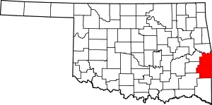 Le Flore County map | |
| Towns | ||
| CDPs | ||
| Other unincorporated communities | ||
| Indian reservation | ||
| Footnotes | ‡This populated place also has portions in another county or counties | |
| ||