Armstrong Peak
Armstrong Peak is a peak, 1,470 metres (4,820 ft) high, standing 15 nautical miles (28 km) southeast of Mount Codrington in Enderby Land of East Antarctica.[1]
| Armstrong Peak | |
|---|---|
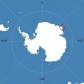 Map of Antarctica indicating location of Armstrong Peak | |
| Highest point | |
| Elevation | 1,470 m (4,820 ft) |
| Coordinates | 66°24′S 53°23′E |
| Geography | |
| Location | Enderby Land, East Antarctica |
Discovery and naming
Armstrong Peak was mapped by Norwegian cartographers from aerial photographs taken by the Lars Christensen Expedition, 1936–37, and named "Austnuten" (the east peak). The peak was re-photographed by Australian National Antarctic Research Expeditions (ANARE) in 1956. An astrofix was obtained nearby in December 1959 by J.C. Armstrong, ANARE surveyor at Mawson Station, for whom the feature was renamed by the Antarctic Names Committee of Australia in 1960.[1]
References
- "Armstrong Peak". Geographic Names Information System. United States Geological Survey. Retrieved 18 June 2010.
External links
- Australian Antarctic Division
- Australian Antarctic Gazetteer
- Australian Antarctic Names and Medals Committee (AANMC)
- Scientific Committee on Antarctic Research (SCAR)
- PDF Map of the Australian Antarctic Territory
- Mawson Station
- ANARE Club
![]() This article incorporates public domain material from the United States Geological Survey document: "Armstrong Peak". (content from the Geographic Names Information System)
This article incorporates public domain material from the United States Geological Survey document: "Armstrong Peak". (content from the Geographic Names Information System)
| General |
| .svg.png.webp) |
|---|---|---|
| Regions | ||
| Waterways | ||
| Famous explorers | ||