Arong, Car Nicobar
Arong is a village in the Nicobar district of Andaman and Nicobar Islands, India. It is located in the Car Nicobar tehsil.[1]
Arong
Ha-ran | |
|---|---|
village | |
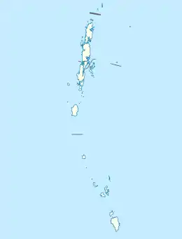 Arong Location in Andaman and Nicobar Islands, India  Arong Arong (India) | |
| Coordinates: 9.162116°N 92.750611°E | |
| Country | India |
| State | Andaman and Nicobar Islands |
| District | Nicobar |
| Tehsil | Car Nicobar |
| Population (2011) | |
| • Total | 1,194 |
| Time zone | UTC+5:30 (IST) |
| Census code | 645015 |
Demographics
According to the 2011 census of India, Arong has 233 households. The effective literacy rate (i.e. the literacy rate of population excluding children aged 6 and below) is 87.73%.[2]
| Total | Male | Female | |
|---|---|---|---|
| Population | 1194 | 617 | 577 |
| Children aged below 6 years | 183 | 87 | 96 |
| Scheduled caste | 0 | 0 | 0 |
| Scheduled tribe | 1117 | 584 | 533 |
| Literates | 887 | 475 | 412 |
| Workers (all) | 527 | 349 | 178 |
| Main workers (total) | 506 | 343 | 163 |
| Main workers: Cultivators | 10 | 7 | 3 |
| Main workers: Agricultural labourers | 4 | 3 | 1 |
| Main workers: Household industry workers | 177 | 131 | 46 |
| Main workers: Other | 315 | 202 | 113 |
| Marginal workers (total) | 21 | 6 | 15 |
| Marginal workers: Cultivators | 1 | 0 | 1 |
| Marginal workers: Agricultural labourers | 0 | 0 | 0 |
| Marginal workers: Household industry workers | 11 | 0 | 11 |
| Marginal workers: Others | 9 | 6 | 3 |
| Non-workers | 667 | 268 | 399 |
References
- "Andaman and Nicobar Islands villages" (PDF). Land Records Information Systems Division, NIC. Archived from the original (PDF) on 4 March 2016. Retrieved 25 July 2015.
- "District Census Handbook - Andaman & Nicobar Islands" (PDF). 2011 Census of India. Directorate of Census Operations, Andaman & Nicobar Islands. Archived from the original (PDF) on 1 August 2015. Retrieved 21 July 2015.
This article is issued from Wikipedia. The text is licensed under Creative Commons - Attribution - Sharealike. Additional terms may apply for the media files.