Aroroy
Aroroy, officially the Municipality of Aroroy, is a 1st class municipality in the province of Masbate, Philippines. According to the 2015 census, it has a population of 86,168 people. [3] The town is known for the Kalanay Cave, one of the most important archaeological sites in Masbate province.
Aroroy | |
|---|---|
| Municipality of Aroroy | |
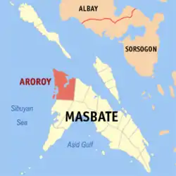 Map of Masbate with Aroroy highlighted | |
OpenStreetMap 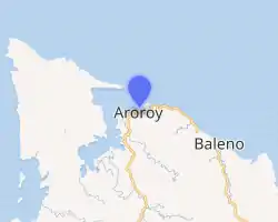
| |
.svg.png.webp) Aroroy Location within the Philippines | |
| Coordinates: 12°30′45″N 123°23′56″E | |
| Country | |
| Region | Bicol Region (Region V) |
| Province | Masbate |
| District | 2nd district |
| Founded | 1904 |
| Barangays | 41 (see Barangays) |
| Government | |
| • Type | Sangguniang Bayan |
| • Mayor | Arturo "Turing" B. Virtucio |
| • Vice Mayor | Valentin C. Alonzo |
| • Representative | Elisa T. Kho |
| • Electorate | 52,209 voters (2019) |
| Area | |
| • Total | 440.30 km2 (170.00 sq mi) |
| Elevation | 32 m (105 ft) |
| Population | |
| • Total | 86,168 |
| • Density | 200/km2 (510/sq mi) |
| • Households | 17,039 |
| Economy | |
| • Income class | 1st municipal income class |
| • Poverty incidence | 41.78% (2015)[4] |
| • Revenue | ₱328,154,098.83 (2016) |
| Time zone | UTC+8 (PST) |
| ZIP code | 5414 |
| PSGC | |
| IDD : area code | +63 (0)56 |
| Climate type | tropical rainforest climate |
| Native languages | Masbateño language Tagalog |
| Website | www |
History and Origin of Name
The town of Aroroy (Al-Oroy its former name), which came from the Spanish word for gold-"oro", was established back in 1822 upon the arrival of a Chinese expedition. The Chinese fleet was composed of seven vessels called "pancos". They entered Lanang River, which is part of Puerto Barrera, the former name of the area now covered by Aroroy. A Moro named Talcum guided this expedition. They were sent by the Chinese merchants who came to Aroroy to explore for gold coins near Lanang River.[5]
During that time, when the present Masbate province was still part of the province of Ibalon (present-day Albay),[6] a captain from the Spanish Army named Gregorio Cordero of Tondo, Manila was exiled in Masbate for the killing of his superior officer. Instead of being incarcerated in the castle of San Pascual in Burias Island, where political and military prisoners were imprisoned by the Captain-General of the Philippine Islands, he was brought to Masbate. Accompanied by his two daughters and a son, they established residency in the Port of Magdalena, municipality of Masbate. He had with him four (4) "Faluas" or Spanish vessels named – Jesus Maria Y Jose, Sacramento, Salvacion and Santa Ana for use in the vigilance against Moro pirates who preyed on the three islands of Masbate, Ticao and Burias.
When the Spaniards discovered the Chinese expedition, Cordero and about one-hundred fifty (150) men, who believed him to possess amulets (anting-anting) which made him invulnerable, sailed to Lanang River to find out the nationality of the said seven (7) vessels which entered Lanang River. When investigated as to where they were going, the aliens answered in their Chinese manner that they were going to "Al-Oroy" meaning to the Gold or in Spanish “Al-oro”. Not satisfied with the results of the investigation with the belief that these are Moro vessels, Cordero and his men established their headquarters for over three (3) months in the presentpoblacion of Aroroy, which was known as Al-Oroy taken from the Chinese reply.
Another expedition of Spaniards from Manila headed by a certain Sarmiento came to explore the gold in the river near Al-oroy in 1861. This expedition was aided by natives of Al-oroy which includes among them were certain Toribio Bunayag, Jose Pusing, Norberto Pusing and Protacio Fabon. Said natives abandoned expedition during the same year because of assaults who are dedicated to pan the riverbeds with bateas and/or limbasan to recover the gold nuggets themselves. This led to the death of Sarmiento and since then said river was called Rio Guinobatan or “River of Assaults”.
Since then the site of Al-Oroy became a "vista" or barrio of the town of Baleno but later was transferred to the town of San Agustin in the interior part of Port Barrera. In 1904, when the towns of Baleno and San Agustin were combined, the name Al-Oroy was changed to Aroroy. It was also in 1904 when Aroroy became a municipality because of its strategic location. San Agustin now is just a barangay of the Municipality of Aroroy.
Geography
Aroroy is geographically located between 12 degrees and 13 degrees Latitude and 123 degrees and 124 degrees Longitude or at the northernmost part of the province of Masbate, Bicol Region. It is bounded on the north by the Masbate Pass, to the East by the municipality of Baleno, to the West by the Sibuyan Sea and to the South by the municipalities of Milagros and Mandaon.[7]
Barangays
Aroroy is politically subdivided into 41 barangays. [2]
- Ambolong
- Amoroy
- Amotag
- Baga-uma
- Balawing
- Balete
- Bangon
- Cabangcalan
- Cabas-An
- Calanay
- Capsay
- Concepcion (formerly Sawmill[8])
- Dayhagan
- Don Pablo Dela Rosa
- Gumahang
- Jaboyoan
- Lanang
- Luy-a
- Macabug
- Malubi
- Managanaga
- Manamoc
- Mariposa
- Mataba
- Matalangtalang
- Matongog
- Nabongsoran
- Pangle
- Panique
- Pinanaan
- Poblacion
- Puro
- San Agustin
- San Isidro
- Sawang
- Syndicate
- Talabaan
- Talib
- Tigbao
- Tinago
- Tinigban
Climate
| Climate data for Aroroy, Masbate | |||||||||||||
|---|---|---|---|---|---|---|---|---|---|---|---|---|---|
| Month | Jan | Feb | Mar | Apr | May | Jun | Jul | Aug | Sep | Oct | Nov | Dec | Year |
| Average high °C (°F) | 27 (81) |
28 (82) |
29 (84) |
31 (88) |
31 (88) |
30 (86) |
29 (84) |
30 (86) |
29 (84) |
29 (84) |
29 (84) |
28 (82) |
29 (84) |
| Average low °C (°F) | 22 (72) |
21 (70) |
22 (72) |
23 (73) |
24 (75) |
25 (77) |
25 (77) |
25 (77) |
25 (77) |
24 (75) |
23 (73) |
23 (73) |
24 (74) |
| Average precipitation mm (inches) | 65 (2.6) |
44 (1.7) |
42 (1.7) |
39 (1.5) |
87 (3.4) |
150 (5.9) |
184 (7.2) |
153 (6.0) |
163 (6.4) |
154 (6.1) |
127 (5.0) |
100 (3.9) |
1,308 (51.4) |
| Average rainy days | 13.9 | 9.2 | 11.1 | 12.5 | 19.6 | 24.3 | 26.5 | 25.0 | 25.5 | 24.4 | 19.4 | 15.1 | 226.5 |
| Source: Meteoblue [9] | |||||||||||||
Demographics
|
| |||||||||||||||||||||||||||||||||||||||||||||
| Source: Philippine Statistics Authority [3] [10] [11][12] | ||||||||||||||||||||||||||||||||||||||||||||||
In the 2015 census, the population of Aroroy was 86,168 people, [3] with a density of 200 inhabitants per square kilometre or 520 inhabitants per square mile.
References
- Municipality of Aroroy | (DILG)
- "Province: Masbate". PSGC Interactive. Quezon City, Philippines: Philippine Statistics Authority. Retrieved 12 November 2016.
- Census of Population (2015). "Region V (Bicol Region)". Total Population by Province, City, Municipality and Barangay. PSA. Retrieved 20 June 2016.
- "PSA releases the 2015 Municipal and City Level Poverty Estimates". Quezon City, Philippines. Retrieved 1 January 2020.
- LGU-Aroroy. "Municipality of Aroroy-Integrated Coastal Management Plan" (PDF). Local Government Unit of Aroroy, Masbate. Archived from the original (PDF) on 6 June 2014. Retrieved 3 June 2014.
- LGU-Masbate City. "History of Masbate City". Local Government Unit of Masbate City. Archived from the original on 2 May 2014. Retrieved 3 June 2014.
- "Sustainable Solar Market Packages (SSMP)-Aroroy, Masbate" (PDF). www.doe.gov.ph. Department of Energy. Archived from the original (PDF) on 6 June 2014. Retrieved 3 June 2014.
- "An Act Changing the Name of the Barrio of Sawmill, Municipality of Aroroy, Province of Masbate, to Concepcion". LawPH.com. Retrieved 2011-04-12.
- "Aroroy: Average Temperatures and Rainfall". Meteoblue. Retrieved 23 June 2020.
- Census of Population and Housing (2010). "Region V (Bicol Region)". Total Population by Province, City, Municipality and Barangay. NSO. Retrieved 29 June 2016.
- Censuses of Population (1903–2007). "Region V (Bicol Region)". Table 1. Population Enumerated in Various Censuses by Province/Highly Urbanized City: 1903 to 2007. NSO.
- "Province of Masbate". Municipality Population Data. Local Water Utilities Administration Research Division. Retrieved 17 December 2016.
External links
- Aroroy Profile at PhilAtlas.com
- Philippine Standard Geographic Code
- Philippine Census Information
- Local Governance Performance Management System
Places adjacent to Aroroy | ||||||||||
|---|---|---|---|---|---|---|---|---|---|---|
| ||||||||||