Arrondissement of Argenteuil
The arrondissement of Argenteuil is an arrondissement of France in the Val-d'Oise department in the Île-de-France region. It has 17 communes.[1] Its population is 412,334 (2016), and its area is 108.6 km2 (41.9 sq mi).[2]
Argenteuil | |
|---|---|
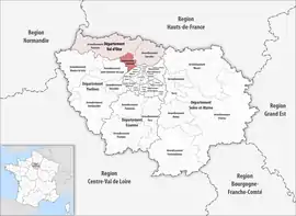 Location within the region Île-de-France | |
| Country | France |
| Region | Île-de-France |
| Department | Val-d'Oise |
| No. of communes | 17 |
| Subprefecture | Argenteuil |
| Area | |
| • Total | 108.6 km2 (41.9 sq mi) |
| Population (2016) | |
| • Total | 412,334 |
| • Density | 3,797/km2 (9,830/sq mi) |
| INSEE code | 951 |
Composition
The communes of the arrondissement of Argenteuil, and their INSEE codes, are:[1]
- Argenteuil (95018)
- Beauchamp (95051)
- Bessancourt (95060)
- Bezons (95063)
- Cormeilles-en-Parisis (95176)
- Eaubonne (95203)
- Ermont (95219)
- Franconville (95252)
- Frépillon (95256)
- La Frette-sur-Seine (95257)
- Herblay-sur-Seine (95306)
- Montigny-lès-Cormeilles (95424)
- Pierrelaye (95488)
- Le Plessis-Bouchard (95491)
- Saint-Leu-la-Forêt (95563)
- Sannois (95582)
- Taverny (95607)
History
The arrondissement of Argenteuil was created in 1966 as part of the department Seine-et-Oise.[3] In 1968 it became part of the new department Val-d'Oise.[4] At the January 2017 reorganisation of the arrondissements of Val-d'Oise, it received 10 communes from the arrondissement of Pontoise.[5]
As a result of the reorganisation of the cantons of France which came into effect in 2015, the borders of the cantons are no longer related to the borders of the arrondissements. The cantons of the arrondissement of Argenteuil were, as of January 2015:[6]
- Argenteuil-Est
- Argenteuil-Nord
- Argenteuil-Ouest
- Bezons
- Cormeilles-en-Parisis
- Herblay
- Sannois
References
- "Arrondissement d'Argenteuil (951)". INSEE. Retrieved 2019-10-05.
- "Comparateur de territoire, géographie au 01/01/2019". INSEE. Retrieved 2019-10-04.
- Ancien département : la Seine-et-Oise
- Historique du Val-d'Oise
- "Arrêté préfectoral, 30 December 2016" (PDF). pp. 42–48. Retrieved 2019-10-29.
- "Populations légales 2012" (PDF). INSEE. December 2014. Retrieved 2019-10-29.