Ashville, Ohio
Ashville is a village in Pickaway County, Ohio, United States. The population was 4,097 at the 2010 census. Ashville is located 22 miles south of Columbus and 11 miles north of Circleville.
Ashville, Ohio | |
|---|---|
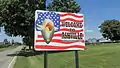
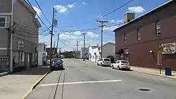 Looking west on West Main Street | |
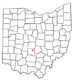 Location of Ashville, Ohio | |
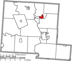 Location of Ashville in Pickaway County | |
 Ashville Location of Ashville, Ohio  Ashville Ashville (the United States)  Ashville Ashville (North America) | |
| Coordinates: 39°43′3″N 82°57′10″W | |
| Country | United States |
| State | Ohio |
| County | Pickaway |
| Township | Harrison |
| Government | |
| • Mayor | Chuck Wise |
| • Village Administrator | Franklin Christman |
| Area | |
| • Total | 2.23 sq mi (5.77 km2) |
| • Land | 2.23 sq mi (5.77 km2) |
| • Water | 0.00 sq mi (0.00 km2) |
| Elevation | 709 ft (216 m) |
| Population | |
| • Total | 4,097 |
| • Estimate (2019)[4] | 4,385 |
| • Density | 1,967.25/sq mi (759.60/km2) |
| Time zone | UTC-5 (Eastern (EST)) |
| • Summer (DST) | UTC-4 (EDT) |
| ZIP code | 43103 |
| Area code(s) | 740 |
| FIPS code | 39-02680[5] |
| GNIS feature ID | 1064348[2] |
| Website | http://ashvilleohio.gov |
History
In 1812 two distilleries were built near Ashville and were owned by William and Richard Staige (Stage). The land that is now Ashville was at that time primarily the property of Richard Staige. After many years he sold his distillery to Mahlon Ashbrook, who did a large business with his brother Absolom. He also built a grist mill on Walnut Creek about 1845 and owned a large store that was run by his sister Iva "Ivy" and her husband Daniel Kellerman. Kellerman was the first postmaster in Ashbrook (later Ashville). The Ashbrook's enterprises failed in 1855. From that time, until the construction of the Scioto Valley Railroad through Ashville and the advent of a depot in 1876, business was slow. Ashville was incorporated in 1882, with the first mayor being W. R. Julian.

A historical museum, Ohio's Small Town Museum, is operated in the community.[6] The museum, established in 1975, claims to be home to America's oldest working traffic light, which directed traffic in downtown Ashville until 1982. This signal was designed by local resident Teddy Boor.[7]
Ashville is featured in the Together Concepts video production "We Are..Teays Valley". The video depicts a surprising number of achievements and innovations, as well as connections to American and world history.[8]
The Ashville-Teays Valley School District area is the subject of a book titled, Amazing Ashville--The Most Colorful Community in America. The book features colorful stories about current and former residents, famous visitors, and unusual events. The book honors achievements in graphic arts, entertainment, patents, publishing, recording, sports, military, movies, advertising, politics, and more. It describes connections to national and world events and political movements. [9]
The Puppeteers of America organization was first incorporated in Ashville in 1961 and the Puppetry Journal was published by the Pickaway Publishing Company in Ashville.[10]
Geography
Ashville is located at 39°43′03″N 82°57′10″W.[11]
According to the United States Census Bureau, the village has a total area of 2.51 square miles (6.50 km2), all of it land.[12]
Demographics
| Historical population | |||
|---|---|---|---|
| Census | Pop. | %± | |
| 1890 | 430 | — | |
| 1900 | 654 | 52.1% | |
| 1910 | 972 | 48.6% | |
| 1920 | 1,032 | 6.2% | |
| 1930 | 1,085 | 5.1% | |
| 1940 | 1,101 | 1.5% | |
| 1950 | 1,303 | 18.3% | |
| 1960 | 1,639 | 25.8% | |
| 1970 | 1,772 | 8.1% | |
| 1980 | 2,046 | 15.5% | |
| 1990 | 2,254 | 10.2% | |
| 2000 | 3,174 | 40.8% | |
| 2010 | 4,097 | 29.1% | |
| 2019 (est.) | 4,385 | [4] | 7.0% |
| U.S. Decennial Census[13] | |||
2010 census
As of the census[3] of 2010, there were 4,097 people, 1,598 households, and 1,100 families living in the village. The population density was 1,632.3 inhabitants per square mile (630.2/km2). There were 1,731 housing units at an average density of 689.6 per square mile (266.3/km2). The racial makeup of the village was 96.7% White, 1.0% African American, 0.4% Native American, 0.3% Asian, 0.1% from other races, and 1.4% from two or more races. Hispanic or Latino of any race were 1.4% of the population.
There were 1,598 households, of which 41.6% had children under the age of 18 living with them, 45.7% were married couples living together, 15.6% had a female householder with no husband present, 7.6% had a male householder with no wife present, and 31.2% were non-families. 25.5% of all households were made up of individuals, and 8.8% had someone living alone who was 65 years of age or older. The average household size was 2.56 and the average family size was 3.05.
The median age in the village was 32.8 years. 29.3% of residents were under the age of 18; 9.8% were between the ages of 18 and 24; 29.6% were from 25 to 44; 21.9% were from 45 to 64; and 9.5% were 65 years of age or older. The gender makeup of the village was 48.5% male and 51.5% female.
2000 census
As of the census[5] of 2000, there were 3,174 people, 1,243 households, and 872 families living in the village. The population density was 2,035.8 people per square mile (785.6/km2). There were 1,337 housing units at an average density of 857.5 per square mile (330.9/km2). The racial makeup of the village was 97.83% White, 0.19% African American, 0.32% Native American, 0.06% Asian, 0.19% from other races, and 1.42% from two or more races. Hispanic or Latino of any race were 1.07% of the population.
There were 1,243 households, out of which 40.4% had children under the age of 18 living with them, 52.5% were married couples living together, 13.4% had a female householder with no husband present, and 29.8% were non-families. 24.9% of all households were made up of individuals, and 9.9% had someone living alone who was 65 years of age or older. The average household size was 2.55 and the average family size was 3.03.
In the village, the population was spread out, with 29.6% under the age of 18, 9.6% from 18 to 24, 33.8% from 25 to 44, 17.7% from 45 to 64, and 9.3% who were 65 years of age or older. The median age was 31 years. For every 100 females there were 93.5 males. For every 100 females age 18 and over, there were 85.3 males.
The median income for a household in the village was $40,778, and the median income for a family was $47,092. Males had a median income of $35,236 versus $22,231 for females. The per capita income for the village was $16,645. About 6.3% of families and 9.5% of the population were below the poverty line, including 11.5% of those under age 18 and 6.0% of those age 65 or over.
Government
Ashville is governed by the mayor–council system of government. As of 2020, the mayor was Chuck Wise, the council members were President Pro Tempore Nelson Embrey, Roger L. Clark, Brad Lutz, Randy Loveless, David Rainey, and Tracie Sorvillo, and the village administrator was Franklin Christman.[14]
Education
Teays Valley Local School District operates three schools within the village. They include Teays Valley High School, East Middle School, and Ashville Elementary.[15]
Ashville has a public library, a branch of the Pickaway County Library.[16]
Arts and culture
Ashville's Fourth of July Celebration has been featured in articles by The New York Times and The Philadelphia Inquirer. The celebration was captured by social realist artist and photographer, Ben Shahn, in 1938 for the Farm Security Administration. Thousands of people come from all over the state to enjoy the parades, fish sandwiches, musical entertainment, games, rides, small town atmosphere, concessions, and fireworks.
The Ashville Viking Festival has been running since 2003.
Notable residents
- Harley H. Christy, admiral
- Champ Henson, football player
- John Holmes, pornographic actor
- William Ashbrook Kellerman, editor, explorer and photographer
- Isham Randolph, Chicago and Panama Canal civil engineer
Gallery
- Iconic traffic light
 Ashville corporation limit sign on Lockbourne-Eastern Road
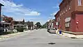 Looking north on Long Street
 Looking east on East Main Street
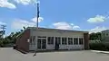 Ashville Post Office
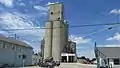 Ashville Grain, LLC
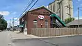 Former Power Station, now a restaurant.
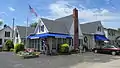 Former Village Curiosity Shoppe
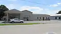 Ashville Police Department
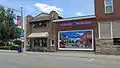 Ohio's Small Town Museum
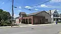 Floyd E. Younkin Library
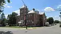 Former Ashville High School, now apartments
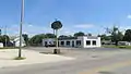 Ashville Cleaning Center
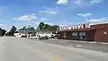 IGA Food Market
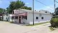 Cherry Street Diner
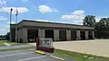 Harrison Township Fire Department
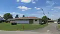 Village of Ashville Administrative Building
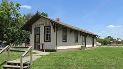 Ashville Depot
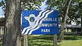 Ashville Community Park
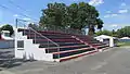 Ashville Community Park
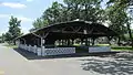 Ashville Community Park
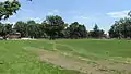 Ashville Community Park
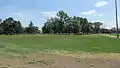 Ashville Community Park
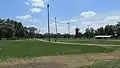 Ashville Community Park
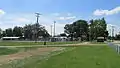 Ashville Community Park
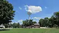 World's Oldest Traffic Light water tower
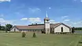 Village Chapel Church
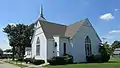 New Hope Free Will Baptist Church
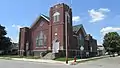 Zion United Methodist Church
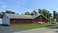 Ashville Church of Christ in Christian Union
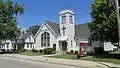 First English Lutheran Church
References
- "2019 U.S. Gazetteer Files". United States Census Bureau. Retrieved July 27, 2020.
- "US Board on Geographic Names". United States Geological Survey. 2007-10-25. Retrieved 2008-01-31.
- "U.S. Census website". United States Census Bureau. Retrieved 2013-01-06.
- "Population and Housing Unit Estimates". Retrieved May 21, 2020.
- "U.S. Census website". United States Census Bureau. Retrieved 2008-01-31.
- Ashville Area Heritage Society
- Neato Stuff At the Ashville Museum Archived 2010-01-02 at the Wayback Machine, Ohio's Small Town Museum in Ashville. Accessed 2009-08-13.
- A New Film Sheds Light on Local Achievements
- Hines, Bob, 2020. Amazing Ashville--The Most Colorful Community in America. Reedy Press, St. Louis, MO.
- Code of Regulations
- "US Gazetteer files: 2010, 2000, and 1990". United States Census Bureau. 2011-02-12. Retrieved 2011-04-23.
- "US Gazetteer files 2010". United States Census Bureau. Archived from the original on 2012-01-25. Retrieved 2013-01-06.
- "Census of Population and Housing". Census.gov. Retrieved June 4, 2015.
- Village of Ashville - Council Members, Ashville, 2020. Accessed 2020-01-21.
- "Teays Valley High School". Teays Valley Local School District. Retrieved 3 March 2018.
- "Locations". Pickaway County Library. Archived from the original on 3 March 2018. Retrieved 3 March 2018.
External links
Municipalities and communities of Pickaway County, Ohio, United States | ||
|---|---|---|
| City | 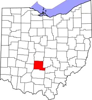 Map of Ohio highlighting Pickaway County | |
| Villages | ||
| Townships | ||
| CDPs | ||
| Unincorporated communities | ||
| Ghost town | ||
| Footnotes | ‡This populated place also has portions in an adjacent county or counties | |
| ||
| Authority control |
|
|---|