Bédoin
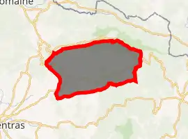
Bédoin is a commune in the Vaucluse department in the Provence-Alpes-Côte d'Azur region in southeastern France.
Bédoin | |
|---|---|
 The village of Bédoin | |
.svg.png.webp) Coat of arms | |
Location of Bédoin 
| |
 Bédoin  Bédoin | |
| Coordinates: 44°07′26″N 5°10′50″E | |
| Country | France |
| Region | Provence-Alpes-Côte d'Azur |
| Department | Vaucluse |
| Arrondissement | Carpentras |
| Canton | Pernes-les-Fontaines |
| Intercommunality | Ventoux-Comtat Venaissin |
| Government | |
| • Mayor (2020–2026) | Alain Constant[1] |
| Area 1 | 91.03 km2 (35.15 sq mi) |
| Population (2017-01-01)[2] | 3,099 |
| • Density | 34/km2 (88/sq mi) |
| Time zone | UTC+01:00 (CET) |
| • Summer (DST) | UTC+02:00 (CEST) |
| INSEE/Postal code | 84017 /84410 |
| Elevation | 240–1,883 m (787–6,178 ft) (avg. 300 m or 980 ft) |
| 1 French Land Register data, which excludes lakes, ponds, glaciers > 1 km2 (0.386 sq mi or 247 acres) and river estuaries. | |
Geography
Located at the base of Mont Ventoux, it is the starting point of one of the three routes to the summit of the mountain (the other routes start in Malaucène and Sault). The Tour de France frequently uses this approach to Mont Ventoux hence the strong presence of cycling in the town.
History
In 1794, the village of Bédoin was destroyed by the Revolutionaries and 66 people were executed.
See also
References
- "Répertoire national des élus: les maires". data.gouv.fr, Plateforme ouverte des données publiques françaises (in French). 2 December 2020. Retrieved 7 December 2020.
- "Populations légales 2017". INSEE. Retrieved 6 January 2020.
| Wikimedia Commons has media related to Bédoin. |
This article is issued from Wikipedia. The text is licensed under Creative Commons - Attribution - Sharealike. Additional terms may apply for the media files.