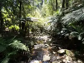
Badger Creek, Victoria
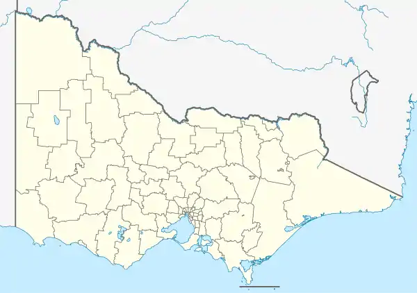
Badger Creek is a town in Victoria, Australia, 53 km north-east from Melbourne's central business district. Its local government area is the Shire of Yarra Ranges. At the 2016 census, Badger Creek had a population of 1,563.[1]
| Badger Creek Victoria | |||||||||||||||
|---|---|---|---|---|---|---|---|---|---|---|---|---|---|---|---|
 | |||||||||||||||
 Badger Creek | |||||||||||||||
| Coordinates | 37.685°S 145.538°E | ||||||||||||||
| Population | 1,563 (2016 census)[1] | ||||||||||||||
| Postcode(s) | 3777 | ||||||||||||||
| Elevation | 210 m (689 ft) | ||||||||||||||
| Location |
| ||||||||||||||
| LGA(s) | Shire of Yarra Ranges | ||||||||||||||
| State electorate(s) | Eildon | ||||||||||||||
| Federal Division(s) | McEwen | ||||||||||||||
| |||||||||||||||
Badger Creek is near the Healesville Sanctuary and the former Aboriginal reserve, Coranderrk, now known as the Coranderrk Bushland.
History
The creek was named after the wombats in the area which were often called badgers.[2]
Badger Creek was surveyed as a township in 1894, but was not settled to any extent until some time later. The Coranderrk school opened in 1890, being replaced by the Badger Creek school in 1899.[3] The Post Office opened around 1902 as Badger Creek State School, was renamed Badger Creek around 1907 and closed in 1930.[4]
The weir in the Badger Creek reserve was constructed in 1909 and feeds water to the Silvan Reservoir.
See also
References
- "2016 Census QuickStats Badger Creek". Australian Bureau of Statistics. Retrieved 26 April 2019.
- Lady Wild Life, Common Wombat, archived from the original on 25 July 2008, retrieved 1 September 2008
- Monash University, Australian Places - Badger Creek, archived from the original on 11 May 2004, retrieved 1 September 2008
- Premier Postal History, Post Office List, retrieved 11 April 2008