Matlock, Victoria
Matlock is a town in Victoria, Australia on the Warburton–Woods Point Road, in the Shire of Mansfield.
| Matlock Victoria | |||||||||
|---|---|---|---|---|---|---|---|---|---|
 Matlock | |||||||||
| Coordinates | 37°36′S 146°13′E | ||||||||
| Population | 0 (2016 census)[1] | ||||||||
| Established | 1863 | ||||||||
| Postcode(s) | 3723 | ||||||||
| Elevation | 1,150 m (3,773 ft) | ||||||||
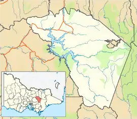
| Location | |||||||||
| LGA(s) | |||||||||
| State electorate(s) | Eildon | ||||||||
| Federal Division(s) | Indi | ||||||||
| |||||||||
The town began after gold was discovered in 1863. The Post Office opened on 21 July 1864, closed in 1934, reopened in 1956 (when a sawmill was established) and closed in 1970.[2] Prior to 1864 the town was known as Emerald Hill, but was changed to avoid confusion with the Melbourne suburb of the same name (this second locality later underwent a name change to South Melbourne). At its peak, the town had a population of around 300, and included several suburbs including Thackery, Alhambra, Mutton Town, and Harpers Creek.
The town was destroyed by fire in 1873, and a smaller village was built in a slightly different location. Mining activity slowed in the 1870s and 1880s, although there was a resurgence in population in the 1890s. By the 1930s only two businesses remained; a wine shop and a post office. A sawmill operated from 1953 to 1975.
Climate
Owing to its altitude of nearly 1.2 km and latitude of 37.5° S, as well as windward position, Matlock yields a cold oceanic climate (Cfb), approaching subpolar oceanic (Cfc); with particularly heavy snowfall in the winter months, with snow even falling in summer. Precipitation is extreme, especially in winter.
| Climate data for Matlock, VIC; 1,184 m AMSL; 37° 35′ 20.04″ S | |||||||||||||
|---|---|---|---|---|---|---|---|---|---|---|---|---|---|
| Month | Jan | Feb | Mar | Apr | May | Jun | Jul | Aug | Sep | Oct | Nov | Dec | Year |
| Average high °C (°F) | 21.4 (70.5) |
21.5 (70.7) |
18.8 (65.8) |
13.7 (56.7) |
9.1 (48.4) |
6.4 (43.5) |
5.0 (41.0) |
6.2 (43.2) |
9.1 (48.4) |
12.7 (54.9) |
15.4 (59.7) |
18.5 (65.3) |
13.2 (55.7) |
| Average low °C (°F) | 7.2 (45.0) |
7.6 (45.7) |
6.2 (43.2) |
3.6 (38.5) |
1.5 (34.7) |
0.0 (32.0) |
−0.9 (30.4) |
−0.6 (30.9) |
0.4 (32.7) |
2.7 (36.9) |
3.9 (39.0) |
5.7 (42.3) |
3.1 (37.6) |
| Average precipitation mm (inches) | 87 (3.4) |
69 (2.7) |
92 (3.6) |
141 (5.6) |
181 (7.1) |
182 (7.2) |
214 (8.4) |
223 (8.8) |
189 (7.4) |
173 (6.8) |
146 (5.7) |
129 (5.1) |
1,826 (71.8) |
| Source: | |||||||||||||
References
- Australian Bureau of Statistics (27 June 2017). "Matlock (State Suburb)". 2016 Census QuickStats. Retrieved 20 August 2020.

- Phoenix Auctions History, Post Office List, retrieved 20 January 2021