Baie-D'Urfé
Baie-D'Urfé (French pronunciation: [bɛ dyʁfe]; previously Baie d'Urfé or Baie d'Urfee)[6] is an on-island suburb of Montreal, Quebec, Canada. It is part of the West Island area of the Island of Montreal.[7]
Baie-D'Urfé | |
|---|---|
| Town of Baie-D'Urfé | |
.jpg.webp) The town hall of Baie-D'Urfé | |
.svg.png.webp) Coat of arms | |
 Location on the Island of Montreal. (Outlined areas indicate demerged municipalities). | |
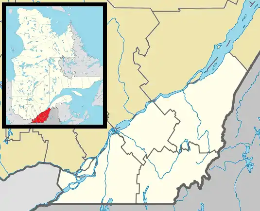 Baie-D'Urfé Location in southern Quebec. | |
| Coordinates: 45°25′N 73°55′W[1] | |
| Country | |
| Province | |
| Region | Montréal |
| RCM | None |
| Founded | 1686[2] |
| Town charter | March 1911[3] |
| Merged into Beaconsfield–Baie-D'Urfé | January 1, 2002 |
| Reconstituted | January 1, 2006 |
| Named for | François-Saturnin Lascaris d'Urfé |
| Government | |
| • Mayor | Maria Tutino |
| • Federal riding | Lac-Saint-Louis |
| • Prov. riding | Jacques-Cartier |
| Area | |
| • Total | 6.0 km2 (2.3 sq mi) |
| Population (2016) | |
| • Total | 3,823 |
| • Density | 635.8/km2 (1,647/sq mi) |
| • Pop 2011-2016 | |
| • Dwellings | 1,335 |
| Time zone | UTC−5 (EST) |
| • Summer (DST) | UTC−4 (EDT) |
| Postal code(s) | H9X |
| Area code(s) | 514 and 438 |
| Highways | |
| Website | baie-durfe.qc.ca |
As part of the 2002–2006 municipal reorganization of Montreal, Baie-D'Urfé was merged into the city of Montreal on January 1, 2002, joining with neighbouring Beaconsfield to create the borough of Beaconsfield–Baie-D'Urfé. After a change of government and a 2004 referendum, both of them voted to demerge and were reconstituted as independent municipalities on January 1, 2006. However, they remain part of the urban agglomeration of Montreal.
Overview
Baie-D'Urfé is largely a "bedroom community" that extends from Autoroute 40 to Lac Saint-Louis. Primarily residential, it is characterized by large houses on spacious lots. The residential section of the municipality has retained a rural charm, accentuated by its lack of sidewalks and limited commercial activity. It is a favourite spot for boaters, who use the local marinas. The community is within the part of the Island of Montreal locally referred to as the West Island. North of Autoroute 20 and the CN and CP railway lines lies a modest-sized industrial park. The industrial park, covering approximately a third of the town's land area, is somewhat isolated from the rest of the town, features its own off-hours security patrol, and is home to a number of large industrial firms' operations.
Baie-D'Urfé is named after François-Saturnin Lascaris d'Urfé, a French Sulpician priest known as l'Abbé d'Urfé.[7] He was the community's first pastor, who was sent by the Gentlemen of Saint-Sulpice to serve as a missionary for the parish of Saint-Louis-du-Bout-de-l'Île (which was later renamed in his honour), a small community of settlers, soldiers, traders, and Indians.
The town's active community members participate in many of the town's associated or private clubs, including the Baie-D'Urfé Curling Club. It competes with a few other suburbs for top spot in the rankings of highest average household incomes in Canada. The median income for a household in Baie-D'Urfé was $128,611, and the median income for a family was $194,335. Males had an average income of $112,882, compared to $62,245 for females.
Prior to 2002, the town's name was written as Baie-d'Urfé (with no capital "d"); prior to 1960, its name was officially spelled Baie-d'Urfée.
 The town hall opened in 1914[3] after renovations designed by local resident Edward Maxwell
.jpg.webp) Fritz Community Centre
Fritz Community Centre
Government
The current mayor of Baie-D'Urfé is Maria Tutino. Her specific portfolio includes agglomeration and intergovernmental relations.[8]
There are six Town Councilors:[8]
- Janet Ryan
- Wanda Lowensteyn
- Lynda Phelps
- Heidi Ektvedt
- Andrea Gilpin
- Kevin Doherty
Baie-D'Urfé is the first town in Canada to have a youth council; this consists of young people aged 10 years and up, and is entitled the Junior Council. It was established in 2008. The town celebrated its centennial in 2011, and the Junior Council re-enacted two of the town's earliest council meetings (which had been held originally on July 18 and September 16, 1911, respectively).
Demographics
| Year | Pop. | ±% |
|---|---|---|
| 1966 | 4,061 | — |
| 1971 | 3,885 | −4.3% |
| 1976 | 3,955 | +1.8% |
| 1981 | 3,674 | −7.1% |
| 1986 | 3,571 | −2.8% |
| 1991 | 3,849 | +7.8% |
| 1996 | 3,774 | −1.9% |
| 2001 | 3,813 | +1.0% |
| 2006 | 3,902 | +2.3% |
| 2011 | 3,850 | −1.3% |
| 2016 | 3,823 | −0.7% |
| Language | Population | Percentage (%) |
|---|---|---|
| English | 2,580 | 72% |
| French | 675 | 19% |
| Other | 330 | 9% |
| Language | Population | Percentage (%) |
|---|---|---|
| English | 1,995 | 54% |
| French | 825 | 23% |
| Other | 835 | 23% |
| Ethnicity | Population | Percentage (%) |
|---|---|---|
| Not a visible minority | 3,285 | 88.5% |
| Visible minorities | 425 | 11.5% |
Education
The Commission scolaire Marguerite-Bourgeoys operates French-language public schools.[10] École primaire Joseph-Henrico is located in the city.[11]
The Lester B. Pearson School Board operates English-language public schools. Dorset Elementary School is in the city.[12] A portion is zoned to Christmas Park Elementary School and St. Edmund Elementary School in Beaconsfield.[13]
The Alexander von Humboldt Schule Montréal, a private German international school, is in the town.
See also
- Dowker Island
- List of former boroughs
- Montreal Merger
- Municipal reorganization in Quebec
References
- Reference number 388456 of the Commission de toponymie du Québec (in French)
- First Citizen of Baie d'Urfé
- Baie-D’Urfé – History and Heritage
- "Ministère des Affaires municipales, des Régions et de l'Occupation du territoire: Baie-D'Urfé". Archived from the original on 2012-05-01. Retrieved 2012-03-11.
- Parliament of Canada Federal Riding History: LAC-SAINT-LOUIS (Quebec)
- The town's name
- Town of Baie-D'Urfé website
- Baie-D'Urfé Town Council
- http://ville.montreal.qc.ca/pls/portal/docs/PAGE/MTL_STATS_FR/MEDIA/DOCUMENTS/PROFIL_SOCIOD%C9MO_BAIE-D'URF%C9%202016.PDF
- "Recherche d'établissements." Commission scolaire Marguerite-Bourgeoys. Retrieved on December 8, 2014.
- "Pour nous joindre Archived 2016-04-19 at the Wayback Machine." École primaire Joseph-Henrico. Retrieved on April 11, 2016. "20, rue Maughan Baie d'Urfé, Qc H9X 3C9"
- "Contact Us." Dorset Elementary School. Retrieved on April 11, 2016. "106 Dorset Road Baie D'Urfé, Québec H9X 2Z6"
- "School Board Map." Lester B. Pearson School Board. Retrieved on September 28, 2017.
External links
| Wikimedia Commons has media related to Baie-D'Urfé. |
- Town of Baie-D'Urfé website
- History of Baie-D'Urfé
- Baie-D'Urfé Yacht Club
- Baie-D'Urfé Curling Club
- Baie-D'Urfé Aquatic Club
- From collectionscanada.gc.ca, Gordon & Gotch's 1924 Map of the Island of Montreal. Baie-D'Urfé is named on this map.
Places adjacent to Baie-D'Urfé | |
|---|---|