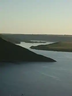
Bakota Bay
Bakota Bay (Ukrainian: Бакотська затока) is a bay located on Dniester formed after construction of the Dniester Hydro Power Station. The bay is part of the Podilski Tovtry National Nature Park. Its area is about 1,590 ha (3,900 acres).
| Bakota Bay | |
|---|---|
 | |
 Bakota Bay 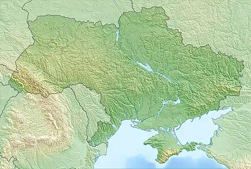 Bakota Bay | |
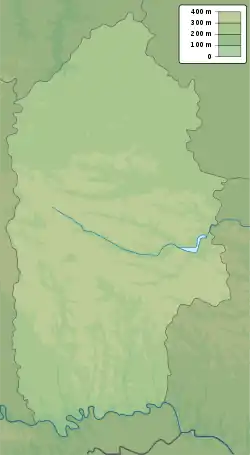
| Location | Dniester River, Podilski Tovtry |
| Coordinates | |
| Ocean/sea sources | Atlantic Ocean |
| Basin countries | Ukraine |
| Max. width | 1,700 km (1,100 mi) |
| Surface area | 1,590 ha (3,900 acres) |
| Max. depth | 34 m (112 ft) |
| Official name | Bakotska Bay |
| Designated | 29 July 2004 |
| Reference no. | 1396[1] |
Overview
The bay is located near villages of Horayivka and Kolodiyivka, and 50 km (31 mi) southeast from Kamianets-Podilskyi. Located in a river canyon, it represents typical to the basin of upper Dniester natural habitats of plants and animals. It plays an important role in preservation a number of rare in Europe and Ukraine:
- species of birds
- first of all predatory (Northern goshawk, Accipiter gentilis; Eurasian sparrowhawk, Accipiter nisus; Common buzzard, Buteo buteo; Short-toed snake eagle, Circaetus gallicus; Common kestrel, Falco tinnunculus),
- of extended stay during spring and autumn migrations birds of the wetland habitat (Mallard, Anas platyrhynchos; Mute swan, Cygnus olor; Great egret, Egretta alba; Little egret, Egretta garzetta; Wood sandpiper, Tringa glareola; Northern lapwing, Vanellus vanellus; others)
- spawning of fish.
Physical and biogeographical characteristics
It is a continental biogeographical region on a map of European Emerald network. According to geobotanical categorization of Ukraine, it belongs to East European province of the European broadleaf area. It belongs to the mid-portion of Dniester basin (upstream of Dniester Reservoir).
Wetland physical features
It is located within Volhynian-Podolian tectonic block and noted with close to the surface occurrences of rocks of the crystalline basement. Here could be found limestone, marls, sandstones, shales, as well as granites and gneisses that are overlaid with loesses. The area surface is mostly raised gentle rolling hill loess plain. After the physical and geographical categorization of Ukraine, it belongs to West-Podolian region of West Podolian Province of the Podolian Forest-steppe zone. Soils are dark grey podzol, chernozems podzol predominantly on loess rocks.
The bay was created in 1976 owing to creation of Dniester Reservoir on Dniester with a length of 194 km (121 mi) and a volume of 3 km3 (0.72 cu mi), to which downstream adjacent a buffer reservoir with a length of 17 km (11 mi) and a volume of 0.031 km3 (0.0074 cu mi). Water mineralization in upper Dniester oscillates around 205–570 mg/L (14.4–40.0 gr/imp gal). It belongs to predominantly the secondary type of hydrocarbon-calcium class. The water quality is generally good, in the area's vicinity is taking place water catchment for the needs of Kamianets-Podilskyi.
The climate is temperate continental with mild winters and warm, wet summers. The average air temperature in January -5.5 °C, in July +18.8 °C. A period with a temperature of over +10 °C is about 168 days.
See also
References
- "Bakotska Bay". Ramsar Sites Information Service. Retrieved 7 October 2018.
External links
- Bakota Bay at the Biomon Wetlands
- Bakota Bay. Igotoworld.
- View of the bay.