Bang Phae District
Bang Phae (Thai: บางแพ, pronounced [bāːŋ pʰɛ̄ː]) is a district (amphoe) in the eastern part of Ratchaburi Province, western Thailand.
Bang Phae
บางแพ | |
|---|---|
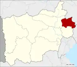 District location in Ratchaburi Province | |
| Coordinates: 13°41′29″N 99°55′49″E | |
| Country | Thailand |
| Province | Ratchaburi |
| Seat | Bang Phae |
| District established | 1914 |
| Area | |
| • Total | 172.596 km2 (66.640 sq mi) |
| Population (2017) | |
| • Total | 44,768 |
| • Density | 259.38/km2 (671.8/sq mi) |
| Time zone | UTC+7 (ICT) |
| Postal code | 70160 |
| Geocode | 7006 |
History
The district was created in 1914[1] from 17 tambons from the districts Ban Pong, Photharam, and Damnoen Saduak. At first a temporary district office was located in a pavilion of Wat Hua Pho in tambon Hua Pho. Originally named Lam Phraya (ลำพระยา), it was renamed Hua Pho in 1917.[2] In 1939 it was renamed Bang Phae,[3] following the location of the district office since 1918.
Geography
Neighboring districts are (from the south clockwise), Damnoen Saduak and Photharam of Ratchaburi Province; Mueang Nakhon Pathom and Sam Phran of Nakhon Pathom Province; and Ban Phaeo of Samut Sakhon Province.
Administration
The district is divided into seven sub-districts (tambons), which are further subdivided into 65 villages (mubans). There are two sub-district municipalities (thesaban tambons). Bang Phae covers tambons Bang Phae and Wang Yen, and Pho Hak the tambon Pho Hak. There are a further four tambon administrative organizations (TAO).
| No. | Name | Thai | Pop.[4] |
|---|---|---|---|
| 1. | Bang Phae | บางแพ | 8,246 |
| 2. | Wang Yen | วังเย็น | 7,905 |
| 3. | Hua Pho | หัวโพ | 4,688 |
| 4. | Wat Kaeo | วัดแก้ว | 5,838 |
| 5. | Don Yai | ดอนใหญ่ | 3,904 |
| 6. | Don Kha | ดอนคา | 3,558 |
| 7. | Pho Hak | โพหัก | 10,629 |
References
- แจ้งความกระทรวงมุรธาธร เรื่อง ตั้งอำเภอลำพระยาในเมืองราชบุรี (PDF). Royal Gazette (in Thai). 31 (0 ง): 1789. 1914-11-08.
- ประกาศกระทรวงมหาดไทย เรื่อง เปลี่ยนชื่ออำเภอ (PDF). Royal Gazette (in Thai). 34 (0 ก): 40–68. 1917-04-29.
- พระราชกฤษฎีกาเปลี่ยนนามอำเภอ กิ่งอำเภอ และตำบลบางแห่ง พุทธศักราช ๒๔๘๒ (PDF). Royal Gazette (in Thai). 56 (0 ก): 354–364. April 17, 1939.
- "Population statistics 2009". Department of Provincial Administration.