Basse Santa Su
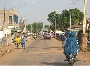
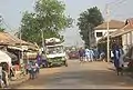
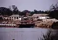
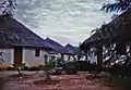
Basse Santa Su, usually known as Basse, is a town in the Gambia, lying on the south bank of the River Gambia. The easternmost major town in the nation, it is the capital of the Upper River Region and is known for its important market. As of 2009 it has an estimated population of 18,414.[1] The history of the town dates back to the founding of Kabakama, now a neighborhood, in the mid 13th century by the Mandinka army of Tiramakhan Traore, who was ultimately buried there, expanding the Mali Empire west.[2]
Basse Santa Su | |
|---|---|
 | |
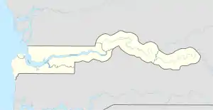 Basse Santa Su Location in the Gambia | |
| Coordinates: 13°19′N 14°13′W | |
| Country | The Gambia |
| Division | Upper River Division |
| District | Fulladu East |
| Population | |
| • Total | 18,414 |
| Time zone | UTC+0 (GMT) |
Climate
Basse Santa Su has a tropical savanna climate (Aw) with no rainfall from November to May and heavy rainfall from June to October.
| Climate data for Basse Santa Su | |||||||||||||
|---|---|---|---|---|---|---|---|---|---|---|---|---|---|
| Month | Jan | Feb | Mar | Apr | May | Jun | Jul | Aug | Sep | Oct | Nov | Dec | Year |
| Average high °C (°F) | 33.8 (92.8) |
35.7 (96.3) |
38.2 (100.8) |
39.5 (103.1) |
39.2 (102.6) |
35.3 (95.5) |
32.4 (90.3) |
31.3 (88.3) |
31.6 (88.9) |
33.8 (92.8) |
34.6 (94.3) |
33.1 (91.6) |
34.9 (94.8) |
| Daily mean °C (°F) | 24.2 (75.6) |
26.0 (78.8) |
29.2 (84.6) |
31.3 (88.3) |
31.9 (89.4) |
29.7 (85.5) |
27.8 (82.0) |
27.0 (80.6) |
27.0 (80.6) |
28.1 (82.6) |
26.2 (79.2) |
23.6 (74.5) |
27.7 (81.8) |
| Average low °C (°F) | 14.6 (58.3) |
16.4 (61.5) |
20.3 (68.5) |
23.1 (73.6) |
24.7 (76.5) |
24.2 (75.6) |
23.2 (73.8) |
22.7 (72.9) |
22.4 (72.3) |
22.4 (72.3) |
17.9 (64.2) |
14.1 (57.4) |
20.5 (68.9) |
| Average rainfall mm (inches) | 0 (0) |
0 (0) |
0 (0) |
1 (0.0) |
18 (0.7) |
106 (4.2) |
191 (7.5) |
243 (9.6) |
216 (8.5) |
62 (2.4) |
2 (0.1) |
0 (0) |
839 (33) |
| Source: Climate-Data.org[3] | |||||||||||||
References
- "Gambia: largest cities and towns and statistics of their population". World Gazetteer. Archived from the original on May 22, 2011. Retrieved January 5, 2009.
- Djibril Tamsir Niane, "Histoire des Mandingues de l'Ouest: le royaume du Gabou", p 22
- "Climate: Basse Santa Su". Climate-Data.org. Retrieved August 6, 2020.
This article is issued from Wikipedia. The text is licensed under Creative Commons - Attribution - Sharealike. Additional terms may apply for the media files.
