Basudih
Basudih is a village in Nala block, Jamtara district, Jharkhand state, India has a Population (2001 Census) of 500 in about 50 families.
Basudih | |
|---|---|
Village | |
 Basudih Location in Jamtara, Jharkhand  Basudih Basudih (India) | |
| Coordinates: 23.98298°N 87.10255°E | |
| Country | |
| State | Jharkhand |
| District | Jamtara |
| Founded by | Shree Brajamohan Maji |
| Area | |
| • Total | 5 km2 (2 sq mi) |
| Elevation | 155 m (509 ft) |
| Population (2001) | |
| • Total | 500 |
| • Density | 100/km2 (300/sq mi) |
| Languages (*For language details see Nala block#Language and religion) | |
| • Official | Hindi, Urdu |
| Time zone | UTC+5:30 (IST) |
| PIN | 815359 |
| Telephone code | 06428 |
| Vehicle registration | JH-21 |
| Sex ratio | 959 ♂/♀ |
| Website | jamtara |
Geography
| Cities, towns and locations in the Deoghar, Dumka and Jamtara districts in Santhal Pargana Division M: Municipality, CT: census town, R: Rural/ Urban centre, D: Dam, Owing to space constraints in the small map, the actual locations in a larger map may vary slightly |
Location
Basudih is located at 23.98298°N 87.10255°E.
Overview
The map shows a large area, which is a plateau with low hills, except in the eastern portion where the Rajmahal hills intrude into this area and the Ramgarh hills are there. The south-western portion is just a rolling upland. The entire area is overwhelmingly rural with only small pockets of urbanisation.[1]
Note: The full screen map is interesting. All places marked on the map are linked in the full screen map and one can easily move on to another page of his/her choice. Enlarge the full screen map to see what else is there – one gets railway connections, many more road connections and so on.
Demographics
As of 2001 India census, Basudih had a population of 500. Males constitute 51% of the population and females 49%. Basudih has an average literacy rate of 71%, higher than the national average of 59.5%, male literacy is 78%, and female literacy is 62%. In Basudih, 12% of the population is under 6 years of age.
Climate
Basudih has a humid subtropical climate (Köppen climate classification Cwa), with warm, wet summers and mild winters.
| Climate data for Basudih | |||||||||||||
|---|---|---|---|---|---|---|---|---|---|---|---|---|---|
| Month | Jan | Feb | Mar | Apr | May | Jun | Jul | Aug | Sep | Oct | Nov | Dec | Year |
| Record high °C (°F) | 33.3 (91.9) |
35.6 (96.1) |
42.8 (109.0) |
46.3 (115.3) |
48.3 (118.9) |
45.2 (113.4) |
41.5 (106.7) |
38.6 (101.5) |
38.1 (100.6) |
37.6 (99.7) |
35.8 (96.4) |
31.2 (88.2) |
48.3 (118.9) |
| Average high °C (°F) | 25.9 (78.6) |
28.9 (84.0) |
34.3 (93.7) |
38.4 (101.1) |
37.5 (99.5) |
35.5 (95.9) |
32.7 (90.9) |
32.5 (90.5) |
32.9 (91.2) |
33.0 (91.4) |
30.5 (86.9) |
27.0 (80.6) |
32.4 (90.4) |
| Average low °C (°F) | 10.2 (50.4) |
13.2 (55.8) |
17.4 (63.3) |
22.3 (72.1) |
23.9 (75.0) |
24.7 (76.5) |
24.1 (75.4) |
23.7 (74.7) |
23.6 (74.5) |
21.0 (69.8) |
16.0 (60.8) |
11.1 (52.0) |
19.3 (66.7) |
| Record low °C (°F) | 1.7 (35.1) |
1.8 (35.2) |
5.8 (42.4) |
13.8 (56.8) |
14.5 (58.1) |
17.8 (64.0) |
13.4 (56.1) |
16.8 (62.2) |
13.8 (56.8) |
11.8 (53.2) |
4.8 (40.6) |
2.8 (37.0) |
1.7 (35.1) |
| Average precipitation mm (inches) | 9.0 (0.35) |
15.0 (0.59) |
21.0 (0.83) |
35.0 (1.38) |
72.0 (2.83) |
198.0 (7.80) |
343.0 (13.50) |
293.0 (11.54) |
273.0 (10.75) |
116.0 (4.57) |
9.0 (0.35) |
7.0 (0.28) |
1,391 (54.77) |
| Average rainy days | 1.5 | 2.3 | 2.2 | 2.8 | 6.3 | 11.3 | 18.9 | 16.9 | 14.1 | 5.7 | 1.1 | 0.8 | 83.9 |
| Average relative humidity (%) | 60 | 53 | 47 | 50 | 60 | 73 | 83 | 83 | 81 | 74 | 65 | 62 | 66 |
| Source: NOAA (1971-1990) [2] | |||||||||||||
Gallery
- Images of different places in Basudih
 Primary School Basudih
 Lixmi Puja
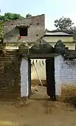 Shree Taraniprasad Maji House
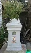 Tulsi Mandir
 Basudih Road
 Water Supply
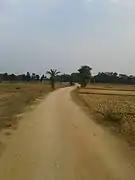 Main Road
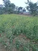 Sarso Khet
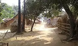 Santhal Para
 Highway
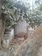 Maa Chandi Temple
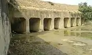 Basudih Dam
References
- Roychoudhury, P.C. "Bihar District Gazetteers: Santhal Parganas". Chapter I: General. Secretariat Press, Patna, 1965. Retrieved 10 November 2020.
- "Basudih Climate Normals 1971-1990". National Oceanic and Atmospheric Administration. Retrieved 22 December 2012.