Batkanu
Batkanu is a village and seat of the chiefdom of Libeisaygahun in Bombali District in the Northern Province of Sierra Leone.
Batkanu | |
|---|---|
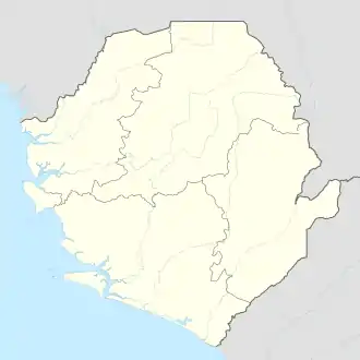 Batkanu Location in Sierra Leone | |
| Coordinates: 09°05′00″N 12°25′00″W | |
| Country | |
| Province | Northern Province |
| District | Bombali District |
| Chiefdom | Libeisaygahun |
| Elevation | 112 ft (34 m) |
| Time zone | UTC+0 (GMT) |
Geographic facts
Latitude: 9.0833, Longitude: -12.4167, Elevation: 114 feet/34 meters.
Climate
Batkanu's climate is relatively warm, with summer temperatures ranging from 20 degrees Celsius to 30 degrees Celsius (68 to 86 °F). Batkanu has cloud coverage for the majority of the year and typically has little precipitation.
| Climate data for Batkanu | |||||||||||||
|---|---|---|---|---|---|---|---|---|---|---|---|---|---|
| Month | Jan | Feb | Mar | Apr | May | Jun | Jul | Aug | Sep | Oct | Nov | Dec | Year |
| Average high °C (°F) | 33 (91) |
35 (95) |
36 (96) |
35 (95) |
34 (93) |
32 (89) |
29 (84) |
28 (82) |
30 (86) |
32 (89) |
33 (91) |
32 (89) |
32 (89) |
| Average low °C (°F) | 20 (68) |
21 (69) |
22 (71) |
22 (71) |
22 (71) |
21 (69) |
21 (69) |
21 (69) |
21 (69) |
21 (69) |
21 (69) |
20 (68) |
21 (69) |
| Average precipitation mm (inches) | 2.5 (0.1) |
5.1 (0.2) |
25 (1) |
94 (3.7) |
230 (8.9) |
390 (15.2) |
450 (17.6) |
480 (18.8) |
470 (18.4) |
410 (16.2) |
180 (6.9) |
18 (0.7) |
2,730 (107.5) |
| Source: Weatherbase [1] | |||||||||||||
References
- "Weatherbase: Historical Weather for Batkanu, Sierra Leone". Weatherbase. 2011. Retrieved on November 24, 2011.
| District capital | 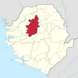 | |
|---|---|---|
| Chiefdoms | ||
| Towns | ||
This article is issued from Wikipedia. The text is licensed under Creative Commons - Attribution - Sharealike. Additional terms may apply for the media files.