Beaver, Iowa
Beaver is a city in Amaqua Township, Boone County, Iowa, United States. The population was 48 at the 2010 census. It is part of the 'Boone, Iowa Micropolitan Statistical Area', which is a part of the larger Ames-Boone, Iowa Combined Statistical Area.
Beaver, Iowa | |
|---|---|
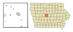 Location of Beaver, Iowa | |
| Coordinates: 42°2′16″N 94°8′28″W | |
| Country | |
| State | |
| County | Boone |
| Township | Amaqua |
| Area | |
| • Total | 0.25 sq mi (0.65 km2) |
| • Land | 0.25 sq mi (0.65 km2) |
| • Water | 0.00 sq mi (0.00 km2) |
| Elevation | 1,024 ft (312 m) |
| Population | |
| • Total | 48 |
| • Estimate (2019)[3] | 50 |
| • Density | 200.00/sq mi (77.35/km2) |
| Time zone | UTC-6 (Central (CST)) |
| • Summer (DST) | UTC-5 (CDT) |
| ZIP code | 50031 |
| Area code(s) | 515 |
| FIPS code | 19-05185 |
| GNIS feature ID | 0454432 |
History
Beaver was laid out in 1879.[4] The community takes its name from nearby Beaver Creek.[5] The city was incorporated in 1911.[4]
Geography
Beaver is located at 42°2′16″N 94°8′28″W (42.037808, -94.141096).[6]
According to the United States Census Bureau, the city has a total area of 0.25 square miles (0.65 km2), all land.[7]
Demographics
| Year | Pop. | ±% |
|---|---|---|
| 1920 | 132 | — |
| 1930 | 111 | −15.9% |
| 1940 | 126 | +13.5% |
| 1950 | 114 | −9.5% |
| 1960 | 115 | +0.9% |
| 1970 | 113 | −1.7% |
| 1980 | 85 | −24.8% |
| 1990 | 46 | −45.9% |
| 2000 | 53 | +15.2% |
| 2010 | 48 | −9.4% |
| 2019 | 50 | +4.2% |
| Source:"U.S. Census website". United States Census Bureau. Retrieved 2020-03-28. and Iowa Data Center Source: | ||
2010 census
As of the census[2] of 2010, there were 48 people, 20 households, and 13 families living in the city. The population density was 192.0 inhabitants per square mile (74.1/km2). There were 28 housing units at an average density of 112.0 per square mile (43.2/km2). The racial makeup of the city was 100.0% White.
There were 20 households, of which 25.0% had children under the age of 18 living with them, 55.0% were married couples living together, 10.0% had a female householder with no husband present, and 35.0% were non-families. 30.0% of all households were made up of individuals, and 20% had someone living alone who was 65 years of age or older. The average household size was 2.40 and the average family size was 3.08.
The median age in the city was 44.5 years. 25% of residents were under the age of 18; 6.4% were between the ages of 18 and 24; 18.9% were from 25 to 44; 29.2% were from 45 to 64; and 20.8% were 65 years of age or older. The gender makeup of the city was 43.8% male and 56.3% female.
2000 census
As of the census[9] of 2000, there were 53 people, 21 households, and 14 families living in the city. The population density was 207.0 people per square mile (78.7/km2). There were 26 housing units at an average density of 101.5 per square mile (38.6/km2). The racial makeup of the city was 94.34% White, 1.89% Native American, 1.89% Asian, and 1.89% from two or more races. Hispanic or Latino of any race were 1.89% of the population.
There were 21 households, out of which 28.6% had children under the age of 18 living with them, 61.9% were married couples living together, 9.5% had a female householder with no husband present, and 28.6% were non-families. 23.8% of all households were made up of individuals, and 9.5% had someone living alone who was 65 years of age or older. The average household size was 2.52 and the average family size was 3.00.
In the city, the population was spread out, with 26.4% under the age of 18, 3.8% from 18 to 24, 24.5% from 25 to 44, 30.2% from 45 to 64, and 15.1% who were 65 years of age or older. The median age was 43 years. For every 100 females, there were 71.0 males. For every 100 females age 18 and over, there were 62.5 males.
The median income for a household in the city was $30,625, and the median income for a family was $31,875. Males had a median income of $26,250 versus $25,625 for females. The per capita income for the city was $13,020. There were no families and 1.8% of the population living below the poverty line, including no under eighteens and 100.0% of those over 64.
References
- "2019 U.S. Gazetteer Files". United States Census Bureau. Retrieved July 17, 2020.
- "U.S. Census website". United States Census Bureau. Retrieved 2012-05-11.
- "Population and Housing Unit Estimates". United States Census Bureau. May 24, 2020. Retrieved May 27, 2020.
- "County History". Boone County. Archived from the original on 12 June 2017. Retrieved 24 March 2018.
- Goldthwait, Nathan Edward (1914). History of Boone County, Iowa. Pioneer Publishing Company. p. 86.
- "US Gazetteer files: 2010, 2000, and 1990". United States Census Bureau. 2011-02-12. Retrieved 2011-04-23.
- "US Gazetteer files 2010". United States Census Bureau. Archived from the original on 2012-01-25. Retrieved 2012-05-11.
- "Census of Population and Housing". Census.gov. Retrieved June 4, 2015.
- "U.S. Census website". United States Census Bureau. Retrieved 2008-01-31.
Municipalities and communities of Boone County, Iowa, United States | ||
|---|---|---|
| Cities | Map of Iowa highlighting Boone County | |
| Townships | ||
| Unincorporated communities | ||
| Ghost town | ||
| Footnotes | ‡This populated place also has portions in an adjacent county or counties | |
| ||
| Authority control |
|
|---|