Bendick Murrell
Bendick Murrell is a town in the South West Slopes region of New South Wales, Australia.
| Bendick Murrell New South Wales | |
|---|---|
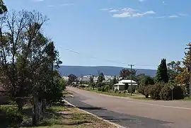 Main Street, Bendick Murrell | |
Bendick Murrell | |
| Coordinates | 34°09′54″S 148°27′04″E |
| Population | 155 (2016 census)[1] |
| Postcode(s) | 2803 |
| Location | |
| LGA(s) | Hilltops Council |
| State electorate(s) | Cootamundra |
| Federal Division(s) | Hume |
Locality
The town is adjacent to the Olympic Highway within the Hilltops local government area, 354 kilometres (220 mi) west of the state capital, Sydney. The town is on the Blayney-Demondrille railway line. At the 2016 census, Bendick Murrell and the surrounding area had a population of 155.[1]
Name
The name of the town is Aboriginal in origin, meaning "plain" and was originally given a local pastoral station.[2]
Services
A provisional school was established in 1883 and the existing school has occupied the same site since 1894.[3] A receiving post office was opened in 1887.[3]
References
- Australian Bureau of Statistics (27 June 2017). "Bendick Murrell (State Suburb)". 2016 Census QuickStats. Retrieved 26 August 2019.

- "Bendick Murrell". Geographical Names Register (GNR) of NSW. Geographical Names Board of New South Wales. Retrieved 14 July 2009.
- ACT Government (2001). "Bendick Murrell". Young Shire Council. Archived from the original on 18 May 2009. Retrieved 14 July 2009.
This article is issued from Wikipedia. The text is licensed under Creative Commons - Attribution - Sharealike. Additional terms may apply for the media files.