Bessacarr
Bessacarr (/ˈbɛsəkər/)[1] is the south-east edge of Doncaster, South Yorkshire, England. Bessacarr is mostly private residential development from the 1960s onward. Bessacarr is largely interwoven with Cantley to the north-east having partially signposted ancient boundaries, upon which its population was approximately 19,803 at the 2001 census.[2]
| Bessacarr | |
|---|---|
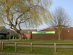 Tall sloped willow and straight tree and Stoops Lane shops in early spring. | |
.jpg.webp) Footpath across Warren Golf Course, Bessacarr | |
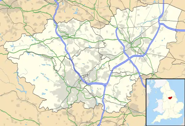 Bessacarr Location within South Yorkshire | |
| Population | 19,803 Doncaster MBC study of 2001 census areas forming Bessacarr's early 20th century boundary |
| OS grid reference | SE6101 |
| • London | 140 mi (230 km) S by SE |
| Metropolitan borough | |
| Metropolitan county | |
| Region | |
| Country | England |
| Sovereign state | United Kingdom |
| Post town | DONCASTER |
| Postcode district | DN4 |
| Dialling code | 01302 |
| Police | South Yorkshire |
| Fire | South Yorkshire |
| Ambulance | Yorkshire |
| UK Parliament | |
Localities
West Bessacarr
The bulk of Bessacarr is often known as West Bessacarr and is south of Bawtry Road. A small minority of the neighbourhood was built in the 1930s or earlier, the majority of the building occurred in the 1960s and 70s. Some recent development has occurred in the late 1990s and into the 21st century. Apartments are a feature of the most recent developments.
Nostell Place includes a Doctor's surgery, veterinary surgery, pharmacist, Co-Operative food store, bakery, hairdresser, hardware store, fish and chip shop and Chinese takeaway amongst others. Nearby is the Flying Childers public house, St Francis of Assisi Anglican Church, Bessacarr Library and Willow Primary School. Some other shops, including an off-licence and a hairdresser / beautician, are further up Alston Road around the corner from Punch's Hotel. Doncaster Lawn Tennis Club is on Saxton Avenue and is accessible via a footpath from Ellers Road.
West Bessacarr is part of the cycle path from Doncaster to Rossington, known locally as "the red path" owing to the colour of its tarmac. Routes including the red path and others within Bessacarr can lead walkers and cyclists to the relatively newly developed area known as Lakeside. Public transport to and from Bessacarr is provided by First Mainline routes 58 and 55B, with the direct 89 bus through the estates being withdrawn in 2004. Primary education for the area is provided by the excellent Bessacarr Primary School including its own nursery and by another called Willow Primary School, both of which feed into the local Hall Cross lower school, formally Ellers Middle School, next to the north-west boundary.
Bessacarr Grange
Bessacarr Grange is a largely 1990s neighbourhood south of the M18 Motorway with some of its own amenities including Yorkshire Wildlife Park accessed by Warning Tongue Lane.
Politics
Bessacarr is currently the name of the ward which as such undergoes boundary and name reviews every eight to twelve years theoretically to avoid malapportionment. Elections are held all-out from 1999 every four years. For the 2015 term the ward is served by one Conservative and two Labour members. The 2014 election of Neil Gethin saw the Labour Party gain a seat for the first time since 1997.[3] The 2015 election saw the first ethnic minority Councillors in Doncaster's history, Majid Khan, for the Bessacarr Ward and Councillor Rachael Blake, for the Rossington Ward.[4] The Conservatives gained a seat in Bessacarr in 2015.
Finningley ward would on a historic synthesis and real-politik critique of the first past the post system be considered a set of three Conservative 'safe seats' and currently includes all bar the latest developed areas of Cantley as well as Bessacarr Grange.
Demography
| Output area | Homes owned outright | Owned with a loan | Socially rented | Privately rented | Other | km² green spaces | km² roads | km² water | km² domestic gardens | km² domestic buildings | km² non-domestic buildings | Usual residents | km² |
|---|---|---|---|---|---|---|---|---|---|---|---|---|---|
| Bessacarr and Cantley ward | 2,338 | 2,085 | 898 | 876 | 130 | 2.76 | 0.69 | 0.21 | 1.90 | 0.46 | 0.08 | 14,408 | 6.72 |
Around 40% of Bessacarr is in Finningley Ward which had the following land use and housing statistics in 2011:
| Output area | Homes owned outright | Owned with a loan | Socially rented | Privately rented | Other | km² green spaces | km² roads | km² water | km² domestic gardens | km² domestic buildings | km² non-domestic buildings | Usual residents | km² |
|---|---|---|---|---|---|---|---|---|---|---|---|---|---|
| Finningley ward | 2,633 | 2,407 | 435 | 605 | 110 | 38.64 | 1.04 | 0.64 | 2.42 | 0.61 | 0.14 | 15,209 | 43.42 |
Notable people
- Louis Tomlinson, singer (One Direction)[6]
See also
- Church of St Francis of Assisi, West Bessacarr
References
- Wells, John (29 January 2010). "Bessacarr". John Wells's phonetic blog. Retrieved 5 March 2010.
- http://www.britishplacenames.co.uk/se6101-bessacarr-doncaster
- Council, Doncaster. "Local Elections 2014 - Doncaster Council". www.doncaster.gov.uk. Retrieved 7 May 2017.
- Council, Doncaster. "Local Elections 2015 - Doncaster Council". www.doncaster.gov.uk. Retrieved 7 May 2017.
- Key Statistics: Dwellings; Quick Statistics: Population Density; Physical Environment: Land Use Survey 2005
- http://www.bbc.co.uk/newsround/26349904
External links
 Media related to Bessacarr at Wikimedia Commons