Bethany, Pennsylvania
Bethany is a borough in Wayne County, Pennsylvania. The borough's population was 246 at the time of the 2010 United States Census.[3]
Bethany, Pennsylvania | |
|---|---|
 Bethany, Pennsylvania | |
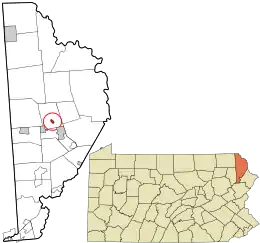
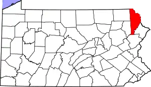
 Location in Wayne County and the U.S. state of Pennsylvania. | |
 Bethany Location of Bethany in Pennsylvania  Bethany Bethany (the United States) | |
| Coordinates: 41°36′52″N 75°17′19″W | |
| Country | United States |
| State | Pennsylvania |
| County | Wayne |
| Area | |
| • Total | 0.50 sq mi (1.30 km2) |
| • Land | 0.50 sq mi (1.29 km2) |
| • Water | 0.00 sq mi (0.01 km2) |
| Elevation | 1,486 ft (453 m) |
| Population (2010) | |
| • Total | 246 |
| • Estimate (2019)[2] | 224 |
| • Density | 449.80/sq mi (173.80/km2) |
| Time zone | UTC-5 (EST) |
| • Summer (DST) | UTC-4 (EDT) |
| Area code(s) | 570 |
| FIPS code | 42-05976 |
| Website | Bethany Borough |
History
The borough was named after Bethany, a place mentioned in the Bible.[4]
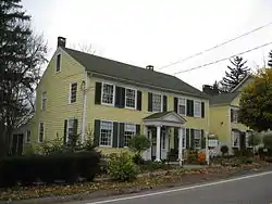
The Wilmot House and Wilmot Mansion are listed on the National Register of Historic Places.[5]
Geography
Bethany is located at 41°36′52″N 75°17′19″W (41.614321, -75.288537).[6]
According to the United States Census Bureau, the borough has a total area of 0.5 square miles (1.3 km2), all of it land.
Demographics
| Historical population | |||
|---|---|---|---|
| Census | Pop. | %± | |
| 1830 | 327 | — | |
| 1840 | 229 | −30.0% | |
| 1850 | 295 | 28.8% | |
| 1860 | 225 | −23.7% | |
| 1870 | 202 | −10.2% | |
| 1880 | 181 | −10.4% | |
| 1890 | 134 | −26.0% | |
| 1900 | 130 | −3.0% | |
| 1910 | 130 | 0.0% | |
| 1920 | 106 | −18.5% | |
| 1930 | 146 | 37.7% | |
| 1940 | 148 | 1.4% | |
| 1950 | 148 | 0.0% | |
| 1960 | 181 | 22.3% | |
| 1970 | 267 | 47.5% | |
| 1980 | 282 | 5.6% | |
| 1990 | 238 | −15.6% | |
| 2000 | 292 | 22.7% | |
| 2010 | 246 | −15.8% | |
| 2019 (est.) | 224 | [2] | −8.9% |
| Sources:[7][8][9] | |||
As of the census of 2010, there were 246 people, 108 households, and 73 families residing in the borough. The racial makeup of the borough was 98% White, 1.6% African American, and 0.4% American Indian or Alaska Native. Hispanic or Latino of any race were 1.6% of the population.
There were 108 households, out of which 25.9% had children under the age of 18 living with them, 56.5% were married couples living together, 8.3% had a female householder with no husband present, and 32.4% were non-families. 26.9% of all households were made up of individuals, and 13% had someone living alone who was 65 years of age or older. The average household size was 2.28 and the average family size was 2.75.
In the borough the population was spread out, with 19.1% under the age of 18, 59.8% from 18 to 64, and 21.1% who were 65 years of age or older. The median age was 48 years.
The median income for a household in the borough was $39,167, and the median income for a family was $41,161. Males had a median income of $29,167 versus $26,042 for females. The per capita income for the borough was $21,683. About 3.2% of families and 6.8% of the population were below the poverty line, including 4.3% of those under the age of eighteen and 3.6% of those 65 or over.
Notable people
- John Azor Kellogg, military leader and Wisconsin politician
- David Wilmot, politician
- George Washington Woodward, failed nominee to the Supreme Court, member of the US House of Representatives
References
- "2019 U.S. Gazetteer Files". United States Census Bureau. Retrieved July 28, 2020.
- "Population and Housing Unit Estimates". United States Census Bureau. May 24, 2020. Retrieved May 27, 2020.
- "U.S. Census website". United States Census Bureau. Retrieved 2011-05-14.
- Herschell, Don (September 22, 1995). "Why name your town Ninevah?". Observer-Reporter. pp. B5. Retrieved 28 April 2015.
- "National Register Information System". National Register of Historic Places. National Park Service. July 9, 2010.
- "US Gazetteer files: 2010, 2000, and 1990". United States Census Bureau. 2011-02-12. Retrieved 2011-04-23.
- "Census of Population and Housing". U.S. Census Bureau. Retrieved 11 December 2013.
- "U.S. Census website". United States Census Bureau. Retrieved 2008-01-31.
- "Incorporated Places and Minor Civil Divisions Datasets: Subcounty Resident Population Estimates: April 1, 2010 to July 1, 2012". Population Estimates. U.S. Census Bureau. Archived from the original on 11 June 2013. Retrieved 11 December 2013.
External links
![]() Media related to Bethany, Pennsylvania at Wikimedia Commons
Media related to Bethany, Pennsylvania at Wikimedia Commons
