Bezirk Gera
The Bezirk Gera was a district (Bezirk) of East Germany. The administrative seat and main town was Gera.
Bezirk Gera | |
|---|---|
District | |
 Coat of arms | |
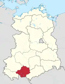 Location of Bezirk Gera within the German Democratic Republic | |
| Coordinates: 50°40′N 11°45′E | |
| Country | German Democratic Republic |
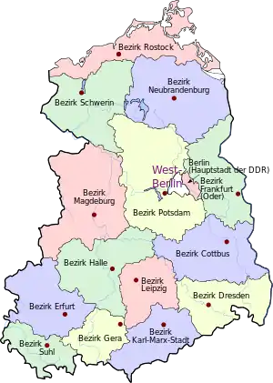
| Subdivisions | 11 Kreise and 2 Stadtkreise |
| Formed | 1952 |
| Dissolved | 1990 |
| Seat | Gera |
| Area | |
| • Total | 4,004 km2 (1,546 sq mi) |
| Population (1989)[1] | |
| • Total | 742,000 |
| • Density | 190/km2 (480/sq mi) |
| Vehicle registration | N |
History
The district was established, with the other 13, on July 25, 1952, replacing the old German states. After October 3, 1990, it was disestablished due to German reunification, becoming again part of the state of Thuringia.
Geography
Position
The Bezirk Gera had borders with the Bezirke of Suhl, Erfurt, Halle, Leipzig and Karl-Marx-Stadt, as well as with West Germany.
References
- "40 Jahre DDR", National central administration for statistics, May 1989
| Authority control |
|---|
This article is issued from Wikipedia. The text is licensed under Creative Commons - Attribution - Sharealike. Additional terms may apply for the media files.