Bhilwara
Bhilwara /biːlˈvɑːrə/ is a city in the Mewar region of Rajasthan, India. It is famous for Textile in the Indian state of Rajasthan.[3] It has been termed as 'textile city'.[4]
Bhilwara | |
|---|---|
| Nicknames: Textile City of Rajasthan, Manchester of Rajasthan | |
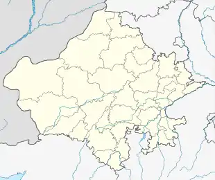 Bhilwara Location in Rajasthan, India  Bhilwara Bhilwara (India) | |
| Coordinates: 25.35°N 74.63°E | |
| Country | |
| State | Rajasthan |
| District | Bhilwara |
| Area | |
| • Total | 69 km2 (27 sq mi) |
| Area rank | 7 |
| Elevation | 421 m (1,381 ft) |
| Population (2011)[1] | |
| • Total | 359,483 |
| • Density | 5,200/km2 (13,000/sq mi) |
| Languages | |
| • Official | Hindi |
| • Regional | Mewari |
| Time zone | UTC+5:30 (IST) |
| PIN | 311001 |
| ISO 3166 code | RJ-IN |
| Vehicle registration | RJ-06 |
| Sex ratio | 1000/915 ♂/♀ |
| Website | bhilwara |
History
Stone Age tools dating from 5,012 to 200,000 years were found in Bundi and Bhilwara districts of the state.[5]
According to substantiation, the present Bhilwara city had a mint where coins known as 'Bhiladi' were minted and from this denomination was derived the name of the district. And other story goes like this that a tribe known as Bheel helped Maharana Pratap in war against Mughal Empire king Akbar lived in Bhilwara region that's this area came to be known as Bheel+Bada (Bheel's area) Bhilwara. Over the years it has emerged out as one of the major cities of Rajasthan. Nowadays, Bhilwara is better known as the textile city in the country.
The oldest part of this town was set up in the middle of the 11th century by building a Krishna Radha mandir (temple) that still exists and is known as the Bada Mandir. The area that is now known as Purana Bhilwara (Patwari Mohalla, Junawas, Manikya Nagar Malikhera). There is also reference to Arjuna having fought here during the Mahabharata period.
Historical records show that a town named Mandal close to Bhilwara served as the military base for the Mughals when they had attacked Chittaurgarh. The ruins of their campsite can still be seen today. A watch tower that was built on a small mound in Mandal is now a Devi temple.
Geography
Bhilwara is located at 25.359854°N 74.652791°E.[6] It has an average elevation of 421 metres (1381 feet). It falls between the districts of Ajmer (in north) and Chittorgarh and Udaipur (in south). Major rivers flowing through the district are Banas, Bedach, Kothari, Khari, Mansi, Menali, Chandrabhaga and Nagdi.
There is no natural lake in the district but there are the number of ponds and dams so the district is the most irrigated in the state of Rajasthan. It has a small man-made pond Mansarover Jheel(Pond) near Azad Nagar which is a famous attraction and gets crowded on weekends.
Climate
| Climate data for Bhilwara (1981–2010, extremes 1962–2005) | |||||||||||||
|---|---|---|---|---|---|---|---|---|---|---|---|---|---|
| Month | Jan | Feb | Mar | Apr | May | Jun | Jul | Aug | Sep | Oct | Nov | Dec | Year |
| Record high °C (°F) | 32.0 (89.6) |
36.7 (98.1) |
41.2 (106.2) |
44.8 (112.6) |
47.8 (118.0) |
47.0 (116.6) |
42.5 (108.5) |
39.2 (102.6) |
40.5 (104.9) |
41.5 (106.7) |
36.0 (96.8) |
33.3 (91.9) |
47.8 (118.0) |
| Average high °C (°F) | 23.7 (74.7) |
27.1 (80.8) |
33.2 (91.8) |
38.0 (100.4) |
41.3 (106.3) |
40.2 (104.4) |
33.9 (93.0) |
31.2 (88.2) |
32.9 (91.2) |
34.2 (93.6) |
30.2 (86.4) |
25.2 (77.4) |
32.6 (90.7) |
| Average low °C (°F) | 7.2 (45.0) |
9.3 (48.7) |
15.7 (60.3) |
20.9 (69.6) |
25.3 (77.5) |
26.3 (79.3) |
24.1 (75.4) |
22.7 (72.9) |
22.0 (71.6) |
17.7 (63.9) |
12.2 (54.0) |
8.2 (46.8) |
17.6 (63.7) |
| Record low °C (°F) | −0.3 (31.5) |
1.7 (35.1) |
6.3 (43.3) |
11.8 (53.2) |
16.9 (62.4) |
16.5 (61.7) |
15.0 (59.0) |
16.0 (60.8) |
15.5 (59.9) |
10.0 (50.0) |
5.0 (41.0) |
0.9 (33.6) |
−0.3 (31.5) |
| Average rainfall mm (inches) | 5.7 (0.22) |
2.2 (0.09) |
3.9 (0.15) |
7.0 (0.28) |
13.4 (0.53) |
41.6 (1.64) |
208.3 (8.20) |
232.1 (9.14) |
55.7 (2.19) |
10.5 (0.41) |
6.5 (0.26) |
1.6 (0.06) |
588.6 (23.17) |
| Average rainy days | 0.4 | 0.2 | 0.1 | 0.5 | 1.3 | 2.8 | 7.9 | 8.9 | 3.4 | 0.7 | 0.3 | 0.2 | 26.8 |
| Average relative humidity (%) (at 08:30 IST) | 70 | 60 | 56 | 50 | 49 | 60 | 77 | 82 | 77 | 62 | 64 | 69 | 65 |
| Source: India Meteorological Department[7][8] | |||||||||||||
Demographics
| Population Growth of Bhilwara | |||
|---|---|---|---|
| Census | Population | %± | |
| 1941 | 10,300 | — | |
| 1951 | 29,700 | 188.3% | |
| 1961 | 43,500 | 46.5% | |
| 1971 | 82,100 | 88.7% | |
| 1981 | 122,300 | 49.0% | |
| 1991 | 184,000 | 50.4% | |
| 2001 | 280,128 | 52.2% | |
| 2011 | 359,483 | 28.3% | |
| source:[9][10] | |||
As of 2011 India census,[11] Bhilwara has a population of 359,483. Males constitute 52% of the population and females 48%. About 13% of the population is under 6 years of age.
Economy
The major industry is textiles, with more than 850 manufacturing units in the town. The main textile product is synthetic fabric used in trousers. It began with a spinning and knitting company named Mewar Textile Mills, owned by industrialist Shri Sampatmal Lodha, started in 1938. Thereafter Shri Laxmi Niwas Jhunjhunwala started his first unit for synthetic textile in 1961 at Bhilwara.
Infrastructure
Road connectivity
National Highway No. 79 part of the Golden Quardrilateral (four lane) and another National Highway No. 76 part of the East West Corridor (four-lane) pass through the district. The total length is 120 km.
National Highway No. 758 (Kota-Ladpura-Bhilwara-Gangapur-Rajsamand-Udaipur) passes through the district. The length of this highway is 146 km and other NH 148D (Bhim-Gulabpura-Uniara).
The total road length in the district was 3,883 km on 31 March 2000.
With a government bus depot in the heart of the city, Bhilwara is connected to all the important cities of Rajasthan and other states. Many private service providers are available. Bhilwara is well connected by road to capital city Jaipur and distance is 253 kilometre.[12]
Rail transport
A broad gauge railway line connecting Ajmer, Jodhpur, Jaipur, Kota, Indore Junction, Ujjain, Delhi, Bharatpur, Agra, Gwalior, Lucknow, Kanpur, Allahabad, Patna, Kolkata, Chittorgarh, Udaipur, Mavli Jn., Ratlam, Vadodara, Surat, Mumbai and Hyderabad passes through the district. Kota (160 km) is the convenient railway station to provide connectivity to the southern states of Karnataka, Andhra Pradesh, Tamil Nadu and Kerala.
Ajmer (130 km) is one of major nearby railway station/junction for connectivity to other major cities like Delhi and Ahmedabad.
Air transport
The nearest airport is at Dabok - Udaipur (165 km) — approximately 2.5 hours, by road. The other nearest airport is at Jaipur (251 km) which takes about 4 hours by road.
Before Jaipur new Airport has started named Kishangarh Airport.
Culture
Great Indian miniature artist Badri Lal Chitrakar highlights the city on international maps for Indian miniature art. He was given several awards including the Shilp Guru/Master Craftsperson award by the vice-president of India on 9 September 2006. Bhilwara is famous for its 'Fad Paintings' which are depictions of traditional stories on cloth using naturally available colours. Bhilwara's Phad Artist Shree Lal Joshi contributed greatly in making and saving Phad Painting in whole India.
Attractions in Bhilwara include the Badnor Fort, Harni Mahadev Temple, Joganiya Mata Temple, Kyara Ke Balaji, Sanganer Fort, Meja dam and Pur Udan Chatri.[13]
Education
Bhilwara has an autonomous engineering college of Government of Rajasthan known as MLV Textile and Engineering College, which offers courses in engineering, including textile engineering. There is also a medical college, Rajmata Vijaya Raje Scindia Medical College.[14]
References
- "Bhilwara City" (PDF).
- Bhilwara-Rajasthan. "Location & Area". bhilwara.rajasthan.gov.in. Retrieved 17 November 2019.
- Bhilwara-Rajasthan. "Home". www.bhilwara.rajasthan.gov.in. Retrieved 15 July 2019.
- "Iranians spontaneously created 'walls of kindness' to help the homeless". BBC Trending (What's popular and why). BBC UK. BBC. 20 December 2015. Retrieved 1 January 2016.
- Pillai, Geetha Sunil (28 February 2017), "Stone age tools dating back 2,00,000 years found in Rajasthan", The Times of India
- "Maps, Weather, and Airports for Bhilwara, India". www.fallingrain.com.
- "Station: Bhilwara Climatological Table 1981–2010" (PDF). Climatological Normals 1981–2010. India Meteorological Department. January 2015. pp. 133–134. Archived from the original (PDF) on 5 February 2020. Retrieved 20 January 2021.
- "Extremes of Temperature & Rainfall for Indian Stations (Up to 2012)" (PDF). India Meteorological Department. December 2016. p. M176. Archived from the original (PDF) on 5 February 2020. Retrieved 20 January 2021.
- "Historical Census of India". Archived from the original on 17 February 2013. Retrieved 22 March 2014.
- "Major Agglomerations of the World - Population Statistics and Maps". www.citypopulation.de.
- "Census of India 2001: Data from the 2001 Census, including cities, villages and towns (Provisional)". Census Commission of India. Archived from the original on 16 June 2004. Retrieved 1 November 2008.
- "Jaipur and Bhilwara By Road, Distance Between Jaipur and Bhilwara , Distance By Road From Jaipur and Bhilwara with Travel Time, Bhilwara Distance from Jaipur, Driving Direction Calculator from jaipur and bhilwara". www.roaddistance.in.
- Sengar, Resham. "Exploring the hidden treasures of Bhilwara in Rajasthan". Times of India Travel. Retrieved 22 March 2020.
- "Churu Medical College named after Deendayal, to start from Aug 28". The Times of India. 21 April 2018. Retrieved 24 April 2020.
External links
 Bhilwara travel guide from Wikivoyage
- "Bhilwara-official portal". Retrieved 24 May 2020.
| Outline |
|  | |||||||||||||
|---|---|---|---|---|---|---|---|---|---|---|---|---|---|---|---|
| Governance |
| ||||||||||||||
| Divisions and districts |
| ||||||||||||||
| Major cities | |||||||||||||||
| Related templates |
| ||||||||||||||