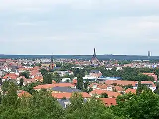
Bitterfeld-Wolfen
Bitterfeld-Wolfen is a town in the district Anhalt-Bitterfeld, Saxony-Anhalt, Germany. It is situated in south-eastern Saxony-Anhalt, west of the river Mulde, in an area that is dominated by heavy industry and lignite mining. The town was formed by merger of the towns Bitterfeld and Wolfen and the municipalities Greppin, Holzweißig and Thalheim on 1 July 2007.
Bitterfeld-Wolfen | |
|---|---|
 | |
 Coat of arms | |
Location of Bitterfeld-Wolfen within Anhalt-Bitterfeld district  | |
 Bitterfeld-Wolfen 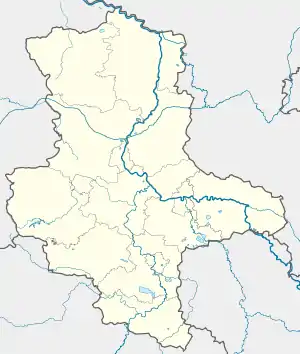 Bitterfeld-Wolfen | |
| Coordinates: 51°37′N 12°19′E | |
| Country | Germany |
| State | Saxony-Anhalt |
| District | Anhalt-Bitterfeld |
| Government | |
| • Mayor | Armin Schenk (CDU) |
| Area | |
| • Total | 87.55 km2 (33.80 sq mi) |
| Highest elevation | 90 m (300 ft) |
| Lowest elevation | 75 m (246 ft) |
| Population (2019-12-31)[1] | |
| • Total | 38,159 |
| • Density | 440/km2 (1,100/sq mi) |
| Time zone | UTC+01:00 (CET) |
| • Summer (DST) | UTC+02:00 (CEST) |
| Postal codes | 06731–06749 |
| Dialling codes | 03493, 03494 |
| Vehicle registration | ABI, AZE, BTF, KÖT, ZE |
| Website | www.bitterfeld-wolfen.de |
Geography
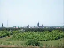
Bitterfeld-Wolfen is 25 kilometres (16 mi) northeast of Halle (Saale) and about 35 kilometres (22 mi) north of Leipzig. Eastward lies the Muldestausee lake, southward the Goitzsche lake with docks, and westwards the lido of Sandersdorf. The town lies in a nature preserve, Bitterfelder Bergbaurevier.
Neighbouring municipalities
Adjoining municipalities are from the north and clockwise Raguhn-Jeßnitz, Muldestausee, Delitzsch, Sandersdorf-Brehna and Zörbig.
Climate
-Deutschland.png.webp)
The average air temperature in Bitterfeld is 10.0 °C (50.0 °F) and the yearly rainfall 518 millimetres (20.4 in).
History
Town fusion
On 1 July 2007 the independent towns Wolfen and Bitterfeld and the municipalities Greppin, Thalheim and Holzweißig were merged to form the present-day town of Bitterfeld-Wolfen.
Historical Population
(of the present-day town)
|
|
|
¹ Census results
² 2011 Census
³ Source: Bitterfeld-Wolfen Town Hall
Source: Statistisches Landesamt Sachsen-Anhalt[3]
Bitterfeld
Bitterfeld has approximately 15,000 inhabitants (2006). It was first mentioned in 1224. Part of the Electorate of Saxony, it came to the Prussian Province of Saxony in 1815. Until the administrative reform of 2007, it was the capital of the district of Bitterfeld.
Wolfen
Wolfen has approximately 24,000 inhabitants (2006). It is located north of Bitterfeld. Wolfen was first mentioned around 1400. The discovery of lignite in 1846, and the construction of an Agfa dye factory in 1895 brought industry and population growth.
Twin towns - sister cities
Bitterfeld-Wolfen is twinned with:[4]
 Vierzon, France, since 1959
- Villefontaine, France, since 1990
 Witten, Germany, since 1994
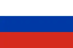 Dzerzhinsk, Russia, since 1996
 Kamienna Góra, Poland, since 2006
- Marl, Germany, since 2007
References
- "Bevölkerung der Gemeinden – Stand: 31. Dezember 2019" (PDF). Statistisches Landesamt Sachsen-Anhalt (in German).
- Deutscher Wetterdienst, Normalperiode 1961-1990
- "Statistisches Landesamt Sachsen-Anhalt – Bevölkerungsbewegungen nach Gemeinden". Archived from the original on 2014-02-21. Retrieved 2015-11-20.
- "Partnerstädte". bitterfeld-wolfen.de (in German). Bitterfeld-Wolfen. Retrieved 2019-11-27.
Towns and municipalities in the district of Anhalt-Bitterfeld | ||
|---|---|---|
Coat of arms | ||
| Authority control |
|---|