Blende, Colorado
Blende is an unincorporated community and a census-designated place (CDP) located in Pueblo County, Colorado, United States. The population of the Blende CDP was 878 at the United States Census 2010.[4] Pueblo County governs the unincorporated community. The Pueblo post office (Zip Code 81006) serves the area.[3]
Blende, Colorado | |
|---|---|
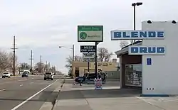 Looking east along Santa Fe Drive in Blende. | |
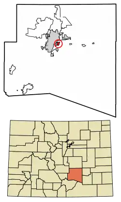 Location of the Blende CDP in Pueblo County, Colorado. | |
 Blende Location of the Blende CDP in the State of Colorado. | |
| Coordinates: 38°14′49″N 104°34′17″W[1] | |
| Country | |
| State | |
| County | Pueblo County |
| Government | |
| • Type | unincorporated community |
| Area | |
| • Total | 0.839 sq mi (2.172 km2) |
| • Land | 0.839 sq mi (2.172 km2) |
| • Water | 0.0002 sq mi (0.0004 km2) |
| Elevation | 4,737 ft (1,444 m) |
| Population (2010) | |
| • Total | 878 |
| • Density | 1,046/sq mi (404/km2) |
| Time zone | UTC-7 (MST) |
| • Summer (DST) | UTC-6 (MDT) |
| ZIP Code[3] | Pueblo 81006 |
| Area code(s) | 719 |
| GNIS feature[2] | Blende CDP |
Geography
The Blende CDP has an area of 537 acres (2.172 km2), including 0.01 acre (0.0004 km2) of water.[1]
Demographics
The United States Census Bureau initially defined the Blende CDP for the United States Census 2010.
| Year | Pop. | ±% |
|---|---|---|
| 2010 | 878 | — |
| 2020 | — | |
| Source: United States Census Bureau | ||
See also
- Outline of Colorado
- State of Colorado
- Colorado cities and towns
- Colorado counties
- Colorado metropolitan areas
References
- "State of Colorado Census Designated Places - BAS20 - Data as of January 1, 2020". United States Census Bureau. Retrieved December 26, 2020.
- "U.S. Board on Geographic Names: Domestic Names". United States Geological Survey. Retrieved December 26, 2020.
- "Look Up a ZIP Code". United States Postal Service. Retrieved December 26, 2020.
- "2010: DEC Summary File 1". United States Census Bureau. Retrieved December 26, 2020.
External links
Municipalities and communities of Pueblo County, Colorado, United States | ||
|---|---|---|
| City | 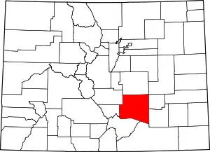 Map of Colorado highlighting Pueblo County | |
| Towns | ||
| CDPs | ||
| Unincorporated communities | ||
| Ghost towns | ||
| ||
| Authority control |
|---|
This article is issued from Wikipedia. The text is licensed under Creative Commons - Attribution - Sharealike. Additional terms may apply for the media files.