Vineland, Colorado
Vineland is an unincorporated community and a census-designated place (CDP) located in and governed by Pueblo County, Colorado, United States. The CDP is a part of the Pueblo, CO Metropolitan Statistical Area. The population of the Vineland CDP was 251 at the United States Census 2010.[4] The Pueblo post office (Zip Code 81006) serves the area.[3]
Vineland, Colorado | |
|---|---|
 Santa Fe Drive in Vineland, looking west from 36th Lane. | |
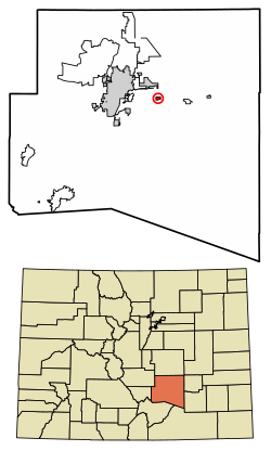 Location of the Vineland CDP in Pueblo County, Colorado. | |
 Vineland Location of the Vineland CDP in the United States. | |
| Coordinates: 38°14′41″N 104°27′36″W[1] | |
| Country | |
| State | |
| County | Pueblo County |
| Government | |
| • Type | unincorporated community |
| Area | |
| • Total | 0.566 sq mi (1.467 km2) |
| • Land | 0.566 sq mi (1.467 km2) |
| • Water | 0.000 sq mi (0.000 km2) |
| Elevation | 4,646 ft (1,416 m) |
| Population (2010) | |
| • Total | 251 |
| • Density | 443/sq mi (171/km2) |
| Time zone | UTC-7 (MST) |
| • Summer (DST) | UTC-6 (MDT) |
| ZIP Code[3] | Pueblo 81006 |
| Area code(s) | 719 |
| GNIS feature[2] | Vineland CDP |
Geography
Vineland is just east of the St. Charles River on East US Highway 50 (Business), sometimes called Sante Fe. The area is known in for its family-operated vegetable farms.
The Vineland CDP has an area of 363 acres (1.467 km2), all land.[1]
Demographics
The United States Census Bureau initially defined the Vineland CDP for the United States Census 2010.
| Year | Pop. | ±% |
|---|---|---|
| 2010 | 251 | — |
| 2020 | — | |
| Source: United States Census Bureau | ||
Education
Vineland is served by the Pueblo County School District 70. It is the home of Pueblo County High School, Vineland Elementary School, and Vineland Middle School.
See also
- Outline of Colorado
- State of Colorado
- Colorado cities and towns
- Colorado counties
- Colorado metropolitan areas
References
- "State of Colorado Census Designated Places - BAS20 - Data as of January 1, 2020". United States Census Bureau. Retrieved December 27, 2020.
- "U.S. Board on Geographic Names: Domestic Names". United States Geological Survey. Retrieved December 27, 2020.
- "Look Up a ZIP Code". United States Postal Service. Retrieved December 27, 2020.
- "2010: DEC Summary File 1". United States Census Bureau. Retrieved December 27, 2020.
External links
- Vineland @ Colorado.com
- Vineland @ UncoverColorado.com
- Pueblo County Rural School District 70
- Pueblo County website
Municipalities and communities of Pueblo County, Colorado, United States | ||
|---|---|---|
| City | 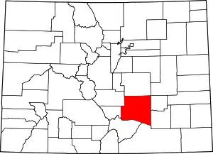 Map of Colorado highlighting Pueblo County | |
| Towns | ||
| CDPs | ||
| Unincorporated communities | ||
| Ghost towns | ||
| ||