Bligh County

Bligh County was one of the original Nineteen Counties in New South Wales and is now one of the 141 Cadastral divisions of New South Wales. The Cudgegong River and the Goulburn River are its southern boundaries; the Krui River is the eastern boundary, and the Burragundy River the northern boundary. It includes the villages of Cassilis and Dunedoo.

Bligh
New South Wales
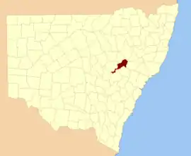
Location in New South Wales
Lands administrative divisions around Bligh:
Napier Pottinger Buckland
Lincoln Bligh Brisbane
Gordon Wellington Phillip

The county was named after William Bligh, Admiral and Governor of New South Wales (1805-1808).[1] The electoral district of Phillip, Brisbane and Bligh was the first electoral district for the area, between 1856 and 1859.

Parishes within this county

A full list of parishes found within this county; their current LGA and mapping coordinates to the approximate centre of each location is as follows:

ParishLGACoordinates
BellaleppaUpper Hunter Shire32°01′54″S 150°07′04″E
BerenderryUpper Hunter Shire32°00′54″S 150°10′04″E
BlighMid-Western Regional Council32°09′54″S 149°42′04″E
BobadeenMid-Western Regional Council32°10′54″S 149°48′04″E
BooyamurnaWarrumbungle Shire31°47′54″S 149°50′04″E
BorambilUpper Hunter Shire32°02′54″S 150°02′04″E
BowmanWarrumbungle Shire32°03′54″S 149°37′04″E
BulgaUpper Hunter Shire31°52′54″S 149°59′04″E
BungabaMid-Western Regional Council32°09′54″S 149°38′04″E
CollaroyUpper Hunter Shire32°02′54″S 150°01′04″E
CollieblueWarrumbungle Shire31°51′54″S 149°46′04″E
CollierWarrumbungle Shire31°55′54″S 149°45′04″E
CopeMid-Western Regional Council32°16′54″S 149°39′04″E
CunnaUpper Hunter Shire31°47′49″S 150°05′47″E
CurryallUpper Hunter Shire32°04′54″S 149°50′04″E
DoulagunmalaUpper Hunter Shire31°56′54″S 150°00′04″E
DurridgereMid-Western Regional Council32°10′54″S 149°53′04″E
GoodimanMid-Western Regional Council32°12′54″S 149°23′04″E
GoolmaMid-Western Regional Council32°18′54″S 149°16′04″E
GurobaDubbo Regional Council32°29′24″S 149°14′04″E
LorimerUpper Hunter Shire31°54′54″S 150°13′04″E
MerotherieMid-Western Regional Council32°08′54″S 149°29′04″E
MoanUpper Hunter Shire31°51′10″S 150°09′48″E
MunmurraMid-Western Regional Council32°10′54″S 150°01′04″E
NagoraUpper Hunter Shire31°53′54″S 150°05′04″E
NandouraWarrumbungle Shire32°02′54″S 149°48′04″E
NanimaDubbo Regional Council32°29′54″S 148°59′04″E
NarragambaMid-Western Regional Council32°10′54″S 149°35′04″E
PuggoonMid-Western Regional Council32°17′54″S 149°27′04″E
RotherwoodWarrumbungle Shire31°49′54″S 150°01′04″E
RotherwoodWarrumbungle Shire31°52′24″S 149°53′04″E
RouseMid-Western Regional Council32°08′54″S 149°26′04″E
StubboMid-Western Regional Council32°17′54″S 149°34′04″E
TalbragarWarrumbungle Shire32°01′54″S 149°33′04″E
TallawangMid-Western Regional Council32°12′54″S 149°28′04″E
TerrabanWarrumbungle Shire31°59′54″S 149°39′04″E
TomimbilUpper Hunter Shire32°06′54″S 150°00′04″E
TureeWarrumbungle Shire31°58′54″S 149°50′04″E
TurillUpper Hunter Shire32°01′54″S 149°56′04″E
UarbryWarrumbungle Shire32°02′54″S 149°45′04″E
UlanMid-Western Regional Council32°14′54″S 149°44′04″E
WargundyWarrumbungle Shire32°02′54″S 149°27′04″E
WarungWarrumbungle Shire31°45′54″S 150°03′04″E
WondabyDubbo Regional Council32°26′54″S 149°12′04″E
WorobilMid-Western Regional Council32°22′54″S 149°13′04″E
WuulumanDubbo Regional Council32°29′24″S 149°10′04″E
YarragalDubbo Regional Council32°35′54″S 149°06′04″E
YarrobilMid-Western Regional Council32°19′54″S 149°21′04″E

References

  1. "Bligh County". Geographical Names Register (GNR) of NSW. Geographical Names Board of New South Wales.
This article is issued from Wikipedia. The text is licensed under Creative Commons - Attribution - Sharealike. Additional terms may apply for the media files.