Bloomfield, Kentucky
Bloomfield is a home rule-class city in Nelson County, Kentucky, in the United States. The population was 838 during the 2010 U.S. census.
City of Bloomfield | |
|---|---|
 KY 48 in Bloomfield | |
 Location of Bloomfield in Nelson County, Kentucky. | |
| Coordinates: 37°54′52″N 85°19′9″W | |
| Country | United States |
| State | Kentucky |
| County | Nelson |
| Incorporated | 1819[1] |
| Named for | the family of a local landowner[2] |
| Area | |
| • Total | 1.46 sq mi (3.79 km2) |
| • Land | 1.44 sq mi (3.73 km2) |
| • Water | 0.02 sq mi (0.06 km2) |
| Elevation | 676 ft (206 m) |
| Population (2010) | |
| • Total | 838 |
| • Estimate (2019)[4] | 1,066 |
| • Density | 740.79/sq mi (285.96/km2) |
| Time zone | UTC-5 (Eastern (EST)) |
| • Summer (DST) | UTC-4 (EDT) |
| ZIP code | 40008 |
| Area code(s) | 502 |
| FIPS code | 21-07516 |
| GNIS feature ID | 0487497 |
| Website | www |
History
The community on the east fork of Simpson Creek originally grew up on sites purchased from Leven Powell's 2,000-acre (810 ha) land grant, which he received from the state of Virginia in 1779 and surveyed in 1781.[5] The community on the east bank of the creek was known as Middlesburg when its first post office opened in 1803;[2] the west bank was known as Gandertown from its sport of "ganderpulling". Dr. John Bemiss of Rochester, New York, had settled in the area in 1799;[5] in 1817, he laid out the town and renamed it Bloomfield, supposedly after his wife's maiden name (Bloomer) and his daughter's married name (Merrifield). The post office adopted this name the next year,[2] but, according to the state's Land Office, the town was still formally incorporated under the name Middlesburg in 1819.[1]
Bloomfield's economy has always been agriculturally based, but there was a flour mill and a tobacco auction house in the 19th century. The public library was established in 1916 by the local Woman's Club.[5]
Geography
Bloomfield is located at 37°54′52″N 85°19′9″W (37.914332, -85.319232)[6] on the East Fork of Simpson Creek (part of the Salt River watershed). It is concentrated around the intersection of US 62, KY 55 and KY 48, 9 miles (14 km) northeast of Bardstown, and about 20 miles (32 km) southeast of Louisville. According to the United States Census Bureau, the city has a total area of 1.3 square miles (3.4 km2), of which 1.3 square miles (3.4 km2) is land and 0.78% is water.
Demographics
| Historical population | |||
|---|---|---|---|
| Census | Pop. | %± | |
| 1810 | 68 | — | |
| 1830 | 301 | — | |
| 1870 | 435 | — | |
| 1900 | 385 | — | |
| 1910 | 352 | −8.6% | |
| 1920 | 471 | 33.8% | |
| 1930 | 455 | −3.4% | |
| 1940 | 535 | 17.6% | |
| 1950 | 666 | 24.5% | |
| 1960 | 916 | 37.5% | |
| 1970 | 1,072 | 17.0% | |
| 1980 | 954 | −11.0% | |
| 1990 | 845 | −11.4% | |
| 2000 | 855 | 1.2% | |
| 2010 | 838 | −2.0% | |
| 2019 (est.) | 1,066 | [4] | 27.2% |
| U.S. Decennial Census[7] | |||
As of the census of 2010,[8] there were 838 people, 334 households, and 230 families residing in the city. The population density was 636.8 people per square mile (245.9/km2). There were 384 housing units at an average density of 291.8 per square mile (112.7/km2). The racial makeup of the city was 89.3% White (88.1% non-Hispanic), 8.6% African American, 0.48% Asian, 0.72% from other races, and 0.95% from two or more races. Hispanics or Latinos of any race were 2.0% of the population. No one in the city identified exclusively as a Native American or Pacific Islander.
There were 334 households, out of which 35.3% had children under the age of 18 living with them, 48.8% were married couples living together, 14.4% had a female householder with no husband present, 5.7% had a male householder with no wife present, and 31.1% were non-families. 28.1% of all households were made up of individuals, and 12.3% had someone living alone who was 65 years of age or older. The average household size was 2.51 and the average family size was 3.04.
The age distribution was 27.2% under 18, 6.8% from 18 to 24, 22.8% from 25 to 44, 26.6% from 45 to 64, and 16.6% who were 65 or older. The median age was 38.5 years. For every 100 females, there were 97.6 males. For every 100 females age 18 and over, there were 84.8 males.
The median income for a household in the city was $50,938, and the median income for a family was $51,528. Full-time male workers had a median income of $46,944 versus $26,510 for females. The per capita income for the city was $20,279. About 18.1% of families and 18.9% of the population were below the poverty line, including 34.7% of those under age 18 and 10.2% of those age 65 or over.
Education
There are two public schools, Bloomfield Elementary School and Bloomfield Middle School; there are two schools now closed: the former Bloomfield High School and Eli H Brown Elementary school, both now privately owned. Eli Brown was a black-only school during segregation.
Bloomfield has a lending library, a branch of the Nelson County Public Library.[9]
Notable residents
- Jereboam Beauchamp and wife Anna, buried in the same coffin at their request. In 1825, Beauchamp murdered Col. Solomon Sharp in Frankfort after his (alleged) seduction of Anna. When he was remanded to the Frankfort jail, Anna refused to be separated from him even by force. On the day he were sentenced to hang, they attempted suicide by stabbing: Anna died from her wound but Beauchamp lived to be hanged, Kentucky's first legal lynching. The pair's devotion inspired popular treatment of their story, including Politian by Edgar Allan Poe.[5]
- Jerry Bruckheimer, film and television producer, maintains a second home nearby; his wife, Linda Bruckheimer, owns several historic buildings downtown
- James Guthrie, state representative, Secretary of the Treasury, senator, & president of the L&N Railroad
- Stith Thompson, American folklore scholar
References
- Commonwealth of Kentucky. Office of the Secretary of State. Land Office. "Bloomfield, Kentucky Archived June 10, 2015, at the Wayback Machine". Accessed 15 July 2013.
- Rennick, Robert. Kentucky Place Names, p. 23. University Press of Kentucky (Lexington), 1987. Accessed 8 October 2013.
- "2019 U.S. Gazetteer Files". United States Census Bureau. Retrieved July 24, 2020.
- "Population and Housing Unit Estimates". United States Census Bureau. May 24, 2020. Retrieved May 27, 2020.
- City of Bloomfield. "History of the City of Bloomfield, Kentucky". 2013. Accessed 8 October 2013.
- "US Gazetteer files: 2010, 2000, and 1990". United States Census Bureau. 2011-02-12. Retrieved 2011-04-23.
- "Census of Population and Housing". Census.gov. Retrieved June 4, 2015.
- "U.S. Census website". United States Census Bureau. Retrieved 2011-05-14.
- "Kentucky Public Library Directory". Kentucky Department for Libraries and Archives. Archived from the original on 11 January 2019. Retrieved 7 June 2019.
External links
 Media related to Bloomfield, Kentucky at Wikimedia Commons
- Official website
- Bloomfield Historic District - National Register of Historic Places inventory form
Municipalities and communities of Nelson County, Kentucky, United States | ||
|---|---|---|
| Cities | 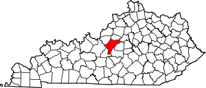 Location of Nelson County, Kentucky | |
| CDPs | ||
| Other unincorporated communities | ||
| ||
| Authority control |
|---|