Blue, Oklahoma
Blue is an unincorporated community and census-designated place in Bryan County, Oklahoma, United States.[1] It is located 9 miles (14 km) east of Durant, the county seat. It is named after the nearby Blue River. As of the 2010 census it had a population of 195.[2] Its post office was established on July 1, 1874.[3]
Blue, Oklahoma | |
|---|---|
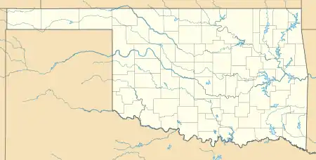 Blue Location in Oklahoma | |
| Coordinates: 33°59′46″N 96°13′50″W | |
| Country | United States |
| State | Oklahoma |
| County | Bryan |
| Area | |
| • Total | 2.5 sq mi (6.5 km2) |
| • Land | 2.5 sq mi (6.5 km2) |
| • Water | 0 sq mi (0 km2) |
| Elevation | 580 ft (180 m) |
| Population (2010) | |
| • Total | 195 |
| • Density | 77/sq mi (29.9/km2) |
At the time of its founding, Blue was located in Blue County, Choctaw Nation. In 1886 that portion of Blue County was joined by portions of Atoka County and Kiamitia County to form Jackson County. Jackson County's western border was the Blue River, just west of the village of Blue.
References
- http://www.odl.state.ok.us/almanac/2005/12-muni.pdf Oklahoma Municipal Government, from the Oklahoma Almanac
- "Geographic Identifiers: 2010 Demographic Profile Data (G001): Blue CDP, Oklahoma". U.S. Census Bureau, American Factfinder. Archived from the original on February 12, 2020. Retrieved February 24, 2014.
- Shirk, George H. Oklahoma Place Names. University of Oklahoma Press, 1987. ISBN 978-0-8061-2028-7
Municipalities and communities of Bryan County, Oklahoma, United States | ||
|---|---|---|
| City | 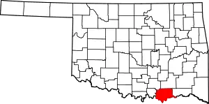 Bryan County map | |
| Towns | ||
| CDPs | ||
| Other unincorporated communities | ||
| Ghost towns | ||
| Indian reservations | ||
| Footnotes | ‡This populated place also has portions in an adjacent county or counties | |
| ||
This article is issued from Wikipedia. The text is licensed under Creative Commons - Attribution - Sharealike. Additional terms may apply for the media files.
