Bonnievale, Western Cape
Bonnievale is a settlement in the Cape Winelands District Municipality in the Western Cape province of South Africa.
Bonnievale | |
|---|---|
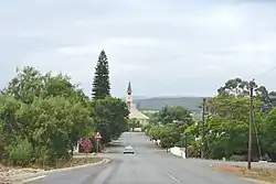 Church street in Bonnievale | |
 Bonnievale  Bonnievale | |
| Coordinates: 33°55′39″S 20°6′2″E | |
| Country | South Africa |
| Province | Western Cape |
| District | Cape Winelands |
| Municipality | Langeberg |
| Area | |
| • Total | 27.07 km2 (10.45 sq mi) |
| Population (2011)[1] | |
| • Total | 9,092 |
| • Density | 340/km2 (870/sq mi) |
| Racial makeup (2011) | |
| • Black African | 11.1% |
| • Coloured | 75.3% |
| • Indian/Asian | 0.2% |
| • White | 10.7% |
| • Other | 2.7% |
| First languages (2011) | |
| • Afrikaans | 89.7% |
| • Xhosa | 6.0% |
| • English | 1.7% |
| • Sotho | 1.3% |
| • Other | 1.3% |
| Time zone | UTC+2 (SAST) |
| Postal code (street) | 6730 |
| PO box | 6730 |
| Area code | 023 |
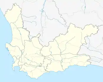
The town is 64 km southeast of Worcester, in the Breede River Valley. It was founded in 1922, and was named after the railway siding called Vale at its opening in 1902 and Bonnie Vale in 1917. Municipal status was gained in April 1953.[2] Bonnievale is surrounded by the Langeberge and Riversonderend Mountains. Situated on the Cape Wine Route, the area caters to tourists[3] with locally made cheese and wine, along with private game reserves and extensive hiking trails.[4]
Gallery
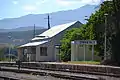
Old station building, 1922–2012 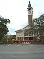
NG Church, built c. 1922 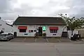
DJ le Roux Museum 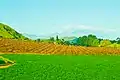
Weltevrede vineyards
References
- "Main Place Bonnievale". Census 2011.
- "Dictionary of Southern African Place Names (Public Domain)". Human Science Research Council. p. 89.
- https://www.route-62-info.co.za/routes/town/222/bonnievale
- https://www.info-bonnievale.co.za/
Municipalities and communities of Cape Winelands District Municipality, Western Cape | ||
|---|---|---|
District seat: Stellenbosch | ||
| Witzenberg | .svg.png.webp) Cape Winelands District within South Africa | |
| Drakenstein | ||
| Stellenbosch | ||
| Breede Valley | ||
| Langeberg | ||
This article is issued from Wikipedia. The text is licensed under Creative Commons - Attribution - Sharealike. Additional terms may apply for the media files.