Bono, Vermillion County, Indiana
Bono is an unincorporated community in Helt Township, Vermillion County, in the U.S. state of Indiana.[2]
Bono | |
|---|---|
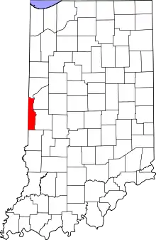 Vermillion County's location in Indiana | |
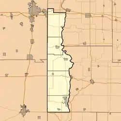 Bono Location in Vermillion County | |
| Coordinates: 39°45′37″N 87°29′38″W | |
| Country | United States |
| State | Indiana |
| County | Vermillion |
| Township | Helt |
| Elevation | 636 ft (194 m) |
| Time zone | UTC-5 (Eastern (EST)) |
| • Summer (DST) | UTC-4 (EDT) |
| ZIP code | 47847 |
| Area code(s) | 765 |
| GNIS feature ID | 431326 |
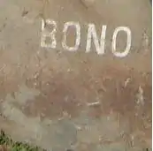
The Bono Rock, a local historical landmark.
Geography
Bono is located at 39°45′37″N 87°29′38″W about two miles east of the state line, at the intersection of Indiana State Road 71 and County Road 850 South. Bono Cemetery is located about a third of a mile west of town. The area around the town is mostly flat and open farmland; a small tributary of Norton Creek begins at Bono and flows southeast.
References
- "US Board on Geographic Names". United States Geological Survey. October 25, 2007. Retrieved 2016-07-15.
- "Bono, Indiana". Geographic Names Information System. United States Geological Survey. Retrieved 2010-08-19.
- History of Parke and Vermillion Counties, Indiana. B.F. Bowen & Cos. 1913. p. 412.
- Baker, Ronald L. (October 1995). From Needmore to Prosperity: Hoosier Place Names in Folklore and History. Indiana University Press. p. 71. ISBN 978-0-253-32866-3.
...commendatory, meaning "good".
Municipalities and communities of Vermillion County, Indiana, United States | ||
|---|---|---|
| City | Map of Indiana highlighting Vermillion County | |
| Towns | ||
| Townships | ||
| CDPs | ||
| Other unincorporated communities | ||
| Ghost towns | ||
| Footnotes | ‡This populated place also has portions in an adjacent county or counties | |
| ||
This article is issued from Wikipedia. The text is licensed under Creative Commons - Attribution - Sharealike. Additional terms may apply for the media files.