Vermillion Township, Vermillion County, Indiana
Vermillion Township is one of five townships in Vermillion County, Indiana, United States. As of the 2010 census, its population was 924 and it contained 401 housing units.[2]
Vermillion Township | |
|---|---|
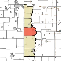 Location in Vermillion County | |
| Coordinates: 39°52′16″N 87°27′19″W | |
| Country | United States |
| State | Indiana |
| County | Vermillion |
| Government | |
| • Type | Indiana township |
| Area | |
| • Total | 50.98 sq mi (132.0 km2) |
| • Land | 50.51 sq mi (130.8 km2) |
| • Water | 0.47 sq mi (1.2 km2) 0.92% |
| Elevation | 610 ft (186 m) |
| Population (2010) | |
| • Total | 924 |
| • Density | 18.3/sq mi (7.1/km2) |
| Time zone | UTC-5 (Eastern (EST)) |
| • Summer (DST) | UTC-4 (EDT) |
| ZIP codes | 47847, 47854 47928, 47966 |
| Area code(s) | 765 |
| GNIS feature ID | 453954 |
History
Vermillion Township took its name from Vermillion County, which was named after the Vermilion River.[3]
Geography
According to the 2010 census, the township has a total area of 50.98 square miles (132.0 km2), of which 50.51 square miles (130.8 km2) (or 99.08%) is land and 0.47 square miles (1.2 km2) (or 0.92%) is water.[2]
Cities
Unincorporated towns
(This list is based on USGS data and may include former settlements.)
Cemeteries
The township contains twelve cemeteries: Carmack, Johnson, Johnson, Juliet, Lebanon, Memorial Chapel, Miller, Old Hopewell, Thomas, Walnut Hill, Wimsett and Zener.
Landmarks
- Newport Chemical Depot
- The Newport Covered Bridge was listed on the National Register of Historic Places in 1994.[4]
School districts
- North Vermillion Community School Corporation
Political districts
- Indiana's 8th congressional district
- State House District 42
- State Senate District 38
References
- "US Board on Geographic Names". United States Geological Survey. October 25, 2007. Retrieved 2017-05-09.
- "Population, Housing Units, Area, and Density: 2010 - County -- County Subdivision and Place -- 2010 Census Summary File 1". United States Census. Archived from the original on 2020-02-10. Retrieved 2013-05-10.
- History of Parke and Vermillion Counties, Indiana. B.F. Bowen & Cos. 1913. p. 423.
- "National Register Information System". National Register of Historic Places. National Park Service. July 9, 2010.
External links
Places adjacent to Vermillion Township, Vermillion County, Indiana | |
|---|---|
Municipalities and communities of Vermillion County, Indiana, United States | ||
|---|---|---|
| City | Map of Indiana highlighting Vermillion County | |
| Towns | ||
| Townships | ||
| CDPs | ||
| Other unincorporated communities | ||
| Ghost towns | ||
| Footnotes | ‡This populated place also has portions in an adjacent county or counties | |
| ||
This article is issued from Wikipedia. The text is licensed under Creative Commons - Attribution - Sharealike. Additional terms may apply for the media files.
