Bono Township, Lawrence County, Indiana
Bono Township is one of nine townships in Lawrence County, Indiana, United States. As of the 2010 census, its population was 833 and it contained 393 housing units.[2][3]
Bono Township | |
|---|---|
 Countryside in the township | |
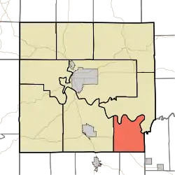 Location in Lawrence County | |
| Coordinates: 38°43′19″N 86°21′32″W | |
| Country | |
| State | |
| County | Lawrence |
| Government | |
| • Type | Indiana township |
| • Trustee | Michelle Porter[1] |
| Area | |
| • Total | 26.3 sq mi (68 km2) |
| • Land | 26.06 sq mi (67.5 km2) |
| • Water | 0.24 sq mi (0.6 km2) 0.91% |
| Elevation | 712 ft (217 m) |
| Population (2010) | |
| • Total | 833 |
| • Density | 32/sq mi (12/km2) |
| ZIP codes | 47446, 47452 |
| GNIS feature ID | 0453123 |
History
The Bono Archaeological Site was listed in the National Register of Historic Places in 1985.[4]
Geography
According to the 2010 census, the township has a total area of 26.3 square miles (68 km2), of which 26.06 square miles (67.5 km2) (or 99.09%) is land and 0.24 square miles (0.62 km2) (or 0.91%) is water.[2]
Unincorporated towns
Cemeteries
The township contains Talbott Cemetery.
Major highways
Education
- Mitchell Community Schools
Bono Township residents may obtain a free library card from the Mitchell Community Public Library in Mitchell.[5]
Political districts
- Indiana's 4th congressional district
- State House District 62
- State Senate District 44
References
- "Bono Township, Lawrence County, Indiana". Geographic Names Information System. United States Geological Survey. Retrieved 2009-10-08.
- United States Census Bureau 2008 TIGER/Line Shapefiles
- IndianaMap
- https://lawrencecounty.in.gov/government/township-trustees
- "Population, Housing Units, Area, and Density: 2010 - County -- County Subdivision and Place -- 2010 Census Summary File 1". United States Census. Archived from the original on 2020-02-12. Retrieved 2013-05-10.
- "U.S. Census website". Retrieved 2009-10-09.
- "National Register Information System". National Register of Historic Places. National Park Service. July 9, 2010.
- "Get a card". Mitchell Community Public Library. Retrieved 10 March 2018.
External links
- Indiana Township Association
- United Township Association of Indiana
- City-Data.com page for Bono Township
Places adjacent to Bono Township, Lawrence County, Indiana | |
|---|---|
Municipalities and communities of Lawrence County, Indiana, United States | ||
|---|---|---|
| Cities | Map of Indiana highlighting Lawrence County | |
| Town | ||
| Townships | ||
| CDPs | ||
| Unincorporated communities |
| |
| Former communities | ||
| ||
This article is issued from Wikipedia. The text is licensed under Creative Commons - Attribution - Sharealike. Additional terms may apply for the media files.